Old Maps of Riverview, Indiana
Explore 15 old maps of Riverview, spanning from 1935 to today. These high-resolution historic maps reveal how streets, neighborhoods, landmarks, and natural features evolved over time — perfect for genealogy, metal detecting, research, and local history exploration.
What you can do with these maps:
- See how Riverview changed over time: Compare historical maps to modern-day views to trace roads, homesites, rail lines & more.
- View detailed metadata: Each map includes creators, publishers, year, scale, and archive source.
- Overlay maps with satellite & LiDAR: Visualize the past alongside modern tools to explore terrain & human change.
- Trusted historical sources: Maps sourced from the USGS, Library of Congress, and other archives.
- Access maps your way: View online, download high-res files, or order prints for personal or research use.
Start exploring old maps of Riverview to uncover forgotten places, hidden landmarks, and the deep history beneath your feet.
Riverview, IN maps
(15)- 1935 Map of Oolitic
 1935 Oolitic1935 Print · USGSLawrence and Greene Counties are captured in the mid-1930s during a period of heavy limestone production and rural transition. Local historians can trace family roots through numerous country landmarks like Popcorn Church, Williams Bridge, and the Dark Hollow stone works.6 unique versions available
 - 1942 Map of Oolitic
 1942 Oolitic1942 Print · USGSLawrence County limestone country is seen here in the mid-1930s, documenting the early stone industry and rail networks. Genealogists can trace family landmarks like Popcorn Cem, Bethel Ch, and industrial sites such as Patton Hill Quarry.2 unique versions available
 - 1956 Map of Vincennes, 1967 Print
 1956 Vincennes1967 Print · USGSSouthern Indiana and the Illinois borderlands are captured here in the mid-fifties, showing the region's dense network of river towns and rail lines. Researchers can trace historic river crossings along the Wabash River or locate landmarks like Wyandotte Cave and Lincoln State Park.4 unique versions available
 - 1957 Map of Vincennes
 1957 Vincennes1957 Print · USGSSouthwest Indiana and the Illinois borderlands come alive in the late 1950s, a period of heavy rail traffic and expanding state forests. Genealogists and historians can trace the riverfronts and rail lines of Vincennes, New Harmony, and the vast Crane Naval Ammunition Depot.
 - 1957 Map of Bedford West, 1958 Print
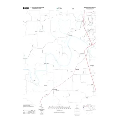
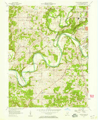 1957 Bedford West1958 Print · USGSLawrence County's river-carved hills and limestone country are captured here during the late fifties as rural life and industry converged. Genealogists can trace family roots through numerous sites like Bryantsville, Eureka, and the Thomson Cem along the East Fork White River.2 unique versions available
 - 1958 Map of Vincennes
 1958 Vincennes1958 Print · USGSSouthern Indiana and the Illinois borderlands are captured during a mid-century period of heavy rail traffic and military activity. Researchers can trace the sprawling bounds of the Crane Naval Ammunition Depot or locate historic settlements like New Harmony and French Lick.2 unique versions available
 - 1979 Map of Bedford West
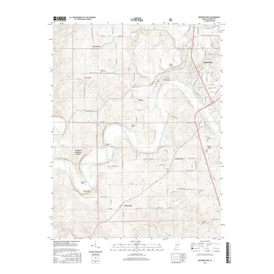
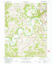 1979 Bedford West1979 Print · USGSLawrence County enters the late seventies with its limestone quarries and river bends clearly defined. Researchers can trace rural lineages through the Wesley Chapel, Crest Haven Cem, and the winding Milwaukee Road railroad.
 - 1986 Map of Bedford
 1986 Bedford1986 Print · USGSSouthern Indiana in the mid-eighties remains a landscape of deep forests, limestone quarries, and vital rail junctions. Genealogists and historians can trace the rural networks connecting French Lick, the Crane Naval Weapons Support Center, and the historic Becks Mill.
 - 1990 Map of Bedford, 1991 Print
 1990 Bedford1991 Print · USGSSouthern Indiana in the early nineties reveals a complex landscape of military reservations, resort towns, and heavy industry. Genealogists and historians can trace family sites like Old Union Cem and Trinity Springs or locate the limestone quarries surrounding Oolitic.
 - 1993 Map of Bedford West, 1996 Print
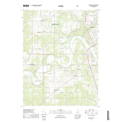
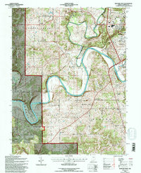 1993 Bedford West1996 Print · USGSLawrence County's river valleys and forested uplands are mapped here in the 1990s as the East Fork White River winds through the Hoosier National Forest. Genealogists can trace family names at Eureka Cem, Bass Cem, and Old Union Ch.
 - 2011 Map of Bedford West, 2011 Print
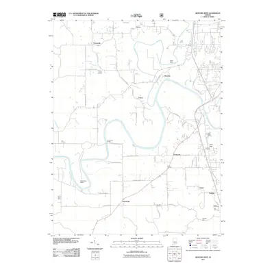 2011 Bedford West2011 Print · USGSCovers Riverview, including Bedford, Bryantsville, and other nearby areas
 - 2013 Map of Bedford West, 2013 Print
 2013 Bedford West2013 Print · USGSCovers Riverview, including Bedford, Bryantsville, and other nearby areas
 - 2016 Map of Bedford West, 2016 Print
 2016 Bedford West2016 Print · USGSCovers Riverview, including Bedford, Bryantsville, and other nearby areas
 - 2019 Map of Bedford West, 2019 Print
 2019 Bedford West2019 Print · USGSCovers Riverview, including Bedford, Bryantsville, and other nearby areas
 - 2022 Map of Bedford West, 2022 Print
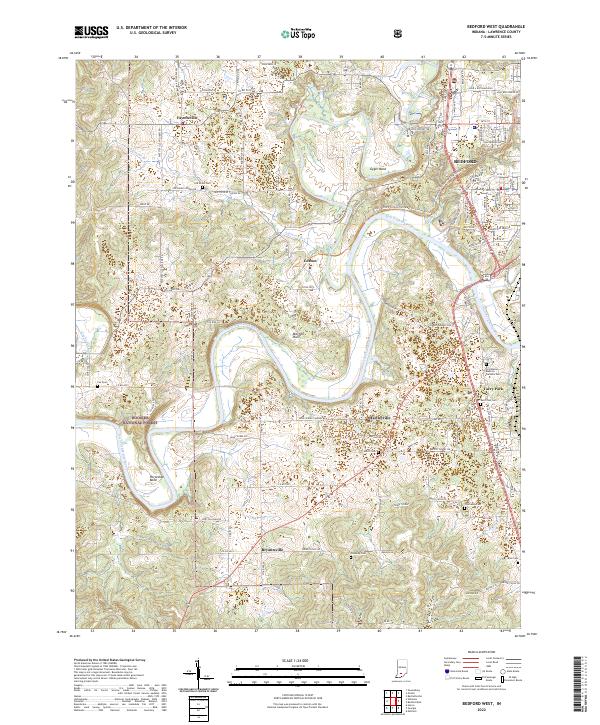 2022 Bedford West2022 Print · USGSLawrence County land south of Fayetteville shows its deep limestone roots and river bends in the early twenty-first century. Researchers can locate numerous family burial sites like Old Union Cem and Cox Cem along the winding East Fork White River.
End of results
Showing maps 1-15 of 15
Top cities near Riverview
- Bedford historical maps
- Mitchell historical maps
- Orleans historical maps
- Guthrie historical maps
- Oolitic historical maps
- Bono historical maps
See more
Frequently asked questions
- What are the different types of historical maps available for Riverview?
- What is the oldest map of Riverview?
- Where can I purchase historical maps of Riverview for my home or office?
- Where can I download high-res historical maps of Riverview?
- Are there historical topographic maps available for Riverview?
- Is there historical aerial imagery available for Riverview?
- Where are historical maps of Riverview sourced from?