Old Maps of Morgantown, Indiana
Explore 22 old maps of Morgantown, spanning from 1942 to today. These high-resolution historic maps reveal how streets, neighborhoods, landmarks, and natural features evolved over time — perfect for genealogy, metal detecting, research, and local history exploration.
What you can do with these maps:
- See how Morgantown changed over time: Compare historical maps to modern-day views to trace roads, homesites, rail lines & more.
- View detailed metadata: Each map includes creators, publishers, year, scale, and archive source.
- Overlay maps with satellite & LiDAR: Visualize the past alongside modern tools to explore terrain & human change.
- Trusted historical sources: Maps sourced from the USGS, Library of Congress, and other archives.
- Access maps your way: View online, download high-res files, or order prints for personal or research use.
Start exploring old maps of Morgantown to uncover forgotten places, hidden landmarks, and the deep history beneath your feet.
Morgantown, IN maps
(22)- 1942 Map of Franklin
 1942 Franklin1942 Print · USGSCentral Indiana during the early years of the war shows a landscape of established rail towns and growing military installations. Genealogists can trace family names across small settlements like Nineveh, Bean Blossom, and Helmsburg, or locate the Indiana University Observatory.
 - 1948 Map of Morgantown, 1956 Print
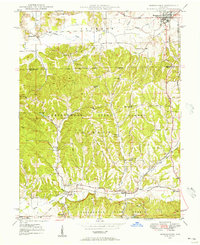 1948 Morgantown1956 Print · USGSThe Morgan and Brown County borderlands come to life in the late 1940s, showing the ridge-and-hollow terrain south of Morgantown. Researchers can trace the Illinois Central railroad through Helmsburg or locate rural landmarks like Mt Zion Ch and Bear Creek Cem.
 - 1950 Map of Morgantown
 1950 Morgantown1950 Print · USGSMid-century Morgan and Brown Counties are shown here at a time when the Illinois Central railroad still linked small rural timber and farming hamlets. Trace family roots and vanished landmarks near Helmsburg, Needmore, and the Bear Creek Cem.2 unique versions available
 - 1953 Map of Indianapolis, 1965 Print
 1953 Indianapolis1965 Print · USGSCentral Indiana and the Illinois borderlands are captured in the mid-sixties, showing the growth of Indianapolis and its industrial rail corridors. Genealogists and historians can trace the development of outlying towns like Zionsville or Beech Grove and find landmarks such as Atterbury AAF and Turkey Run State Park.4 unique versions available
 - 1955 Map of Cope, 1957 Print
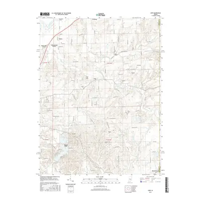
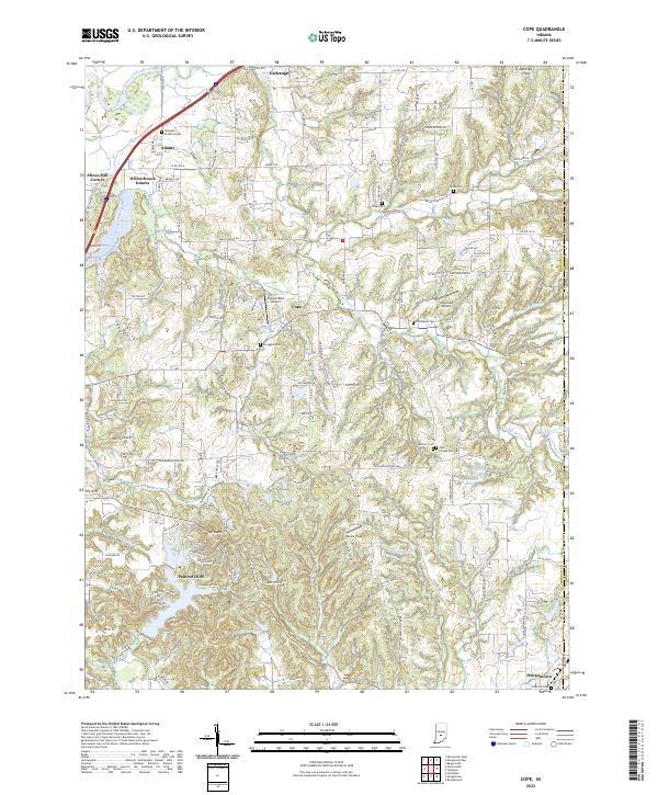
 1955 Cope1957 Print · USGSMid-century Morgan County is captured here at a time when small communities like Cope and Exchange were central to rural life. Researchers can locate family landmarks such as Williams Cem, trace the Illinois Central rail line into Morgantown, or find the old Fish Hatchery.
 - 1956 Map of Indianapolis
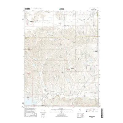
 1956 Indianapolis1956 Print · USGSCentral Indiana in the mid-fifties is captured during a period of industrial growth and military presence. Genealogists and historians can trace the rail networks of the New York Central or locate regional landmarks like Fort Benjamin Harrison and Camp Atterbury.
 - 1957 Map of Indianapolis
 1957 Indianapolis1957 Print · USGSCentral Indiana in the mid-fifties is captured here as a crossroads of major rail lines and nascent federal highways. Genealogists and historians can trace family-named ridges like Poplar Ridge or locate strategic sites like Camp Atterbury and Speedway.2 unique versions available
 - 1961 Map of Morgantown, 1963 Print
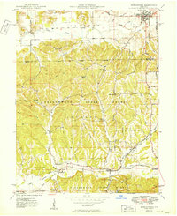
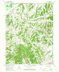
 1961 Morgantown1963 Print · USGSThe wooded highlands of Brown and Morgan counties are captured here in the early sixties as rural life centered on the rail corridor. Trace family history through landmarks like Mt Zion Ch, the Williams Cem, and the village of Helmsburg.5 unique versions available
 - 1962 Map of Indianapolis
 1962 Indianapolis1962 Print · USGSCentral Indiana and the Illinois borderlands are captured here in the early sixties, showing the region's dense rail networks and growing urban centers. Genealogists and historians can locate family-named landmarks and institutions like Crown Hill Cem, Indiana University, and the Indianapolis Motor Speedway.
 - 1965 Map of Cope, 1966 Print
 1965 Cope1966 Print · USGSMorgan County in the mid-sixties is a landscape of winding creek valleys and established rural crossroads. Researchers can trace family history through sites like Williams Cem, Nast Chapel, and the small settlement at Cope.3 unique versions available
 - 1986 Map of Bloomington
 1986 Bloomington1986 Print · USGSMid-century development and vast conservation areas define south-central Indiana during the eighties. Genealogists and historians can trace family roots through numerous landmarks like Beanblossom Cem, New Unionville Church, and the historic corridors of the Indiana RR.3 unique versions available
 - 1998 Map of Morgantown, 2002 Print
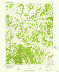
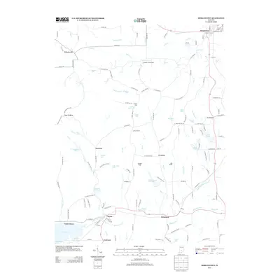
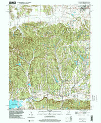 1998 Morgantown2002 Print · USGSMorgan and Brown counties are captured here in the late nineties, showing a landscape defined by the deep timber of Yellowwood State Forest. Genealogists and hikers can trace the Old Railroad Grade or locate historic landmarks like the Covered Bridge and Williams Cem.
 - 2010 Map of Cope, 2010 Print
 2010 Cope2010 Print · USGSCovers Morgantown, including Adams, Chetwynd, and other nearby areas
 - 2010 Map of Morgantown, 2010 Print
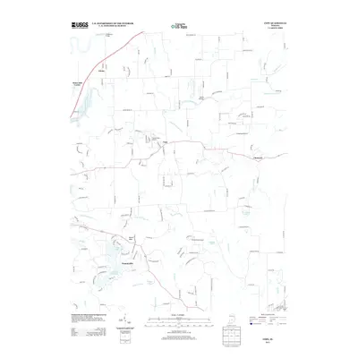
 2010 Morgantown2010 Print · USGSCovers Morgantown, including Fruitdale, Point Idalawn, and other nearby areas
 - 2013 Map of Cope, 2013 Print
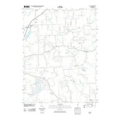
 2013 Cope2013 Print · USGSCovers Morgantown, including Adams, Chetwynd, and other nearby areas
 - 2013 Map of Morgantown, 2013 Print
 2013 Morgantown2013 Print · USGSCovers Morgantown, including Fruitdale, Point Idalawn, and other nearby areas
 - 2016 Map of Morgantown, 2016 Print
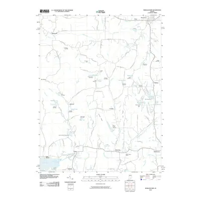
 2016 Morgantown2016 Print · USGSCovers Morgantown, including Fruitdale, Point Idalawn, and other nearby areas
 - 2016 Map of Cope, 2016 Print
 2016 Cope2016 Print · USGSCovers Morgantown, including Adams, Chetwynd, and other nearby areas
 - 2019 Map of Cope, 2019 Print
 2019 Cope2019 Print · USGSCovers Morgantown, including Adams, Chetwynd, and other nearby areas
 - 2019 Map of Morgantown, 2019 Print
 2019 Morgantown2019 Print · USGSCovers Morgantown, including Fruitdale, Point Idalawn, and other nearby areas
 - 2022 Map of Morgantown, 2022 Print
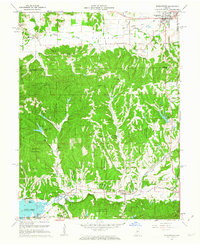
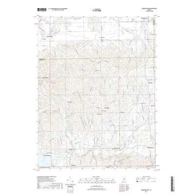
 2022 Morgantown2022 Print · USGSSouthern Indiana ridge country comes alive in the early 2020s, showing the intricate landscape where Morgan and Brown counties meet. Researchers can trace historic family landmarks and rural settlements like Beanblossom, Trevlac, and the Boles - Williams Cem.
 - 2022 Map of Cope, 2022 Print
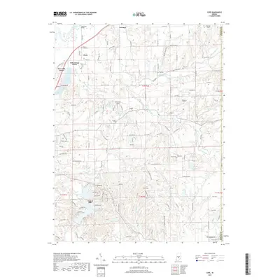
 2022 Cope2022 Print · USGSMorgan County in the early 2020s shows a landscape defined by the winding White River and a network of small family cemeteries. Genealogists can trace local heritage at East Hill Cem and Brian Cem while exploring the development of Morgantown and Painted Hills.
End of results
Showing maps 1-22 of 22
Top cities near Morgantown
- Bloomington historical maps
- Greenwood historical maps
- Franklin historical maps
- Martinsville historical maps
- Mooresville historical maps
- New Whiteland historical maps
See more
Frequently asked questions
- What are the different types of historical maps available for Morgantown?
- What is the oldest map of Morgantown?
- Where can I purchase historical maps of Morgantown for my home or office?
- Where can I download high-res historical maps of Morgantown?
- Are there historical topographic maps available for Morgantown?
- Is there historical aerial imagery available for Morgantown?
- Where are historical maps of Morgantown sourced from?