Old Maps of Adams County, Iowa
Explore 99 old maps of Adams County, spanning from 1954 to today. These high-resolution historic maps reveal how streets, neighborhoods, landmarks, and natural features evolved over time — perfect for genealogy, metal detecting, research, and local history exploration.
What you can do with these maps:
- See how Adams County changed over time: Compare historical maps to modern-day views to trace roads, homesites, rail lines & more.
- View detailed metadata: Each map includes creators, publishers, year, scale, and archive source.
- Overlay maps with satellite & LiDAR: Visualize the past alongside modern tools to explore terrain & human change.
- Trusted historical sources: Maps sourced from the USGS, Library of Congress, and other archives.
- Access maps your way: View online, download high-res files, or order prints for personal or research use.
Start exploring old maps of Adams County to uncover forgotten places, hidden landmarks, and the deep history beneath your feet.
Adams County, IA maps
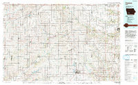
(99)- 1954 Map of Omaha, 1967 Print
 1954 Omaha1967 Print · USGSMid-century development radiates from the river bluffs into the agricultural heartland during this period of post-war growth. Genealogists and historians can trace rail-connected towns like Atlantic and Red Oak or locate the sprawling grounds of Offutt Air Force Base and Manawa Lake.3 unique versions available
 - 1955 Map of Nebraska City, 1967 Print
 1955 Nebraska City1967 Print · USGSThe four-state region surrounding the Missouri River valley appears here in the mid-1950s, a landscape of rail-dependent market towns and rural school districts. Genealogists can locate family landmarks like the Rock Bluff School, St Oswald Church, and the Clarinda State Hospital.3 unique versions available
 - 1957 Map of Nebraska City
 1957 Nebraska City1957 Print · USGSThe four-state junction of Nebraska, Iowa, Missouri, and Kansas comes alive in this mid-fifties survey of the Missouri River valley. Genealogists and historians can trace the rail-and-road networks connecting Nebraska City, Maryville, and the Squaw Creek National Wildlife Refuge.
 - 1957 Map of Omaha
 1957 Omaha1957 Print · USGSWestern Iowa and the Missouri River valley are seen here in the mid-fifties during the height of the rail-and-road era. Researchers can trace the sprawling rail lines of the Chicago And North Western or locate Cold War landmarks like Offutt Air Force Base.
 - 1958 Map of Omaha
 1958 Omaha1958 Print · USGSOmaha and Council Bluffs stand at the center of this mid-fifties landscape, where the Missouri River splits the urban plains of Nebraska from the rolling hills of western Iowa. Genealogists can trace the rail lines of the Wabash RR and Illinois Central RR to rural settlements like Missouri Valley and Red Oak.2 unique versions available
 - 1958 Map of Nebraska City
 1958 Nebraska City1958 Print · USGSThe Missouri River Valley and its fertile four-state borderlands are captured here during the mid-century expansion of the regional highway and rail networks. Genealogists can trace family roots through numerous rural landmarks like Moulton School, Shady Grove Church, and the Clarinda State Hospital.
 - 1980 Map of Corning South
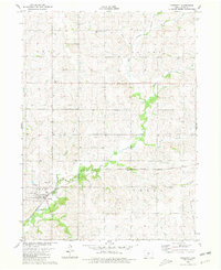
 1980 Corning South1980 Print · USGSThe hill country south of Corning is captured here in the late seventies, showing a landscape defined by the Burlington Northern line and the East Nodaway River. Genealogists can locate Walnut Grove Cemetery and Oak Hill Cem, or trace the One Hundred and Two River through the southern townships.
 - 1980 Map of Lenox
 1980 Lenox1980 Print · USGSTaylor and Adams counties are shown here as they appeared in the late seventies, centered on the rail-fed town of Lenox. Researchers can find family roots at the trio of North Fairview, East Fairview, and West Fairview cemeteries, or trace the legacy of Stringtown and Salem Ch.
 - 1980 Map of Nevinville, 1981 Print
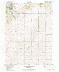
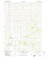
 1980 Nevinville1981 Print · USGSAdair and Adams counties in the early eighties are defined by the winding Middle Nodaway River and scattered farmstead communities. Genealogists and local historians can locate Rose Hill Cem, Mormon Cem, and several rural country churches like Penn Avenue Ch.
 - 1980 Map of Corning North, 1981 Print
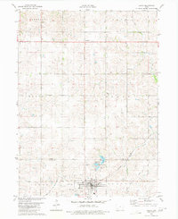
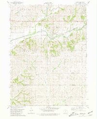
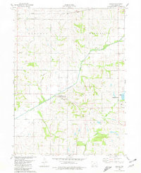
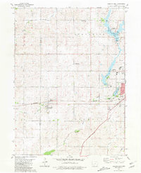
 1980 Corning North1981 Print · USGSAdams County farmland meets modern water recreation in the early 1980s as the Lake Icaria reservoir system reshapes the landscape. Researchers can locate local landmarks like Mt Etna Cem, the Burlington Northern line, and the northern edge of Corning.
 - 1980 Map of Grant, 1981 Print
 1980 Grant1981 Print · USGSSouthwestern Iowa farm country is documented here in the late seventies, showing the rural communities at the intersections of Montgomery, Cass, and Adams counties. Genealogists can trace family footprints across several rural burial grounds like Old East Cem, Reno Cem, and Newtons Grove Cem.
 - 1980 Map of Brooks, 1981 Print
 1980 Brooks1981 Print · USGSSouthwestern Iowa in the early eighties remains a landscape defined by its river valleys and rail lines. Genealogists can locate family landmarks like Methodist Grove Cem, the settlement of Brooks, and the headwaters of the uniquely named One Hundred and Two River.
 - 1980 Map of Bridgewater, 1981 Print
 1980 Bridgewater1981 Print · USGSBridgewater and its surrounding townships are shown here during the late seventies, a period of established rail lines and preserved pioneer history. Genealogists can locate family burial sites like Winn Cem or explore the area around Mormon Trail County Park.
 - 1980 Map of Villisca, 1981 Print
 1980 Villisca1981 Print · USGSVillisca and the surrounding Iowa farmland are captured here in the early eighties, showcasing a landscape defined by the three branches of the Nodaway River. Genealogists can locate several local burial sites including Nodaway Cem and Findley Cem, while following the path of the Burlington Northern rail line.
 - 1980 Map of Carbon, 1981 Print
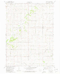
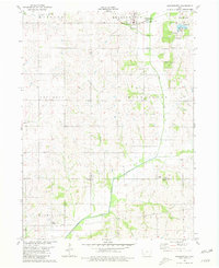
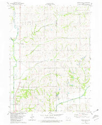
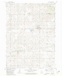
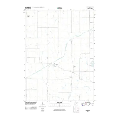
 1980 Carbon1981 Print · USGSAdams County in the early 1980s reveals a transition from traditional rural townships to modern water management. Genealogists and local historians can trace family roots through the Quincy Cem and Oakland Cem or explore the growth of Lake Icaria.
 - 1980 Map of Morton Mills, 1981 Print
 1980 Morton Mills1981 Print · USGSThe river valleys of southwestern Iowa are captured in the late seventies, showing the rural communities of Morton Mills and Sciola along the West Nodaway River. Genealogists can locate family landmarks like Lincoln Center Cem and Strand Ch.
 - 1980 Map of Dewey, 1981 Print
 1980 Dewey1981 Print · USGSSouthwestern Iowa farm country is documented here in the late seventies, showing the rural townships of Victoria, Edna, and Union. Researchers can locate the Victoria Cem, the rail line of the Burlington Northern, and local churches like St Timothy Ch.
 - 1980 Map of Prescott, 1981 Print
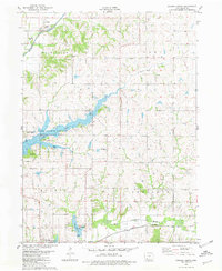
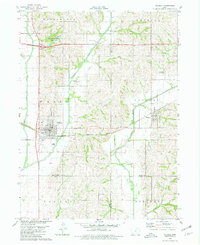
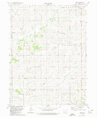
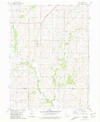
 1980 Prescott1981 Print · USGSAdams County at the start of the 1980s reveals a landscape shaped by the Burlington Northern railroad and the winding Nodaway River. Researchers can locate several family and community landmarks, including the Bohemian National Cem, Summit Cem, and the central Townhall in Prescott.
 - 1981 Map of Orient
 1981 Orient1981 Print · USGSAdair County farm country is captured here in the early eighties, centered on the railroad hub of Orient. Genealogists and local historians can trace legacy sites like the Prairie Lawn Cemetery or the rural settlements of Nevinville and Spaulding.
 - 1981 Map of Creston West
 1981 Creston West1981 Print · USGSUnion County during the early 1980s reveals a landscape of growing towns and established rail lines. Genealogists and historians can trace family locations near Cromwell, locate Spaulding Center Cem, or explore the development around Green Valley Lake.
 - 1981 Map of Kent
 1981 Kent1981 Print · USGSSouthwest Iowa's agricultural heartland is documented here in the early 1980s, centered on the railroad town of Kent. Researchers can trace old family burial sites at McDuthies Cemetery and Morgan Cemetery or follow the Burlington Northern tracks.
 - 1985 Map of Creston
 1985 Creston1985 Print · USGSSouthwest Iowa in the mid-eighties shows a landscape of established farm towns and growing regional hubs connected by vital rail lines. Genealogists and local historians can trace landmarks like Graceland Cem, the Southwestern Community College campus, and the Burlington Northern railroad route.
 - 1985 Map of Mount Ayr
 1985 Mount Ayr1985 Print · USGSThe Iowa-Missouri borderlands are captured here in the mid-eighties, showing a landscape defined by the branching forks of the Platte River and Grand River. Researchers can trace the heritage of rural communities and conservation sites like Lake of Three Fires State Park and Rose Hill Cemetery.2 unique versions available
 - 1993 Map of Creston
 1993 Creston1993 Print · USGSSouthwestern Iowa in the early nineties shows a landscape of established farm towns and modern water reservoirs. Genealogists and local historians can trace the streets of Creston and Winterset, or find rural landmarks like Graceland Cem and Arbor Hill.
 - 2010 Map of Carbon, 2010 Print
 2010 Carbon2010 Print · USGSCovers Adams County, including Corning, Carbon, and other nearby areas
Showing maps 1-25 of 99
Top cities of Adams County
Frequently asked questions
- What are the different types of historical maps available for Adams County?
- What is the oldest map of Adams County?
- Where can I purchase historical maps of Adams County for my home or office?
- Where can I download high-res historical maps of Adams County?
- Are there historical topographic maps available for Adams County?
- Is there historical aerial imagery available for Adams County?
- Where are historical maps of Adams County sourced from?