2020s Maps of Hopkinton, Iowa
Explore 2 historic maps of Hopkinton from the 2020s. These maps offer a rare glimpse into what life looked like during the 2020s — showing old roads, neighborhoods, homes, and landmarks that have changed or disappeared over time.
Whether you're researching your family's past, planning a metal detecting trip, or studying how Hopkinton's landscape evolved across the 2020s, these high-resolution maps are a powerful tool for exploring the history of this region.
- Focus on a specific era: All maps on this page are from the 2020s, giving you a focused view of this time period.
- See what’s changed: Compare century-old streets, trails, and buildings to today's modern landscape using overlays and satellite layers.
- Research with precision: Use these maps for genealogy, historical research, land use analysis, or educational projects.
- View, download, or print: Maps are fully viewable online in high resolution, and can be downloaded or printed for your own records.
Start exploring Hopkinton's history through authentic maps from the 2020s. This is your window into the past.
Hopkinton, IA maps
(2)- 2022 Map of Hopkinton West, 2022 Print
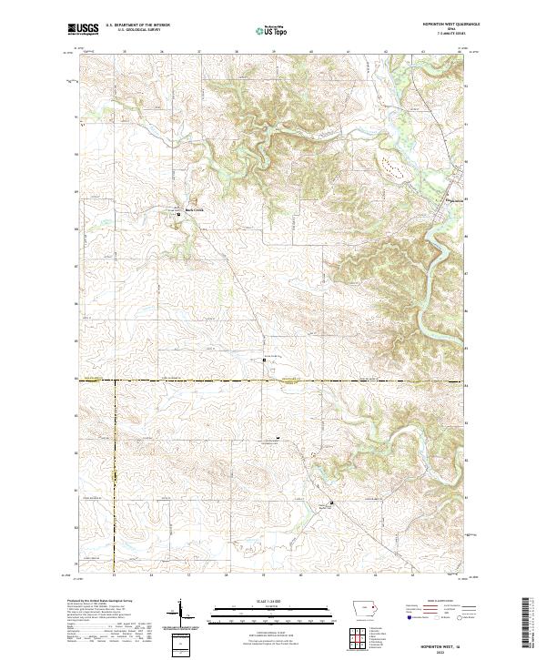 2022 Hopkinton West2022 Print · USGSEastern Iowa farmland at the tri-county junction of Delaware, Linn, and Jones counties is captured in this modern survey. Genealogists can trace family sites at Buck Creek Cem, Grove Creek Cem, and Castle Grove Baptist Cem.
 - 2022 Map of Hopkinton East, 2022 Print
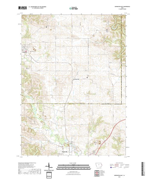 2022 Hopkinton East2022 Print · USGSThe river valleys of Delaware and Jones counties are detailed here in the early twenty-first century, showing the rural landscapes surrounding Monticello and Hopkinton. Genealogists can locate several local burial sites including Willard Cem, Sand Springs Cem, and Livingston Cem.
End of results
Showing maps 1-2 of 2
Top cities near Hopkinton
- Anamosa historical maps
- Manchester historical maps
- Dyersville historical maps
- Monticello historical maps
- Cascade historical maps
- Farley historical maps
See more
Frequently asked questions
- What are the different types of historical maps available for Hopkinton?
- What is the oldest map of Hopkinton?
- Where can I purchase historical maps of Hopkinton for my home or office?
- Where can I download high-res historical maps of Hopkinton?
- Are there historical topographic maps available for Hopkinton?
- Is there historical aerial imagery available for Hopkinton?
- Where are historical maps of Hopkinton sourced from?