2020s Maps of Dickinson County, Iowa
Explore 15 historic maps of Dickinson County from the 2020s. These maps offer a rare glimpse into what life looked like during the 2020s — showing old roads, neighborhoods, homes, and landmarks that have changed or disappeared over time.
Whether you're researching your family's past, planning a metal detecting trip, or studying how Dickinson County's landscape evolved across the 2020s, these high-resolution maps are a powerful tool for exploring the history of this region.
- Focus on a specific era: All maps on this page are from the 2020s, giving you a focused view of this time period.
- See what’s changed: Compare century-old streets, trails, and buildings to today's modern landscape using overlays and satellite layers.
- Research with precision: Use these maps for genealogy, historical research, land use analysis, or educational projects.
- View, download, or print: Maps are fully viewable online in high resolution, and can be downloaded or printed for your own records.
Start exploring Dickinson County's history through authentic maps from the 2020s. This is your window into the past.
Dickinson County, IA maps
(15)- 2022 Map of Jackson, 2022 Print
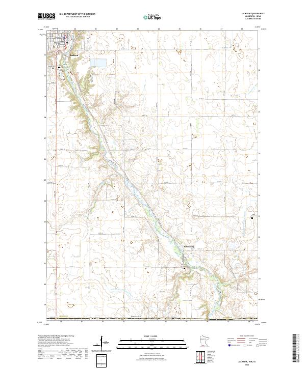 2022 Jackson2022 Print · USGSThe river valley and prairie township of Jackson are captured here in the early 2020s, showing the intersection of local government and rural life. Researchers can locate numerous family and community landmarks, including Riverside Cem, the Jackson County Courthouse, and the settlement of Petersburg.
 - 2022 Map of Round Lake, 2022 Print
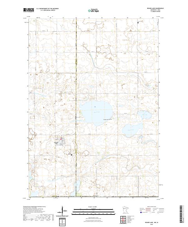 2022 Round Lake2022 Print · USGSThe town of Round Lake and the surrounding Minnesota prairie are captured here in a 2022 survey of the Coteau des Prairies landscape. Researchers can trace family history at Round Lake Cem and Grace Cem or explore the intricate network of Judicial Ditch Number Thirteen and local lakes.
 - 2022 Map of Lakefield SE, 2022 Print
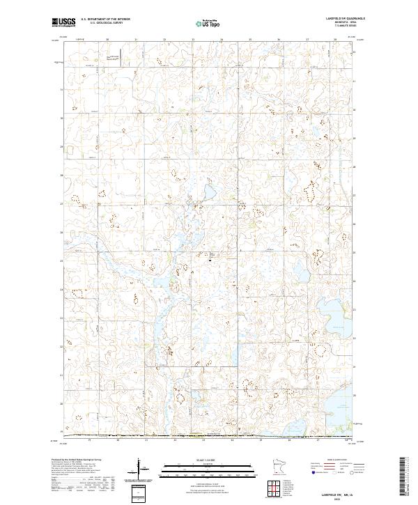
 2022 Lakefield SE2022 Print · USGSJackson County agricultural lands meet the Iowa border in this 2020s study of prairie hydrology and rural settlement. Genealogists and local historians can locate Loon Lake Cem and trace the shores of Loon Lake, Chandler Lake, and Pearl Lake.
 - 2022 Map of Sioux Valley, 2022 Print
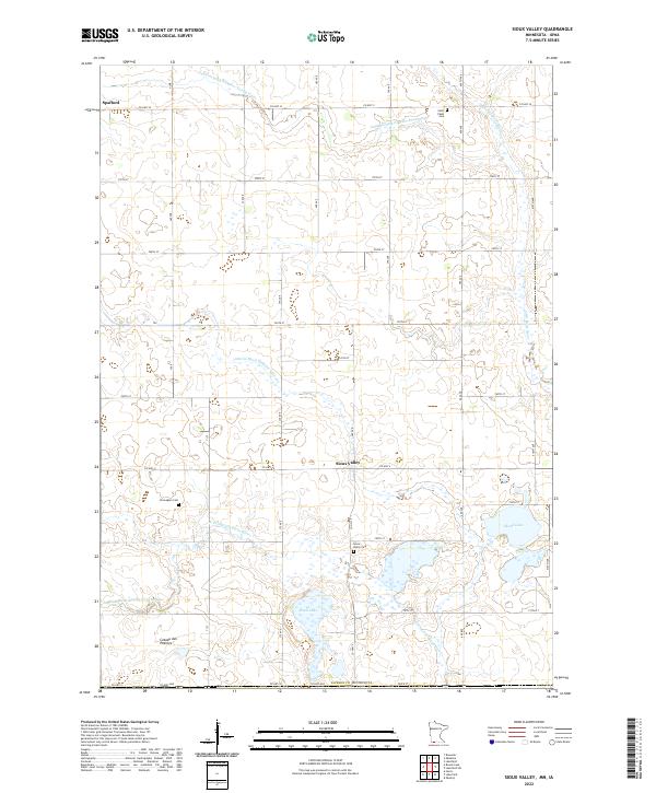 2022 Sioux Valley2022 Print · USGSJackson County, Minnesota, is shown here as a landscape of prairie agriculture and pioneer history just after the millennium. Researchers can trace family sites at Sioux Valley Cem or Norwegian Cem and explore the water systems of Rush Lake and the Little Sioux River.
 - 2022 Map of Lakefield SW, 2022 Print
 2022 Lakefield SW2022 Print · USGSJackson County at the Minnesota-Iowa border reveals a landscape of prairie wetlands and river drainage in the early 2020s. Researchers can locate Holy Trinity Cem and trace the winding Little Sioux River past Rush Lake.
 - 2022 Map of Lake Park SE, 2022 Print
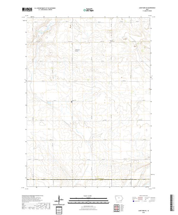 2022 Lake Park SE2022 Print · USGSDickinson County's glaciated uplands are documented in this recent survey, showing the agricultural landscape at the edge of the Coteau des Prairies. Genealogists and local historians can locate the Excelsior Township Cem and Westport Cem among the headwaters of Stony Creek.
 - 2022 Map of May City, 2022 Print
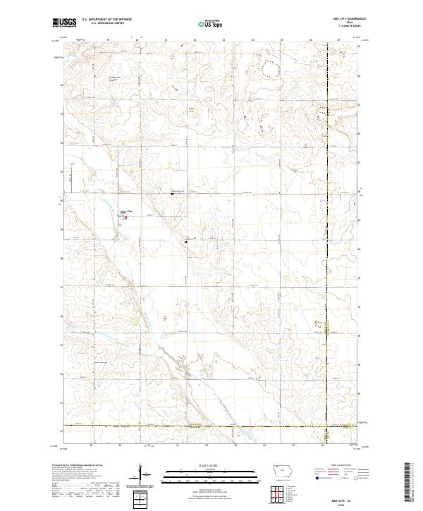 2022 May City2022 Print · USGSOsceola County farmland is meticulously documented here as it appeared in the early 2020s. Genealogists can trace family roots near the May City settlement or locate burials at the Harrison Cem and Mennonite Cem along the Ocheyedan River.
 - 2022 Map of Harris, 2022 Print
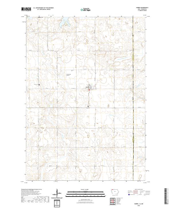 2022 Harris2022 Print · USGSThe town of Harris and the surrounding Osceola County farmland are shown here in the early twenty-first century. Genealogists and local historians can trace rural cemetery sites like Union Cem and Fairview Cem or locate the shoreline of Iowa Lake.
 - 2022 Map of Superior, 2022 Print
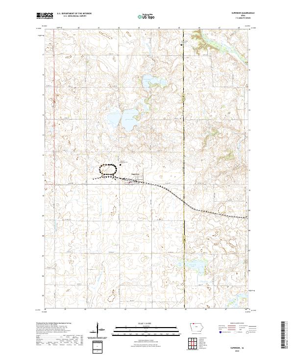 2022 Superior2022 Print · USGSSuperior and the surrounding prairies of the Iowa-Minnesota borderlands are captured here in the early twenty-first century. Genealogists and local historians can trace family locations near the Superior Township Cem, Swan Lake, or along the Des Moines River.
 - 2022 Map of Terril, 2022 Print
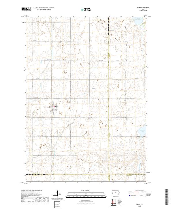 2022 Terril2022 Print · USGSThe community of Terril and the surrounding Iowa prairie are captured in the early 2020s, showing a landscape defined by industrial agriculture and natural basins. Genealogists and local historians can locate Fairview Cem and trace the paths of Big Muddy Cr and Pickerel Run.
 - 2022 Map of Lake Park, 2022 Print
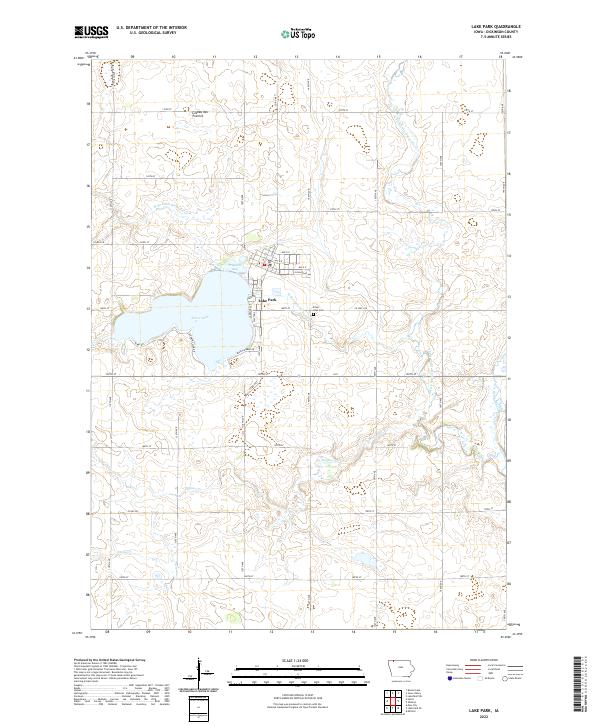 2022 Lake Park2022 Print · USGSLake Park sits along the northern shores of Silver Lake in this recent Dickinson County survey. Genealogists and local historians can trace the town's modern footprint, the Silver Lake Cem, and the winding W Br Little Sioux River.
 - 2022 Map of Okoboji, 2022 Print
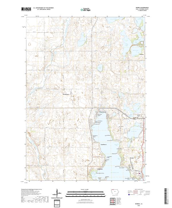 2022 Okoboji2022 Print · USGSThe Iowa Great Lakes region is shown in contemporary detail, tracing the shoreline of West Okoboji Lake and its surrounding communities. Local historians can locate landmarks like Wahpeton, Spirit Lake Municipal Airport, and the Iowa Great Lakes Recreational Trl.
 - 2022 Map of Spirit Lake SE, 2022 Print
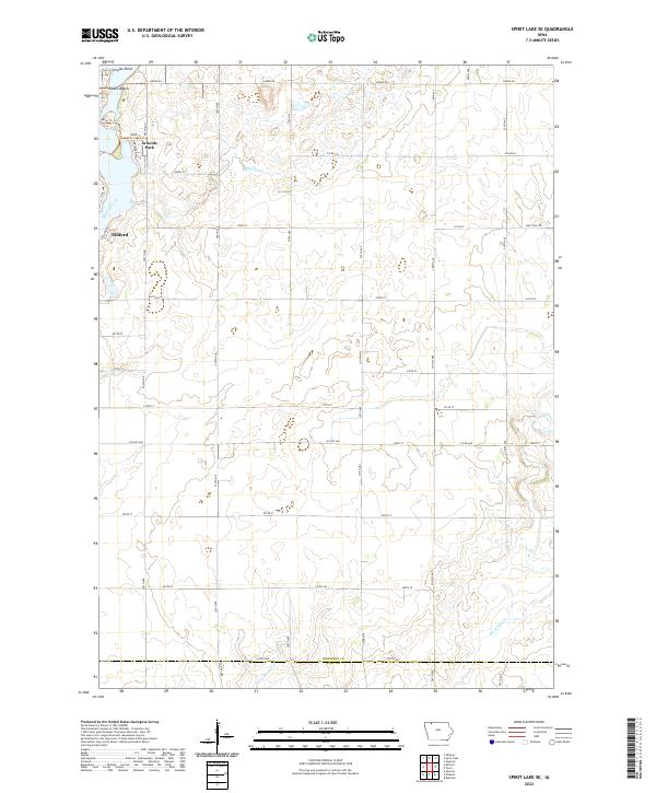 2022 Spirit Lake SE2022 Print · USGSThe southern reach of the Iowa Great Lakes comes into focus during this modern era of rural growth. Genealogists and local historians can trace the lakeside settlements of Arnolds Park and Milford or locate family land near Little Muddy Cr and Kruses Beach.
 - 2022 Map of Milford, 2022 Print
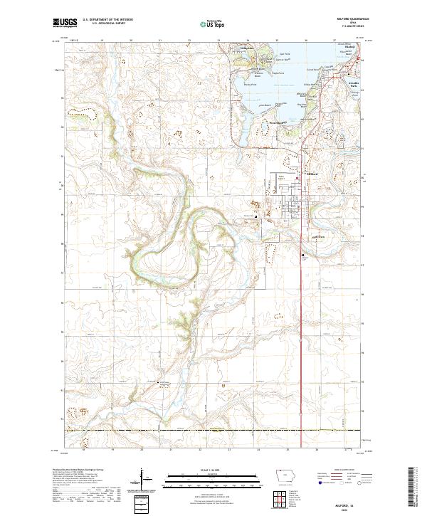 2022 Milford2022 Print · USGSIn the heart of the Iowa Great Lakes during the 2020s, this area showcases the dense settlement of the lakefront alongside the rural Little Sioux River valley. Genealogists and local historians can trace family locations near Milford Cem or explore landmarks like Fuller Airport and Garlock Slough.
 - 2022 Map of Spirit Lake, 2022 Print
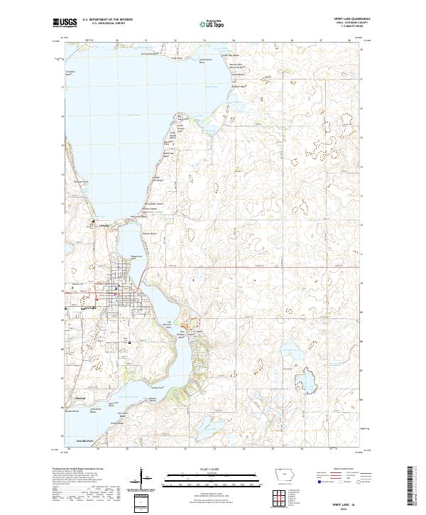 2022 Spirit Lake2022 Print · USGSThe Iowa Great Lakes region is captured here in detail, showcasing the established resort communities and residential growth surrounding the state's largest natural lake. Researchers can trace local genealogy and land use through landmarks like Lakeview Cem, the Dickinson County Courthouse, and named shorelines such as Miniwaukon Beach.
End of results
Showing maps 1-15 of 15
Top cities of Dickinson County
- Spirit Lake historical maps
- Milford historical maps
- Lake Park historical maps
- Arnolds Park historical maps
- Okoboji historical maps
- Orleans historical maps
See more
Frequently asked questions
- What are the different types of historical maps available for Dickinson County?
- What is the oldest map of Dickinson County?
- Where can I purchase historical maps of Dickinson County for my home or office?
- Where can I download high-res historical maps of Dickinson County?
- Are there historical topographic maps available for Dickinson County?
- Is there historical aerial imagery available for Dickinson County?
- Where are historical maps of Dickinson County sourced from?