2020s Maps of Madison County, Iowa
Explore 16 historic maps of Madison County from the 2020s. These maps offer a rare glimpse into what life looked like during the 2020s — showing old roads, neighborhoods, homes, and landmarks that have changed or disappeared over time.
Whether you're researching your family's past, planning a metal detecting trip, or studying how Madison County's landscape evolved across the 2020s, these high-resolution maps are a powerful tool for exploring the history of this region.
- Focus on a specific era: All maps on this page are from the 2020s, giving you a focused view of this time period.
- See what’s changed: Compare century-old streets, trails, and buildings to today's modern landscape using overlays and satellite layers.
- Research with precision: Use these maps for genealogy, historical research, land use analysis, or educational projects.
- View, download, or print: Maps are fully viewable online in high resolution, and can be downloaded or printed for your own records.
Start exploring Madison County's history through authentic maps from the 2020s. This is your window into the past.
Madison County, IA maps
(16)- 2022 Map of East Peru, 2022 Print
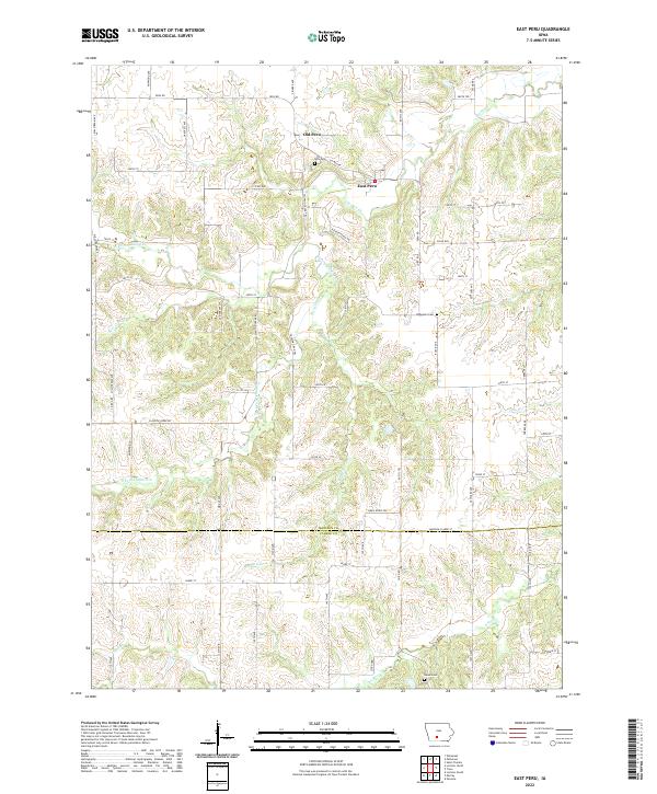 2022 East Peru2022 Print · USGSMadison and Clarke counties are shown in this contemporary study of southern Iowa's rolling creek valleys. Researchers can trace the lineage of local settlements through Old Peru, East Peru, and rural landmarks like the Ebenezer Cem and Union Cem.
 - 2022 Map of Earlham East, 2022 Print
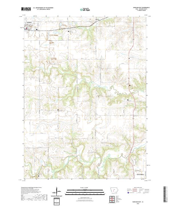 2022 Earlham East2022 Print · USGSMadison County's agricultural heartland is documented here in the early twenty-first century, showing the enduring rural layout of the region. Genealogists and local historians can trace family roots through numerous local sites including North Branch Cem, Worthington Cem, and the settlement of Earlham.
 - 2022 Map of Earlham West, 2022 Print
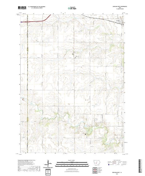 2022 Earlham West2022 Print · USGSMadison County's agricultural heartland is captured here in the early twenty-first century as modern roads trace historic section lines. Genealogists can locate specific family burial sites at Penn Center Cem, Old Penn Center Cem, and Eppard Cem along the North River.
 - 2022 Map of Lorimor North, 2022 Print
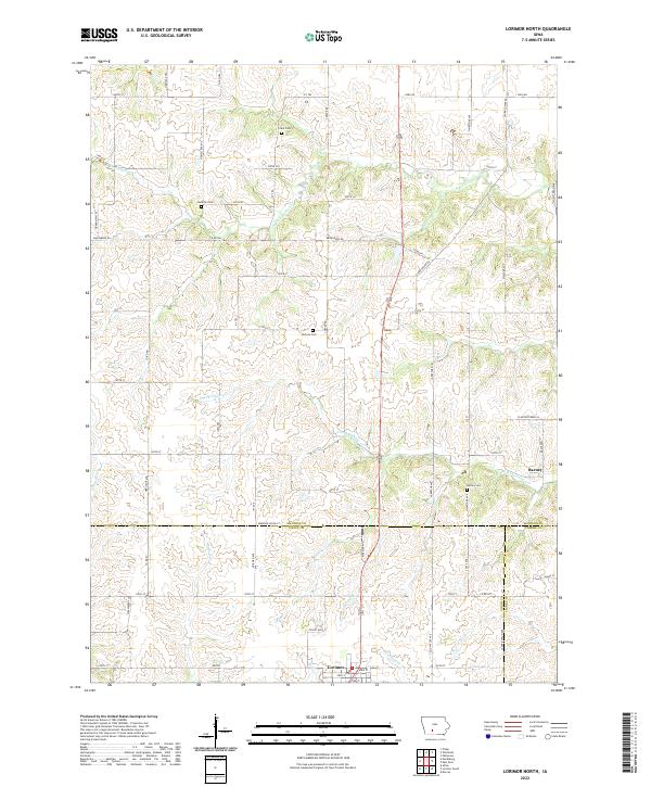 2022 Lorimor North2022 Print · USGSThe rural southern reaches of Madison County are captured here in the early twenty-first century, showcasing a landscape defined by farming and family history. Researchers can locate several historic burial grounds like Hamblin Cem and Barney Cem or trace the winding courses of S Fork Clanton Cr.
 - 2022 Map of Macksburg, 2022 Print
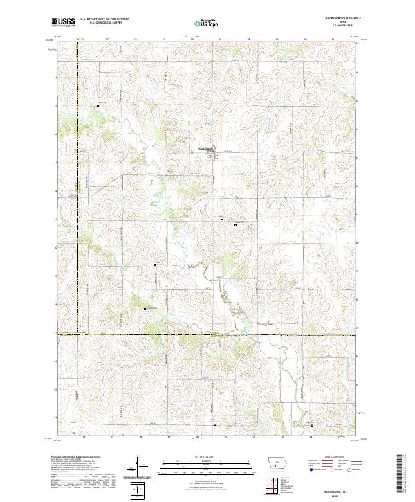 2022 Macksburg2022 Print · USGSMacksburg and the surrounding Madison County farm country are captured here in the early twenty-first century. Researchers can locate numerous local burial sites including West Branch Cem, Kivett Cem, and Dodge Center Cem.
 - 2022 Map of Winterset, 2022 Print
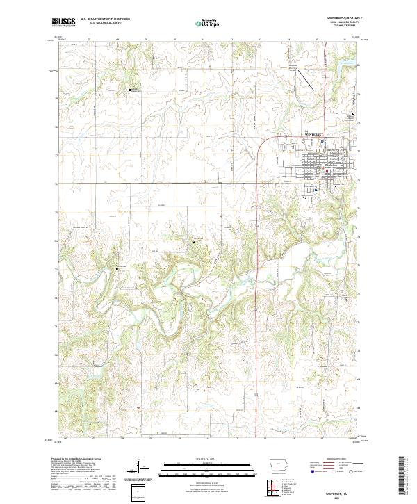 2022 Winterset2022 Print · USGSMadison County's central townships and the seat of Winterset are documented here in detail, showcasing the region's famous river valleys. Genealogists can locate family sites at the McDonald Chase Cemetery, Gordon Cem, or the Madison County Courthouse.
 - 2022 Map of Cumming, 2022 Print
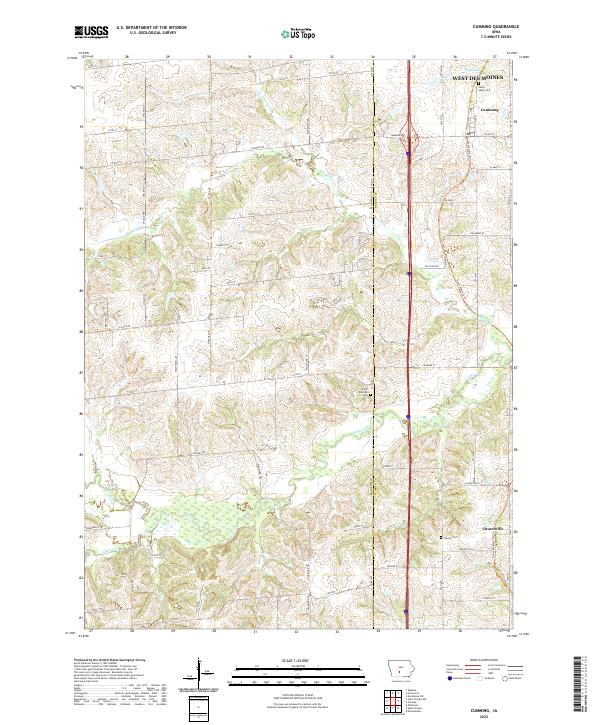 2022 Cumming2022 Print · USGSWarren County at the dawn of the 2020s shows the meeting point of suburban growth and traditional Iowa farmland. Genealogists and local historians can trace family plots at Saint Johns Cemetery or Calvary Cemetery and follow the natural course of North River.
 - 2022 Map of Saint Charles NW, 2022 Print
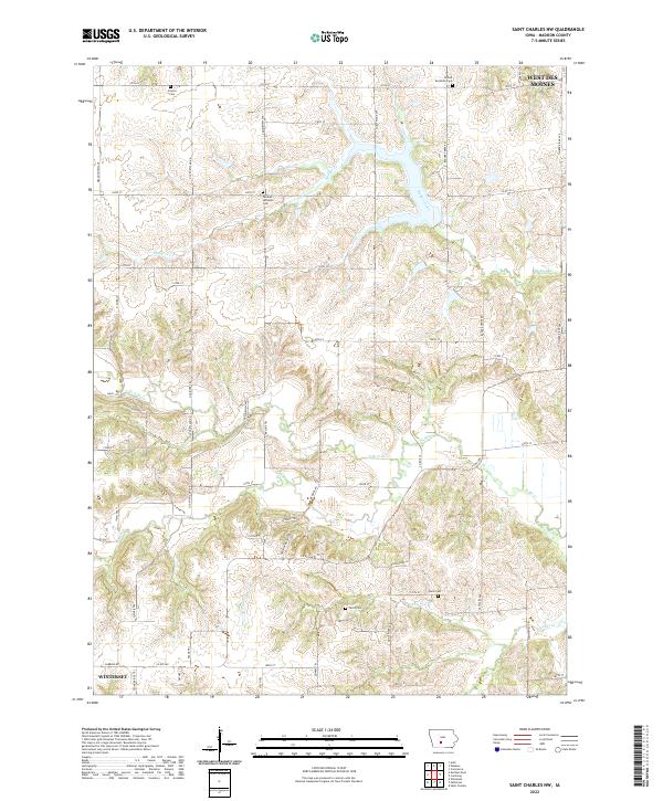 2022 Saint Charles NW2022 Print · USGSMadison County farmland near the North Branch of the North River is documented here in the early 2020s. Genealogists and local historians can trace legacy sites like the German Lutheran Cem, Farris Cem, and Payton Cem.
 - 2022 Map of Redfield, 2022 Print
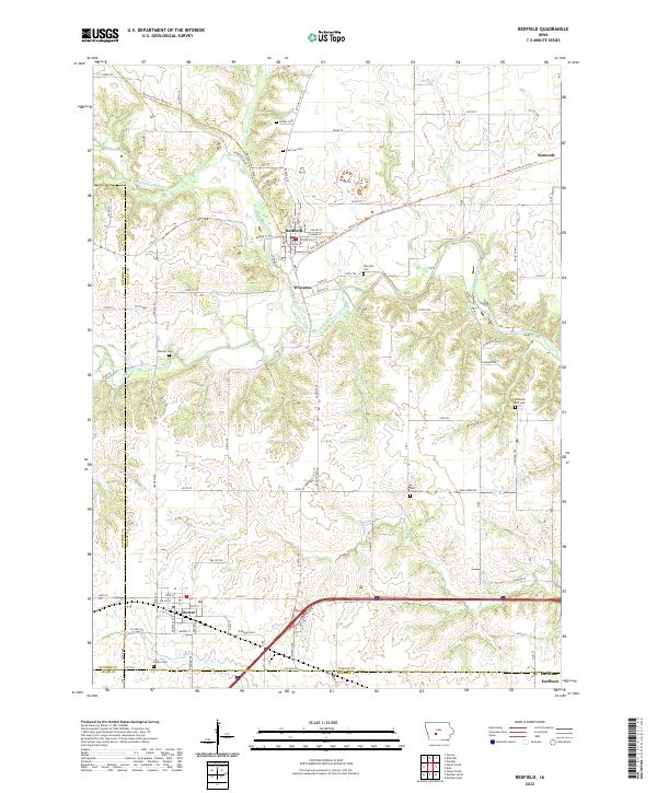 2022 Redfield2022 Print · USGSDallas County river towns and rural cemeteries are preserved in this recent survey of the Raccoon River valley. Genealogists can locate family burial sites at Spillers Cem or Bear Creek Cem and trace the legacy of Wiscotta and Redfield.
 - 2022 Map of Adel, 2022 Print
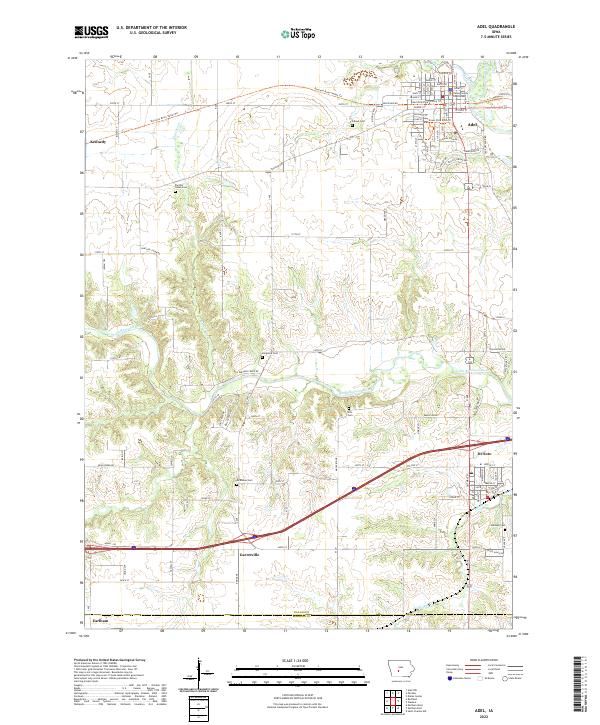 2022 Adel2022 Print · USGSAdel and the surrounding Dallas County countryside are mapped here in the early 2020s, showcasing a landscape of river valleys and growing towns. Researchers can locate numerous pioneer burial sites like Ellis Cem and Longmire Cem or trace the path of the Raccoon River.
 - 2022 Map of Patterson, 2022 Print
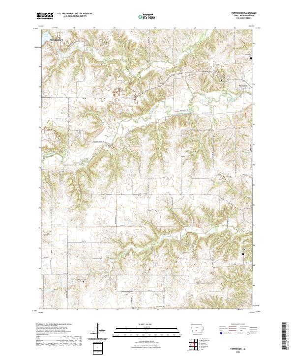 2022 Patterson2022 Print · USGSMadison County's river valleys and timbered ridges are captured here in the early twenty-first century, centered on the Middle River corridor. Genealogists can trace family heritage at several local burial sites, including Beem Cem, Sayre Cem, and Union Chapel Cem.
 - 2022 Map of Truro, 2022 Print
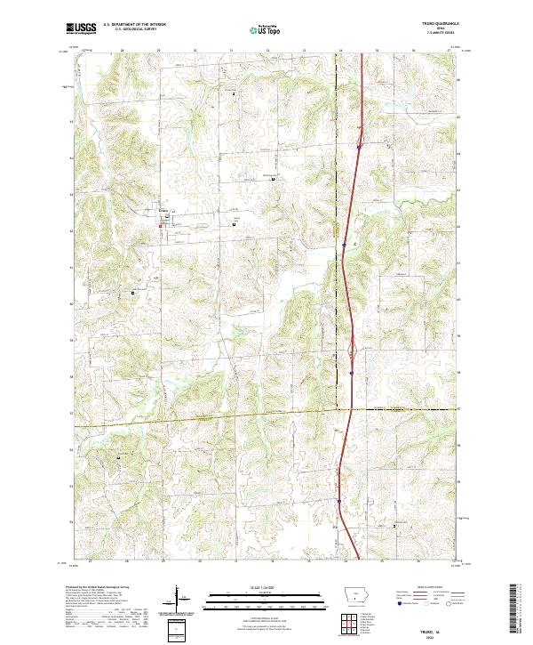 2022 Truro2022 Print · USGSThe intersection of Madison, Warren, and Clarke counties comes into focus in this recent survey of south-central Iowa. Genealogists can locate several local burial grounds including Young Cemetery, Field Cemetery, and Fremont Cemetery near the town of Truro.
 - 2022 Map of Waukee, 2022 Print
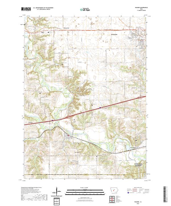 2022 Waukee2022 Print · USGSSuburban growth meets the river valleys of Dallas County in the early 2020s. Researchers can trace family history through many local burial sites like Iowa Veterans Cem and Booneville Cem or locate the junctions of the North Raccoon River.
 - 2022 Map of Saint Charles, 2022 Print
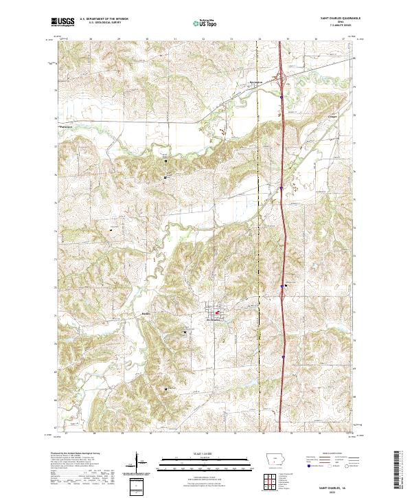 2022 Saint Charles2022 Print · USGSMadison and Warren counties are shown here in the 2020s, centered on the community of St. Charles. Researchers can trace rural lineages through numerous local sites including Saint Charles Cem, Viney Cem, and the crossroads at Hanley.
 - 2022 Map of Pitzer, 2022 Print
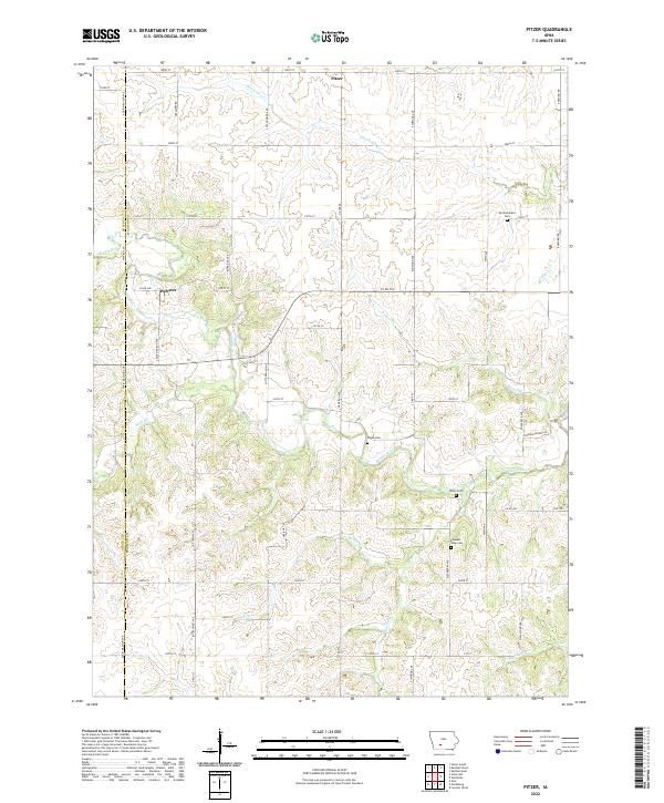 2022 Pitzer2022 Print · USGSMadison County farmland remains a network of quiet country roads and historic river crossings in the early twenty-first century. Genealogists can trace local legacies at Wintermantle Cem, Pleasant View Cem, and the small settlement of Pitzer.
 - 2022 Map of Commerce, 2022 Print
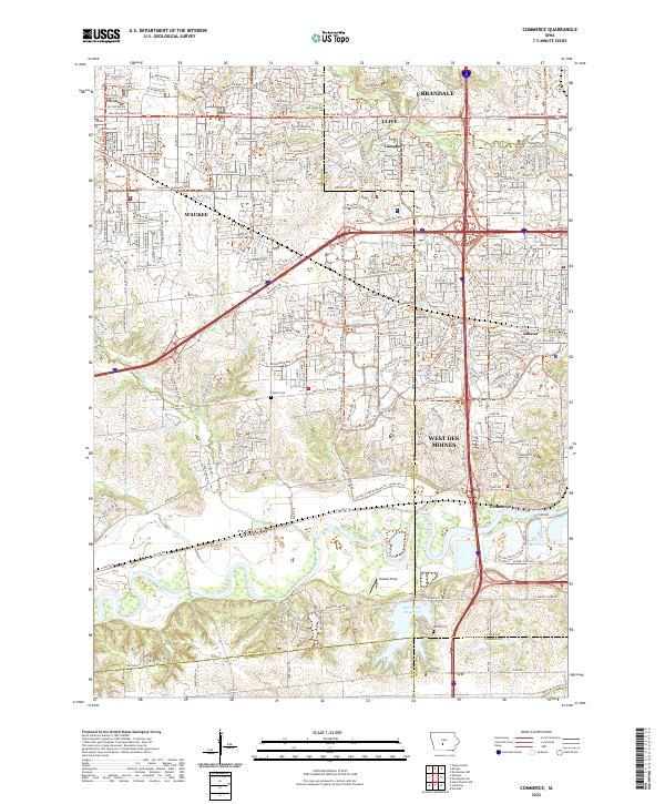 2022 Commerce2022 Print · USGSCentral Iowa's western suburbs emerge from the river valleys in this early 2020s study. Genealogists and local historians can trace legacy sites like Huston Cemetery and Ashawa or the namesake settlement at Commerce.
End of results
Showing maps 1-16 of 16
Top cities of Madison County
Frequently asked questions
- What are the different types of historical maps available for Madison County?
- What is the oldest map of Madison County?
- Where can I purchase historical maps of Madison County for my home or office?
- Where can I download high-res historical maps of Madison County?
- Are there historical topographic maps available for Madison County?
- Is there historical aerial imagery available for Madison County?
- Where are historical maps of Madison County sourced from?