Old Maps of Monona County, Iowa
Explore 147 old maps of Monona County, spanning from 1954 to today. These high-resolution historic maps reveal how streets, neighborhoods, landmarks, and natural features evolved over time — perfect for genealogy, metal detecting, research, and local history exploration.
What you can do with these maps:
- See how Monona County changed over time: Compare historical maps to modern-day views to trace roads, homesites, rail lines & more.
- View detailed metadata: Each map includes creators, publishers, year, scale, and archive source.
- Overlay maps with satellite & LiDAR: Visualize the past alongside modern tools to explore terrain & human change.
- Trusted historical sources: Maps sourced from the USGS, Library of Congress, and other archives.
- Access maps your way: View online, download high-res files, or order prints for personal or research use.
Start exploring old maps of Monona County to uncover forgotten places, hidden landmarks, and the deep history beneath your feet.
Monona County, IA maps
(147)- 1954 Map of Omaha, 1967 Print
 1954 Omaha1967 Print · USGSMid-century development radiates from the river bluffs into the agricultural heartland during this period of post-war growth. Genealogists and historians can trace rail-connected towns like Atlantic and Red Oak or locate the sprawling grounds of Offutt Air Force Base and Manawa Lake.3 unique versions available
 - 1954 Map of Fort Dodge, 1968 Print
 1954 Fort Dodge1968 Print · USGSNorthwest Iowa is shown here during a period of steady industrial and rail activity in the mid-fifties. Researchers can trace the extensive rail lines connecting Fort Dodge to mining and manufacturing sites like Gypsum and Industry Station.3 unique versions available
 - 1955 Map of Sioux City, 1959 Print
 1955 Sioux City1959 Print · USGSThe Missouri River valley in the mid-fifties is captured here during a time of major engineering and social transition. Genealogists and historians can trace the foundations of Gavins Point Dam, tribal boundaries on the Santee Sioux Indian Reservation, and local landmarks like the Norfolk State Hospital.4 unique versions available
 - 1955 Map of Fremont, 1966 Print
 1955 Fremont1966 Print · USGSEastern Nebraska and the Missouri River border are captured during the mid-fifties, just as the interstate system began to emerge. Researchers can trace the development of Omaha, locate the sprawling Offutt Air Force Base, or study the river-bound ecology of the De Soto National Wildlife Refuge.3 unique versions available
 - 1957 Map of Fremont
 1957 Fremont1957 Print · USGSEastern Nebraska and western Iowa thrive along the Platte and Missouri rivers during the mid-fifties. Genealogists can locate small rural schools like Fairview School and tracing the paths of the Union Pacific through towns like Albion and Humphrey.
 - 1957 Map of Omaha
 1957 Omaha1957 Print · USGSWestern Iowa and the Missouri River valley are seen here in the mid-fifties during the height of the rail-and-road era. Researchers can trace the sprawling rail lines of the Chicago And North Western or locate Cold War landmarks like Offutt Air Force Base.
 - 1957 Map of Fort Dodge
 1957 Fort Dodge1957 Print · USGSWest-central Iowa thrived as a network of rail-linked agricultural hubs and river towns during the mid-fifties. Researchers can trace the development of the Des Moines River valley and locate historic landmarks in Fort Dodge, Storm Lake, and Lehigh.
 - 1958 Map of Sioux City
 1958 Sioux City1958 Print · USGSThe Missouri River valley in the late fifties was a bustling intersection of tribal lands, rail corridors, and river towns. Genealogists can trace family roots through specific rural sites like Daisy Valley School, St Johns Church and School, and Yankton State Hospital.
 - 1958 Map of Omaha
 1958 Omaha1958 Print · USGSOmaha and Council Bluffs stand at the center of this mid-fifties landscape, where the Missouri River splits the urban plains of Nebraska from the rolling hills of western Iowa. Genealogists can trace the rail lines of the Wabash RR and Illinois Central RR to rural settlements like Missouri Valley and Red Oak.2 unique versions available
 - 1958 Map of Fremont
 1958 Fremont1958 Print · USGSEastern Nebraska in the late fifties is captured here as a thriving corridor of river-valley commerce and rail transport. Researchers can trace the development of Omaha and Fremont or locate local landmarks like Midland College and Offutt Air Force Base.
 - 1958 Map of Fort Dodge
 1958 Fort Dodge1958 Print · USGSWestern Iowa in the mid-1950s reveals a productive landscape of river-valley industry and prairie agricultural hubs. Researchers can trace the development of the Des Moines River corridor through Fort Dodge and locate vanished local landmarks near Coalville or Storm Lake.
 - 1959 Map of Sioux City
 1959 Sioux City1959 Print · USGSThe tri-state region surrounding the Missouri River is captured here in the late fifties, showing the convergence of Nebraska, South Dakota, and Iowa. Researchers can trace rural lineages through numerous country schoolhouses like Cemetery School and the many numbered Washington School districts.
 - 1966 Map of Macy, 1968 Print
 1966 Macy1968 Print · USGSThe Omaha Indian Reservation and the Missouri River bluffs are documented here in the mid-sixties. Genealogists and local historians can trace rural homestead patterns near Macy, the site of Omaha Tribal Cem, and several numbered schools such as School No 14.
 - 1969 Map of Danbury, 1971 Print
 1969 Danbury1971 Print · USGSDanbury and the surrounding river valleys are captured here in the late sixties as the rail-and-river economy shaped Woodbury County. Researchers can locate several burial grounds including St Marys Cem and Hartleben Cem, or trace the Chicago and North Western line.2 unique versions available
 - 1969 Map of Mapleton, 1971 Print
 1969 Mapleton1971 Print · USGSMapleton was a bustling Monona County rail junction in the late sixties, where two major rail lines converged along the Maple River. Genealogists and local historians can locate family burial plots at Mt Hope Cem and Heisler Cem or trace the winding course of Pumpkin Run.2 unique versions available
 - 1969 Map of Castana, 1971 Print
 1969 Castana1971 Print · USGSMonona County's river valleys and rail corridors are documented here in the late sixties as the agricultural landscape matured. Researchers can trace family roots at Kennebec Cem or follow the Chicago and North Western tracks through Castana and Turin.2 unique versions available
 - 1969 Map of Onawa, 1971 Print
 1969 Onawa1971 Print · USGSOnawa and the surrounding Monona County flatlands are shown in the late sixties as a landscape defined by industrial-scale drainage and rail transit. Genealogists and local historians can trace the town's footprint from the West Monona Sch to the Cemetery and the small siding at Kennebec.
 - 1969 Map of Albaton, 1971 Print
 1969 Albaton1971 Print · USGSThe Missouri River valley along the Iowa-Nebraska border comes to life in this late sixties survey of Monona County. Researchers can trace the intricate Winnebago Indian Reservation Boundary and locate local landmarks like Albaton, Fairview Cem, and Sand Hill Lake.
 - 1969 Map of Hornick, 1971 Print
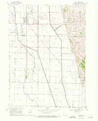 1969 Hornick1971 Print · USGSWoodbury and Monona counties are shown in the late 1960s during a period of extensive water management and rail-dependent farming. Researchers can trace the drainage of the Little Sioux valley through the West Fork Ditch and locate landmarks like Grant Center or the Chicago Milwaukee St Paul and Pacific rail line.
 - 1969 Map of Smithland, 1971 Print
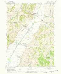 1969 Smithland1971 Print · USGSThe Little Sioux River valley in the late 1960s reveals a landscape of river-bottom commerce and hillside cemeteries. Trace family history at Smithland Cem or follow the Chicago Milwaukee St Paul and Pacific Railroad through Rodney and Ticonic.
 - 1969 Map of Sloan, 1971 Print
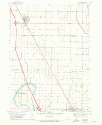 1969 Sloan1971 Print · USGSNear the Woodbury and Monona county line in the late sixties, the railroad towns of Sloan and Whiting centered this agricultural corridor. Researchers can locate family burial plots at Hite Cem and Clark Cem or trace the early paths of the Chicago and North Western line.
 - 1969 Map of Onawa SW, 1971 Print
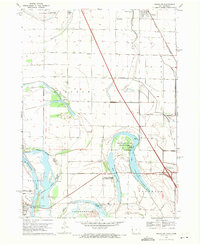 1969 Onawa SW1971 Print · USGSThe Missouri River bottoms at the close of the 1960s reveal a landscape of managed wetlands and vital river crossings. Researchers can trace the Chicago and North Western rail line near Whiting or locate Harrison Cem and Nebowa Camp.
 - 1970 Map of Little Sioux, 1972 Print
 1970 Little Sioux1972 Print · USGSThe Missouri River floodplain comes into sharp focus during the 1970s, showing a landscape shaped by both nature and heavy engineering. Genealogists and local historians can trace early residents through Little Sioux Cem and Roughcorn Cem, or follow the path of the Chicago and North Western railroad.
 - 1970 Map of Tekamah NW, 1972 Print
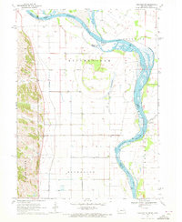 1970 Tekamah NW1972 Print · USGSThe Missouri River floodplain comes into sharp focus during the 1970s, showing a landscape of managed drainage and small rural hubs. Researchers can trace family ties at the Riverside Ch or locate landmarks like Lake Quinnebaugh and the Huff Access County Park.
 - 1970 Map of Blencoe, 1972 Print
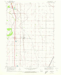 1970 Blencoe1972 Print · USGSMonona County agriculture was at its peak in the early seventies, defined by a massive network of irrigation and drainage canals. Trace the paths of the Chicago and North Western rail line and local landmarks like Graceland Cem and Creswell Landing Strip.
Showing maps 1-25 of 147
Top cities of Monona County
- Onawa historical maps
- Mapleton historical maps
- Whiting historical maps
- Ute historical maps
- Blencoe historical maps
- Moorhead historical maps
See more
Frequently asked questions
- What are the different types of historical maps available for Monona County?
- What is the oldest map of Monona County?
- Where can I purchase historical maps of Monona County for my home or office?
- Where can I download high-res historical maps of Monona County?
- Are there historical topographic maps available for Monona County?
- Is there historical aerial imagery available for Monona County?
- Where are historical maps of Monona County sourced from?