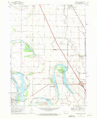
1969 Map of Onawa SW
USGS Topo · Published 1971About this map
Blue Lake and the sweeping curves of the Missouri River define this riverfront landscape along the border of Iowa and Nebraska. The map details a transition between the elevated plains and the fertile bottomlands, where the Chicago and North Western railroad corridor serves the northern settlement of Whiting. A heavy focus on conservation is evident through the inclusion of Lewis and Clark State Park and the expansive Badger Lake State Wildlife Management Area, preserving the wetlands and oxbow features typical of this riparian environment.
Find a feature on this map
28 named features on this map. Tap any name to fly to it.
Don’t see what you’re looking for? This feature index may not catch every label — zoom into the map to look around manually.
Map Details
Editions of this 1969 Onawa SW Map
This is the sole edition of this map. No revisions or reprints were ever made.
Other maps of this area

1955 · Sioux City
USGS Topo · 1:250,000

1955 · Fremont
USGS Topo · 1:250,000

1957 · Fremont
USGS Topo · 1:250,000

1958 · Sioux City
USGS Topo · 1:250,000

1958 · Fremont
USGS Topo · 1:250,000

1959 · Sioux City
USGS Topo · 1:250,000

1966 · Macy
USGS Topo · 1:24,000

1969 · Onawa
USGS Topo · 1:24,000

1969 · Albaton
USGS Topo · 1:24,000
1969 · Hornick
USGS Topo · 1:24,000