Old Maps of Burt County, Nebraska
Explore 102 old maps of Burt County, spanning from 1955 to today. These high-resolution historic maps reveal how streets, neighborhoods, landmarks, and natural features evolved over time — perfect for genealogy, metal detecting, research, and local history exploration.
What you can do with these maps:
- See how Burt County changed over time: Compare historical maps to modern-day views to trace roads, homesites, rail lines & more.
- View detailed metadata: Each map includes creators, publishers, year, scale, and archive source.
- Overlay maps with satellite & LiDAR: Visualize the past alongside modern tools to explore terrain & human change.
- Trusted historical sources: Maps sourced from the USGS, Library of Congress, and other archives.
- Access maps your way: View online, download high-res files, or order prints for personal or research use.
Start exploring old maps of Burt County to uncover forgotten places, hidden landmarks, and the deep history beneath your feet.
Burt County, NE maps
(102)- 1955 Map of Sioux City, 1959 Print
 1955 Sioux City1959 Print · USGSThe Missouri River valley in the mid-fifties is captured here during a time of major engineering and social transition. Genealogists and historians can trace the foundations of Gavins Point Dam, tribal boundaries on the Santee Sioux Indian Reservation, and local landmarks like the Norfolk State Hospital.4 unique versions available
 - 1955 Map of Fremont, 1966 Print
 1955 Fremont1966 Print · USGSEastern Nebraska and the Missouri River border are captured during the mid-fifties, just as the interstate system began to emerge. Researchers can trace the development of Omaha, locate the sprawling Offutt Air Force Base, or study the river-bound ecology of the De Soto National Wildlife Refuge.3 unique versions available
 - 1957 Map of Fremont
 1957 Fremont1957 Print · USGSEastern Nebraska and western Iowa thrive along the Platte and Missouri rivers during the mid-fifties. Genealogists can locate small rural schools like Fairview School and tracing the paths of the Union Pacific through towns like Albion and Humphrey.
 - 1958 Map of Sioux City
 1958 Sioux City1958 Print · USGSThe Missouri River valley in the late fifties was a bustling intersection of tribal lands, rail corridors, and river towns. Genealogists can trace family roots through specific rural sites like Daisy Valley School, St Johns Church and School, and Yankton State Hospital.
 - 1958 Map of Fremont
 1958 Fremont1958 Print · USGSEastern Nebraska in the late fifties is captured here as a thriving corridor of river-valley commerce and rail transport. Researchers can trace the development of Omaha and Fremont or locate local landmarks like Midland College and Offutt Air Force Base.
 - 1959 Map of Sioux City
 1959 Sioux City1959 Print · USGSThe tri-state region surrounding the Missouri River is captured here in the late fifties, showing the convergence of Nebraska, South Dakota, and Iowa. Researchers can trace rural lineages through numerous country schoolhouses like Cemetery School and the many numbered Washington School districts.
 - 1966 Map of Oakland, 1967 Print
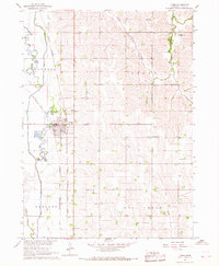
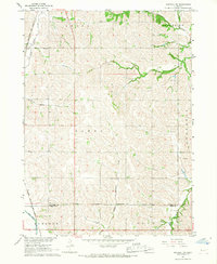
 1966 Oakland1967 Print · USGSBurt County agriculture and rail transport intersect in the mid-sixties, centered on the junction at Oakland. Researchers can trace old property lines and rural education history through several sites like Harmony Sch, Mt Olive Sch, and the Logan Creek Dredge waterway.
 - 1966 Map of West Point SE, 1967 Print
 1966 West Point SE1967 Print · USGSNortheastern Nebraska farmlands appear in detail in the mid-sixties, showcasing a landscape of section-line roads and family burial grounds. Local researchers can trace rural school districts like School No 81 and find historic sites such as Blomgren Cem or Salem Ch.
 - 1966 Map of Uehling, 1967 Print
 1966 Uehling1967 Print · USGSDodge and Cuming counties are shown here in the mid-sixties during a period of significant agricultural and rail activity. Genealogists and local historians can locate several numbered schoolhouses like School No 83 and historic rural churches such as St Johns Ch.
 - 1966 Map of Lyons, 1967 Print
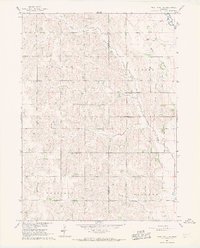
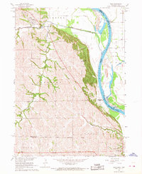
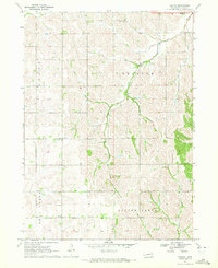
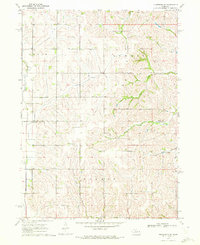
 1966 Lyons1967 Print · USGSBurt County farmland is meticulously detailed in the mid-1960s, showing the intersection of rail commerce and agricultural drainage. Researchers can locate numerous vanished country schools and churches like Jefferson School, Blackbird Church, and the St Johns Cemetery.
 - 1966 Map of West Point NE, 1967 Print
 1966 West Point NE1967 Print · USGSCuming and Burt Counties were defined by a grid of family farms and local school districts during the mid-sixties. Researchers can locate vanished rural landmarks like Townhall, School No 32, and St Josephs Cem across the Neligh and Everett townships.
 - 1966 Map of Walthill SW, 1967 Print
 1966 Walthill SW1967 Print · USGSThurston and Burt County landscapes are captured here in the mid-1960s, showing the intersection of tribal lands and rural development. Trace the rail corridor of the Chicago Burlington and Quincy or locate the old Martin Sch.
 - 1966 Map of Nickerson NW, 1967 Print
 1966 Nickerson NW1967 Print · USGSThe rural borderlands of Dodge, Burt, and Washington counties are captured here in the mid-1960s, showing a landscape of established family farms. Genealogists can trace localized history through numerous country burial sites like Argo Cem and Logan Cem, alongside early district schools such as School No 68.
 - 1966 Map of Bancroft, 1968 Print
 1966 Bancroft1968 Print · USGSBancroft and Rosalie are captured at the edge of the Omaha Indian Reservation in the mid-sixties. Genealogists and local historians can trace rural school locations like School No 10 and School No 72 or the path of the Chicago Burlington and Quincy rail line.
 - 1966 Map of Macy, 1968 Print
 1966 Macy1968 Print · USGSThe Omaha Indian Reservation and the Missouri River bluffs are documented here in the mid-sixties. Genealogists and local historians can trace rural homestead patterns near Macy, the site of Omaha Tribal Cem, and several numbered schools such as School No 14.
 - 1969 Map of Onawa SW, 1971 Print
 1969 Onawa SW1971 Print · USGSThe Missouri River bottoms at the close of the 1960s reveal a landscape of managed wetlands and vital river crossings. Researchers can trace the Chicago and North Western rail line near Whiting or locate Harrison Cem and Nebowa Camp.
 - 1970 Map of Oakland SE, 1971 Print
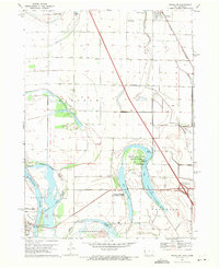
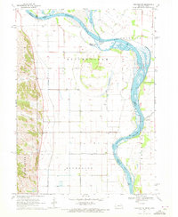
 1970 Oakland SE1971 Print · USGSBurt County land and industry are captured here at the start of the 1970s, focused on the rail-side village of Craig. Genealogists and historians can trace family plots at Silver Creek Cem and follow the route of the Chicago and North Western railroad.2 unique versions available
 - 1970 Map of Little Sioux, 1972 Print
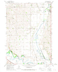
 1970 Little Sioux1972 Print · USGSThe Missouri River floodplain comes into sharp focus during the 1970s, showing a landscape shaped by both nature and heavy engineering. Genealogists and local historians can trace early residents through Little Sioux Cem and Roughcorn Cem, or follow the path of the Chicago and North Western railroad.
 - 1970 Map of Tekamah NW, 1972 Print
 1970 Tekamah NW1972 Print · USGSThe Missouri River floodplain comes into sharp focus during the 1970s, showing a landscape of managed drainage and small rural hubs. Researchers can trace family ties at the Riverside Ch or locate landmarks like Lake Quinnebaugh and the Huff Access County Park.
 - 1970 Map of Bertha, 1972 Print
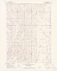
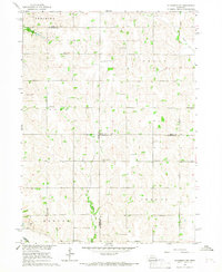
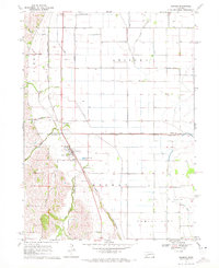
 1970 Bertha1972 Print · USGSBurt County agriculture and community life are captured here in the early seventies, showing a landscape of scattered schools and prairie drainages. Genealogists can trace family roots at Holy Family Cem or locate rural centers like Bertha and Divide Center Ch.
 - 1970 Map of Herman, 1972 Print
 1970 Herman1972 Print · USGSIn the early seventies, the farming country near Herman was defined by its railroad grain connections and a sophisticated network of drainage ditches. Researchers can trace family history at the Herman Cem or explore the rail siding at Ranch Spur.
 - 1970 Map of Mondamin, 1972 Print
 1970 Mondamin1972 Print · USGSThe Missouri River floodplain of western Iowa is captured here in the early seventies, showing a landscape of managed drainage and rail transit. Genealogists and researchers can trace the roads around Mondamin, find the Noyes Cem, and explore the marshes of Round Lake.
 - 1970 Map of Nickerson NE, 1972 Print
 1970 Nickerson NE1972 Print · USGSEastern Nebraska agricultural life is captured here just after the mid-century, showing the rural landscape of the Burt Co and Washington Co border. Genealogists can locate family landmarks like New England Cem and the Alder Grove Ch.
 - 1970 Map of Tekamah, 1972 Print
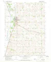
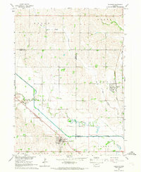
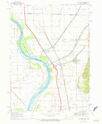
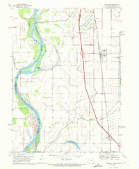
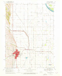 1970 Tekamah1972 Print · USGSTekamah and the surrounding Nebraska-Iowa borderlands are captured here during a period of significant agricultural engineering in the early seventies. Genealogists and local historians can trace family plots at Tekamah Cemetery or locate civic roots near the Courthouse and the Chicago and North Western rail line.2 unique versions available
 - 1986 Map of Sioux City South
 1986 Sioux City South1986 Print · USGSThe tri-state borderlands of Iowa, Nebraska, and South Dakota come into focus in the mid-1980s as a landscape of tribal lands and rail corridors. Researchers can trace the extensive boundaries of the Winnebago Indian Reservation and find local landmarks like Morningside College and Martin Field.2 unique versions available
Showing maps 1-25 of 102
Top cities of Burt County
- Tekamah historical maps
- Oakland historical maps
- Lyons historical maps
- Decatur historical maps
- Arizona historical maps
- Craig historical maps
Frequently asked questions
- What are the different types of historical maps available for Burt County?
- What is the oldest map of Burt County?
- Where can I purchase historical maps of Burt County for my home or office?
- Where can I download high-res historical maps of Burt County?
- Are there historical topographic maps available for Burt County?
- Is there historical aerial imagery available for Burt County?
- Where are historical maps of Burt County sourced from?