
1955 Map of Fremont
USGS Topo · Published 1966About this map
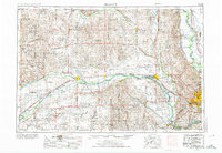
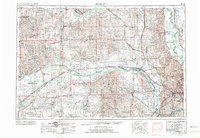
The Elkhorn River and Platte River valley systems dominate this mid-century portrait of Eastern Nebraska and Western Iowa. At the eastern edge, the Missouri River forms the twisting border where the De Soto National Wildlife Refuge and De Soto Lake sit just north of the growing Omaha metropolitan area. The map documents a critical infrastructure moment as Interstate 80 and Interstate 29 begin to redefine regional transit, supplementing a dense network of older rail lines like the Union Pacific RR and Chicago and North Western Ry. To the south, Offutt Air Force Base stands as a significant military installation near the confluence of the Platte and Missouri. The landscape is dotted with established agricultural centers such as Madison, West Point, and Missouri Valley, while the western reaches show the edge of the Sand Hills terrain.
Find a feature on this map
184 named features on this map. Tap any name to fly to it.
Don’t see what you’re looking for? This feature index may not catch every label — zoom into the map to look around manually.
Map Details
Editions of this 1955 Fremont Map
3 editions found
Other maps of this area

1893 · Omaha
USGS Topo · 1:62,500

1893 · Fremont
USGS Topo · 1:125,000

1896 · Stromsburg
USGS Topo · 1:125,000

1896 · Fremont
USGS Topo · 1:125,000

1897 · Lincoln
USGS Topo · 1:125,000

1898 · York
USGS Topo · 1:125,000

1898 · Grand Island
USGS Topo · 1:125,000

1899 · Wahoo
USGS Topo · 1:125,000

1899 · David City
USGS Topo · 1:125,000

1899 · St. Paul
USGS Topo · 1:125,000