2020s Maps of Osceola County, Iowa
Explore 12 historic maps of Osceola County from the 2020s. These maps offer a rare glimpse into what life looked like during the 2020s — showing old roads, neighborhoods, homes, and landmarks that have changed or disappeared over time.
Whether you're researching your family's past, planning a metal detecting trip, or studying how Osceola County's landscape evolved across the 2020s, these high-resolution maps are a powerful tool for exploring the history of this region.
- Focus on a specific era: All maps on this page are from the 2020s, giving you a focused view of this time period.
- See what’s changed: Compare century-old streets, trails, and buildings to today's modern landscape using overlays and satellite layers.
- Research with precision: Use these maps for genealogy, historical research, land use analysis, or educational projects.
- View, download, or print: Maps are fully viewable online in high resolution, and can be downloaded or printed for your own records.
Start exploring Osceola County's history through authentic maps from the 2020s. This is your window into the past.
Osceola County, IA maps
(12)- 2022 Map of Rushmore, 2022 Print
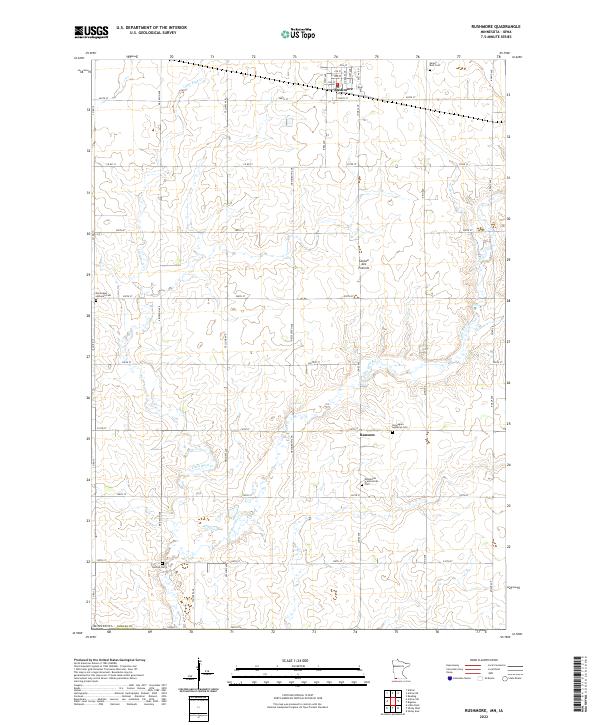 2022 Rushmore2022 Print · USGSNobles County's agricultural heartland is captured here in the early twenty-first century, centered on the upland heights of the Coteau des Prairies. Researchers can map out early family holdings near Rushmore and Ransom, or locate rural burial grounds such as Sunset Rest Cem.
 - 2022 Map of Round Lake, 2022 Print
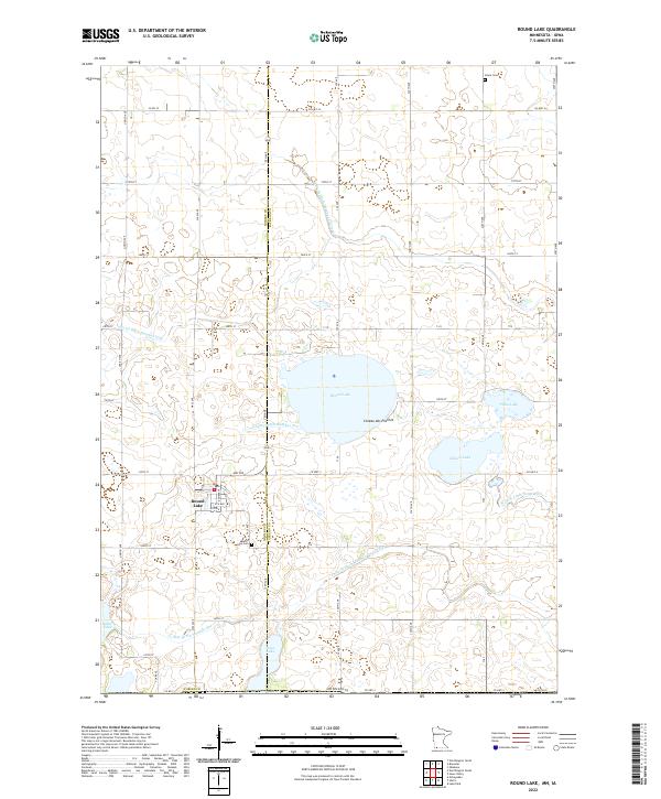 2022 Round Lake2022 Print · USGSThe town of Round Lake and the surrounding Minnesota prairie are captured here in a 2022 survey of the Coteau des Prairies landscape. Researchers can trace family history at Round Lake Cem and Grace Cem or explore the intricate network of Judicial Ditch Number Thirteen and local lakes.
 - 2022 Map of Worthington South, 2022 Print
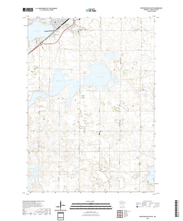 2022 Worthington South2022 Print · USGSThe southern outskirts of Worthington and the surrounding prairie wetlands come into focus in this contemporary survey of Nobles County. Genealogists and local researchers can trace cemetery locations like Saint Marys Cem and follow the path of the Ocheyedan River across the Coteau des Prairies.
 - 2022 Map of Bigelow, 2022 Print
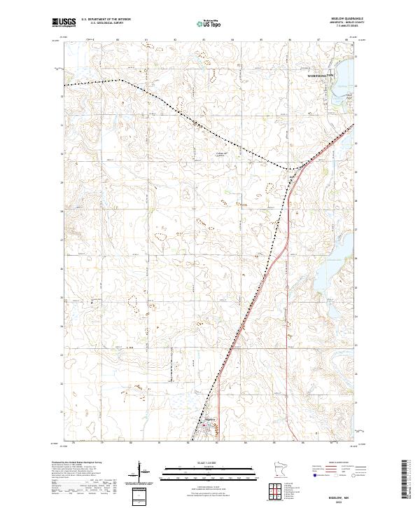 2022 Bigelow2022 Print · USGSNobles County's glacial landscape is documented here in the early 2020s, showing the intersection of prairie hydrology and rural settlement. Genealogists and local historians can locate the historic Ransom Cem and trace the paths of the Ocheyedan River and the town of Bigelow.
 - 2022 Map of Cloverdale, 2022 Print
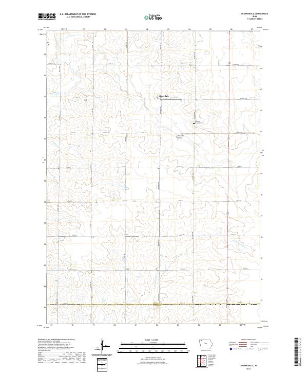 2022 Cloverdale2022 Print · USGSOsceola County farmland is meticulously detailed in the early 2020s, showing the intersection of rural life and the agricultural grid. Trace family history at the Goewey Prairie Cem or follow the headwaters of the N Fork Floyd River near Cloverdale.
 - 2022 Map of Melvin, 2022 Print
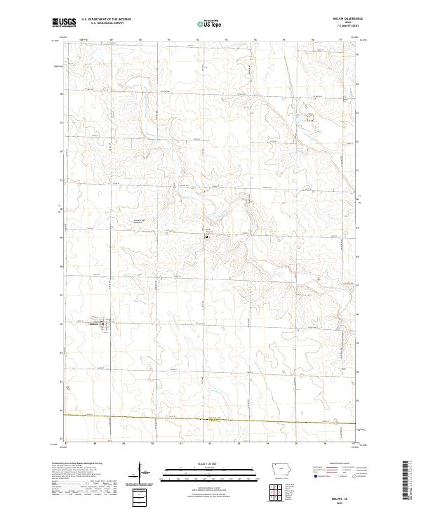 2022 Melvin2022 Print · USGSThe prairie landscape of Osceola County is captured here in the early 2020s, centered on the settlement of Melvin. Family historians can locate the Baker Township Cem and trace the winding courses of the Little Ocheyedan River and Waterman Cr.
 - 2022 Map of Ashton, 2022 Print
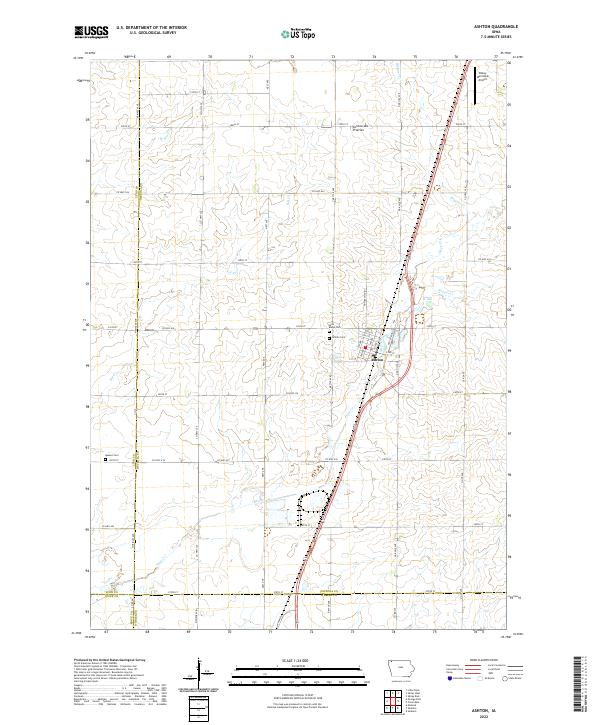 2022 Ashton2022 Print · USGSNorthwest Iowa's agricultural heartland is documented here in the early twenty-first century, centered on the community of Ashton. Researchers can trace local heritage through sites like Saint Marys Cem or follow the paths of Otter Cr and Rat Cr.
 - 2022 Map of Ocheyedan, 2022 Print
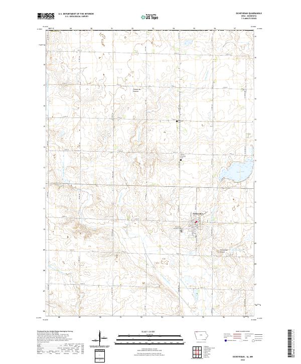 2022 Ocheyedan2022 Print · USGSThis northwestern Iowa prairie landscape reflects a century of agricultural settlement in the early twenty-first century. Family history researchers can locate several area burial grounds, including Zion Lutheran Cem and Horton Township Cem, alongside the prominent Ocheyedan Mound.
 - 2022 Map of May City, 2022 Print
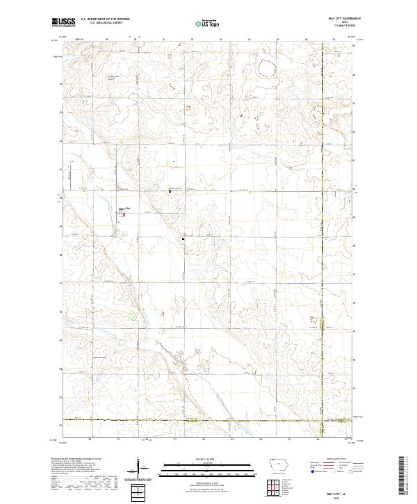 2022 May City2022 Print · USGSOsceola County farmland is meticulously documented here as it appeared in the early 2020s. Genealogists can trace family roots near the May City settlement or locate burials at the Harrison Cem and Mennonite Cem along the Ocheyedan River.
 - 2022 Map of Harris, 2022 Print
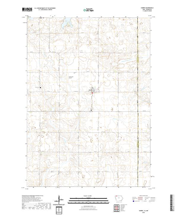 2022 Harris2022 Print · USGSThe town of Harris and the surrounding Osceola County farmland are shown here in the early twenty-first century. Genealogists and local historians can trace rural cemetery sites like Union Cem and Fairview Cem or locate the shoreline of Iowa Lake.
 - 2022 Map of Sibley West, 2022 Print
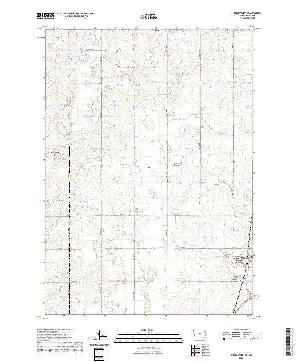 2022 Sibley West2022 Print · USGSOsceola County farmland and the rising Coteau des Prairies define this portion of northwest Iowa in the early twenty-first century. Researchers can trace local genealogy at Hope Church Cem or map the drainage of the Little Rock River and Argo Slough.
 - 2022 Map of Sibley East, 2022 Print
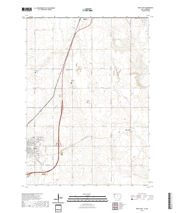 2022 Sibley East2022 Print · USGSOsceola County at the turn of the 21st century features the highest natural elevation in Iowa and the regional hub of Sibley. Genealogists and local historians can trace the town grid around the Osceola County Courthouse and locate the North Sibley Cem and Wilson Township Cem.
End of results
Showing maps 1-12 of 12
Top cities of Osceola County
- Sibley historical maps
- Ocheyedan historical maps
- Ashton historical maps
- Melvin historical maps
- Harris historical maps
Frequently asked questions
- What are the different types of historical maps available for Osceola County?
- What is the oldest map of Osceola County?
- Where can I purchase historical maps of Osceola County for my home or office?
- Where can I download high-res historical maps of Osceola County?
- Are there historical topographic maps available for Osceola County?
- Is there historical aerial imagery available for Osceola County?
- Where are historical maps of Osceola County sourced from?