2020s Maps of Ringgold County, Iowa
Explore 16 historic maps of Ringgold County from the 2020s. These maps offer a rare glimpse into what life looked like during the 2020s — showing old roads, neighborhoods, homes, and landmarks that have changed or disappeared over time.
Whether you're researching your family's past, planning a metal detecting trip, or studying how Ringgold County's landscape evolved across the 2020s, these high-resolution maps are a powerful tool for exploring the history of this region.
- Focus on a specific era: All maps on this page are from the 2020s, giving you a focused view of this time period.
- See what’s changed: Compare century-old streets, trails, and buildings to today's modern landscape using overlays and satellite layers.
- Research with precision: Use these maps for genealogy, historical research, land use analysis, or educational projects.
- View, download, or print: Maps are fully viewable online in high resolution, and can be downloaded or printed for your own records.
Start exploring Ringgold County's history through authentic maps from the 2020s. This is your window into the past.
Ringgold County, IA maps
(16)- 2021 Map of Blockton SE, 2021 Print
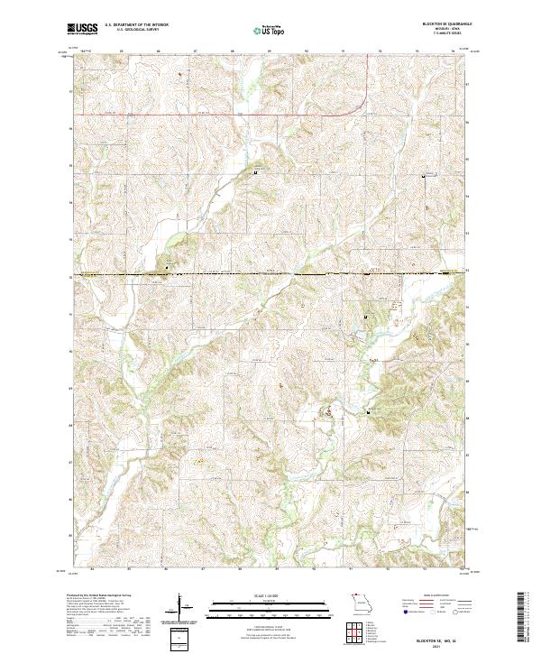 2021 Blockton SE2021 Print · USGSThe Missouri-Iowa border region comes alive through its river valleys and remote burial grounds in this recent survey. Local researchers can trace the course of the East Fork Grand River and locate historic sites like Middle Fork Cem or Crim Cem.
 - 2021 Map of Pawnee, 2021 Print
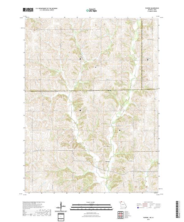 2021 Pawnee2021 Print · USGSThe Missouri-Iowa border comes into focus in this recent survey of the rural landscape between Harrison and Ringgold counties. Genealogists can trace family heritage through numerous burial sites including Mount Zion Cem, Payne Cem, and Brown Cem.
 - 2021 Map of Hatfield, 2021 Print
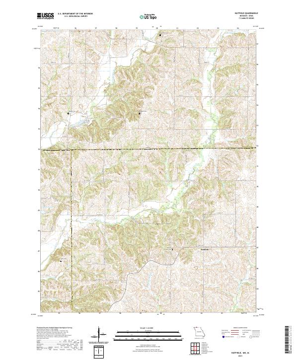 2021 Hatfield2021 Print · USGSThe Missouri-Iowa borderlands near Hatfield are mapped here in fine detail during the early twenty-first century. Researchers can trace rural lineages through local landmarks like Lincoln Center Cem, Oakdale Cem, and the winding Lotts Cr.
 - 2022 Map of Clearfield, 2022 Print
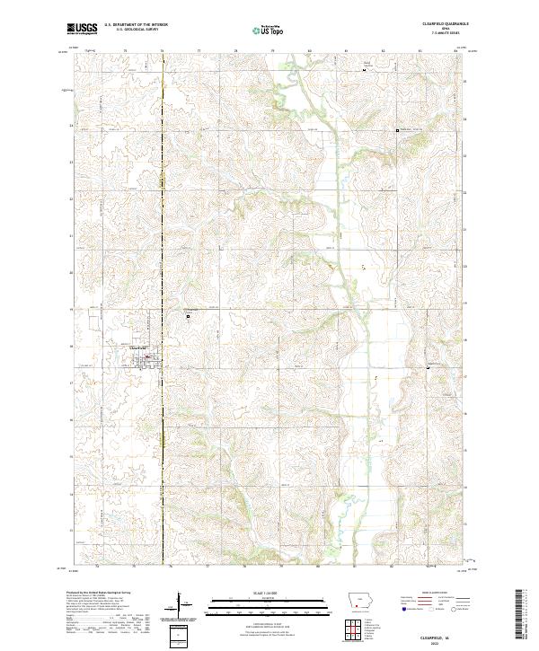 2022 Clearfield2022 Print · USGSClearfield and the surrounding farm country are mapped here at the Taylor and Ringgold county line in recent years. Researchers can pinpoint early family burial sites like Tindie Cem and Rising Sun Cem or trace the path of the Platte River.
 - 2022 Map of Blockton, 2022 Print
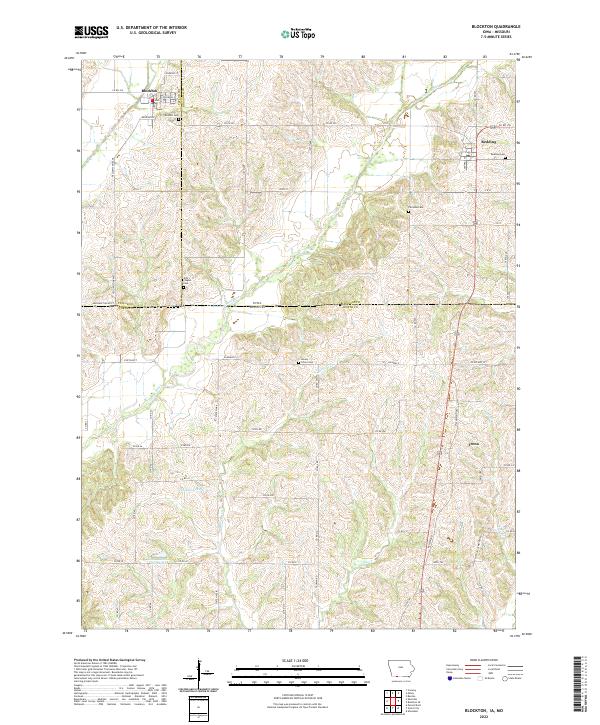 2022 Blockton2022 Print · USGSThe Iowa-Missouri borderlands near Blockton and Redding are shown in detail during the early 2020s. Genealogists and local historians can trace rural roots across five distinct burial sites, including Fairview Cem and Honey Grove Cem, along the Grand River.
 - 2022 Map of Kent, 2022 Print
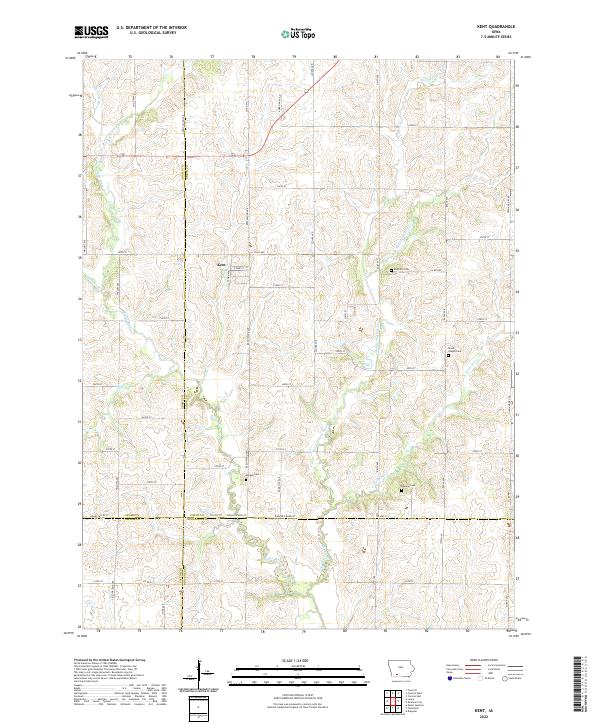 2022 Kent2022 Print · USGSThe rural town of Kent is documented here in the early twenty-first century, surrounded by the headwaters of the Platte River system. Family historians can locate several local burial sites, including McDuffie Cem, Morgan Cem, and the Grove Chapel Cem.
 - 2022 Map of Benton, 2022 Print
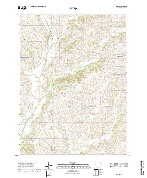 2022 Benton2022 Print · USGSRinggold County’s agricultural heartland is documented here in the early 2020s, showing the enduring rural layout of southern Iowa. Researchers can trace family history through Benton Cem and Marshalltown Cem or explore the banks of the Grand River.
 - 2022 Map of Mount Ayr, 2022 Print
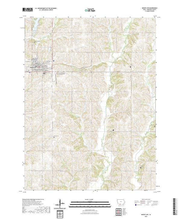 2022 Mount Ayr2022 Print · USGSMount Ayr serves as a classic Iowa county seat at the start of the 2020s, anchoring a landscape defined by the winding E Fork Grand River. Researchers can trace local history through numerous rural burial grounds like Sweet Home Cem and Tedrow Cem, or locate landmarks such as the Ringgold County Courthouse.
 - 2022 Map of Ellston, 2022 Print
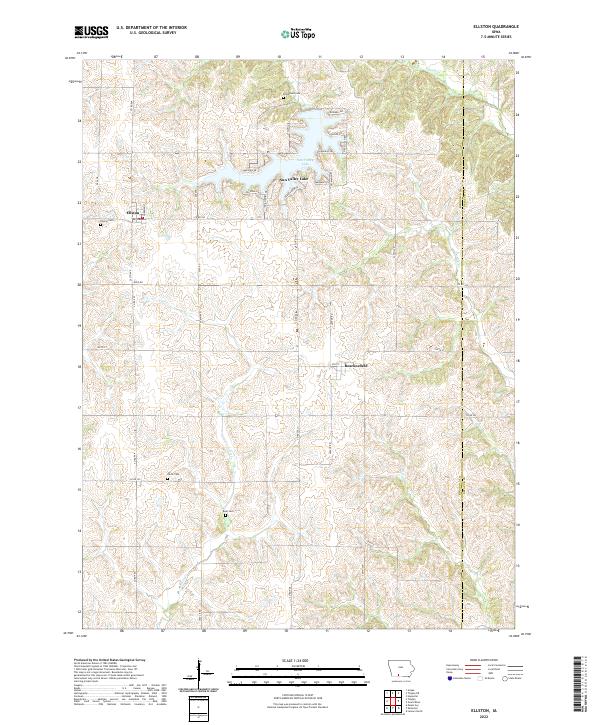 2022 Ellston2022 Print · USGSSouthern Iowa’s rural landscape is captured here in the modern era, showing the intersection of longstanding agricultural roots and the development of Sun Valley Lake. Trace local genealogy and early pioneer sites at Pumptown Cem, Ellston Cem, and the historic path of the Mormon Trl.
 - 2022 Map of Kellerton, 2022 Print
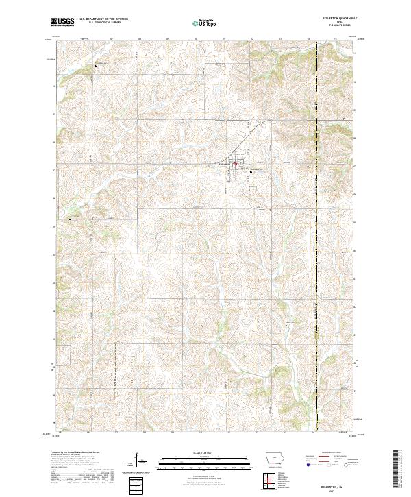 2022 Kellerton2022 Print · USGSThe community of Kellerton and its surrounding farmsteads are shown in detail as they appeared in 2022. Researchers can trace land patterns and family history at several local burial sites, including Woodland Cem, Merritt Cem, and Maple Row Cem.
 - 2022 Map of Shannon City, 2022 Print
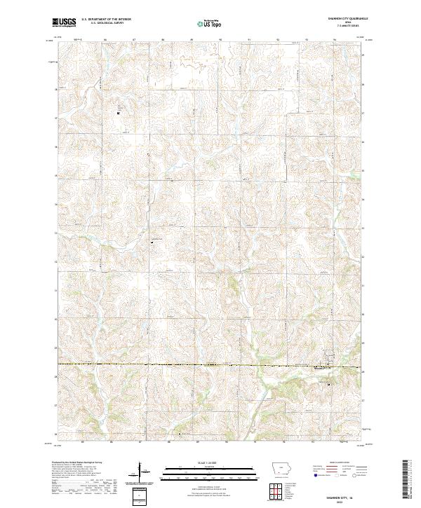 2022 Shannon City2022 Print · USGSShannon City and the rural borderlands of Union and Ringgold counties are documented here in the early twenty-first century. Genealogists and local historians can locate several important burial sites across the landscape, such as Oakland Cem, Harmony Cem, and the Ide Family Cem.
 - 2022 Map of Maloy, 2022 Print
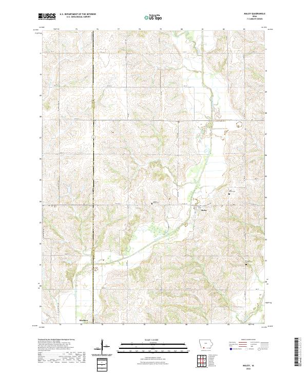 2022 Maloy2022 Print · USGSThe rural borderlands of Taylor and Ringgold counties come into focus in this contemporary Iowa survey. Genealogists can locate family burial plots at Saint Marys Cemetery or Forrest Home Cemetery and trace the paths of the Platte River and Grand River.
 - 2022 Map of Tingley NE, 2022 Print
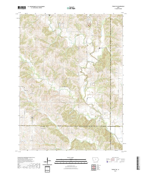 2022 Tingley NE2022 Print · USGSSouthern Iowa rural life at the intersection of four counties is documented here through a landscape shaped by the Thompson River. Family historians can precisely locate local burial sites including Otterbein Cem, Olinger Cem, and Cornwall Cem.
 - 2023 Map of Tingley, 2023 Print
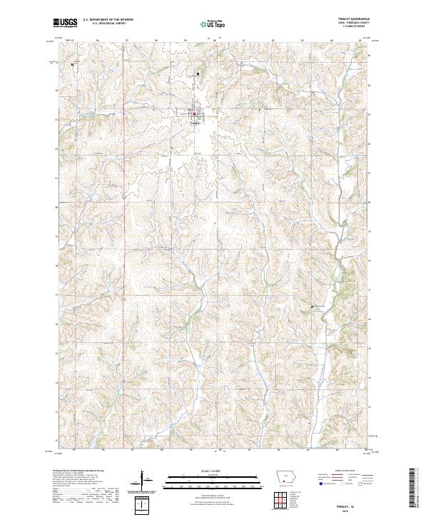 2023 Tingley2023 Print · USGSTingley and the surrounding Ringgold County countryside are captured here in the early twenty-first century, showing a landscape defined by rolling creek valleys. Researchers can locate family sites near Tingley Cem, Johnston Cem, and the quiet community of Eugene.
 - 2023 Map of Diagonal, 2023 Print
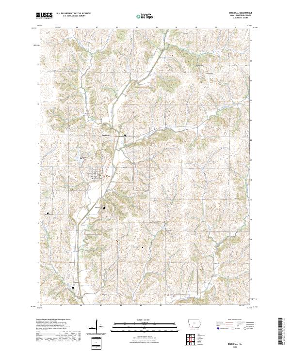 2023 Diagonal2023 Print · USGSRinggold County’s rural character is preserved in this modern survey of the area surrounding Diagonal and the Grand River valley. Researchers can trace local heritage through several burial grounds, including the curiously named Dead Mans Cut Cem and Bohemian Cem.
 - 2023 Map of Arispe, 2023 Print
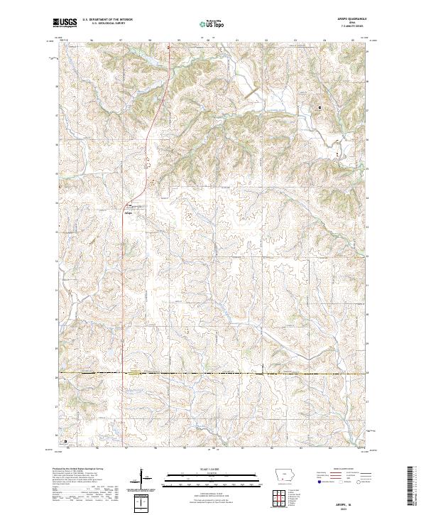 2023 Arispe2023 Print · USGSArispe and the surrounding farm country of southern Iowa are shown here in the 2020s. Researchers can trace the drainage of the East Fork Grand River and locate family burial sites at Abel Cem and Bever Cem.
End of results
Showing maps 1-16 of 16
Top cities of Ringgold County
- Mount Ayr historical maps
- Diagonal historical maps
- Kellerton historical maps
- Tingley historical maps
- Redding historical maps
- Benton historical maps
See more
Frequently asked questions
- What are the different types of historical maps available for Ringgold County?
- What is the oldest map of Ringgold County?
- Where can I purchase historical maps of Ringgold County for my home or office?
- Where can I download high-res historical maps of Ringgold County?
- Are there historical topographic maps available for Ringgold County?
- Is there historical aerial imagery available for Ringgold County?
- Where are historical maps of Ringgold County sourced from?