2020s Maps of Johnson Township, Iowa
Explore 4 historic maps of Johnson Township from the 2020s. These maps offer a rare glimpse into what life looked like during the 2020s — showing old roads, neighborhoods, homes, and landmarks that have changed or disappeared over time.
Whether you're researching your family's past, planning a metal detecting trip, or studying how Johnson Township's landscape evolved across the 2020s, these high-resolution maps are a powerful tool for exploring the history of this region.
- Focus on a specific era: All maps on this page are from the 2020s, giving you a focused view of this time period.
- See what’s changed: Compare century-old streets, trails, and buildings to today's modern landscape using overlays and satellite layers.
- Research with precision: Use these maps for genealogy, historical research, land use analysis, or educational projects.
- View, download, or print: Maps are fully viewable online in high resolution, and can be downloaded or printed for your own records.
Start exploring Johnson Township's history through authentic maps from the 2020s. This is your window into the past.
Johnson Township, IA maps
(4)- 2022 Map of Gilmore City SW, 2022 Print
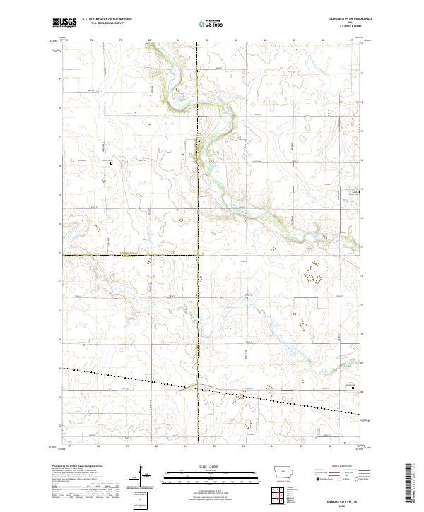 2022 Gilmore City SW2022 Print · USGSNorthwest Iowa farm country is mapped in detail during the early 2020s at the junction of three counties. Genealogists can locate family burial sites at Saint Josephs Cem, Jackson Center Cem, and Lizard Cem along the creek.
 - 2022 Map of Knierim, 2022 Print
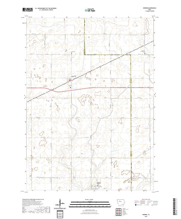 2022 Knierim2022 Print · USGSThe borderlands of Calhoun and Webster counties are captured here in a detailed contemporary view of this agricultural heartland. Researchers can trace rural cemeteries and church sites such as Trinity Cem, Greenfield Cem, and Calvary Presbyterian Cem along a precise grid of county roads.
 - 2022 Map of Moorland, 2022 Print
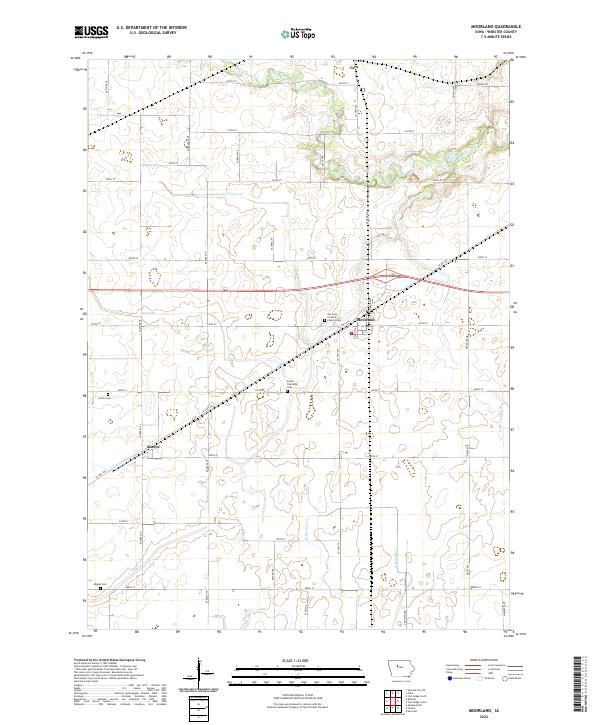 2022 Moorland2022 Print · USGSWebster County's agricultural heartland is documented here in the early twenty-first century, centered on the village of Moorland. Researchers can trace local lineage at Fulton Township Cem or Mizpah Cem and follow the paths of Prairie Cr and Hardin Cr.
 - 2022 Map of Clare, 2022 Print
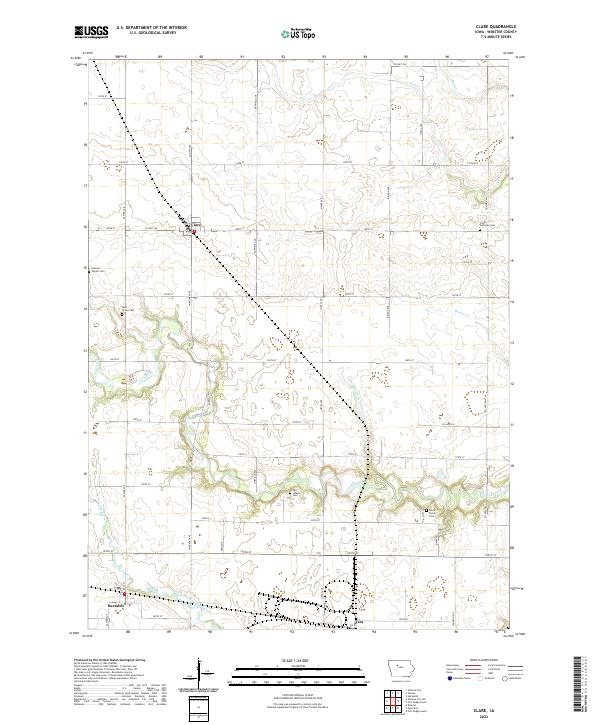 2022 Clare2022 Print · USGSNorthwestern Iowa’s agricultural heartland is documented here in the early twenty-first century, showing the enduring layout of rural Webster County. Researchers can locate historic burial grounds like Old Lizard Cem and trace the paths of Lizard Creek and Bradys Cr.
End of results
Showing maps 1-4 of 4
Top cities near Johnson Township
- Fort Dodge historical maps
- Humboldt historical maps
- Rockwell City historical maps
- Manson historical maps
- Dakota City historical maps
- Gilmore City historical maps
See more
Top neighborhoods of Johnson Township
Frequently asked questions
- What are the different types of historical maps available for Johnson Township?
- What is the oldest map of Johnson Township?
- Where can I purchase historical maps of Johnson Township for my home or office?
- Where can I download high-res historical maps of Johnson Township?
- Are there historical topographic maps available for Johnson Township?
- Is there historical aerial imagery available for Johnson Township?
- Where are historical maps of Johnson Township sourced from?