Old Maps of Edwards County, Kansas for Genealogy
Trace your family roots with 136 historic maps of Edwards County. These high-res maps reveal old neighborhoods, homesites, landmarks, and streets — helping you uncover where your ancestors lived and how the area evolved over time.
- Explore historic neighborhoods: Identify where your relatives may have lived in the 1800s or 1900s.
- Compare maps over time: Trace the changes in streets, buildings, and landmarks for multi-generational research.
- Perfect for genealogy & ancestry research: Used by family historians and researchers to map out lineage and migration.
These maps are an incredible resource for exploring your personal connection to Edwards County's past.
Edwards County, KS maps
(136)- 1889 Map of Larned, 1957 Print
 1889 Larned1957 Print · USGSWestern Kansas at the close of the frontier era shows a landscape being rapidly transformed by the iron rail and river commerce. Genealogists and historians can trace early township growth and rail stations like Rush Centre, Roselle, and the hub at Larned.
 - 1889 Map of Kinsley, 1962 Print
 1889 Kinsley1962 Print · USGSEdwards and Kiowa counties were in the midst of a railroad-driven expansion in the late 1880s as new townsites emerged along the prairie. Researchers can trace early township lines and settlements like Greensburg, Kinsley, and the whistle-stop at Brenham.
 - 1891 Map of Larned
 1891 Larned1891 Print · USGSLarned and the surrounding Kansas plains were undergoing a rapid transformation into a rail-and-river economy in the late 1880s. Local researchers can trace the growth of Larned at the river forks or follow the path of the Atchison Topeka and Santa Fe Railroad through towns like Rush Centre and Garfield.5 unique versions available
 - 1892 Map of Ness
 1892 Ness1892 Print · USGSWestern Kansas at the turn of the century reveals a landscape shaped by the Atchison Topeka and Santa Fe Railroad and prairie watercourses. Researchers can locate early post offices and rail stops like Schoharie P.O., Bazine, and Jetmore.
 - 1892 Map of Kinsley
 1892 Kinsley1892 Print · USGSThe Kansas prairie of Edwards and Kiowa counties is captured here in the late nineteenth century as new railroads transformed the plains into a network of agricultural hubs. Genealogists and historians can trace the early footprints of Greensburg and Kinsley, along with smaller sidings like Mullenville and Brenham.
 - 1892 Map of Spearville
 1892 Spearville1892 Print · USGSWestern Kansas at the peak of the railroad boom comes to life in this late nineteenth-century survey of the high plains. Genealogists and researchers can trace early town sites like Ford, Spearville, and Bucklin along the Arkansas River and competing rail lines.
 - 1894 Map of Spearville
 1894 Spearville1894 Print · USGSWestern Kansas was undergoing a rail-driven boom during the late nineteenth century as new townships emerged along the prairie. Genealogists and historians can trace early trackside settlements like Spearville and Ford or follow the path of the Arkansas River and Coon Creek.4 unique versions available
 - 1894 Map of Kinsley
 1894 Kinsley1894 Print · USGSEdwards and Kiowa Counties are seen here during the rail-driven expansion of the 1890s. Genealogists can trace the early township grids and burgeoning prairie towns like Kinsley, Mullenville, and Haviland along the Arkansas River corridor.8 unique versions available
 - 1894 Map of Ness
 1894 Ness1894 Print · USGSWestern Kansas at the close of the nineteenth century was a land of new rail towns and high plains homesteads. Genealogists and historians can trace the early development of Ness City and Jetmore, alongside smaller stops like Schoharie P.O. and Bazine.5 unique versions available
 - 1955 Map of Great Bend, 1966 Print
 1955 Great Bend1966 Print · USGSCentral Kansas during the mid-sixties transition reveals a landscape defined by new reservoirs and enduring rail corridors. Researchers can trace the development of towns like Hays and Great Bend or locate natural landmarks such as Round Mound and the wetlands of the Quivira National Wildlife Refuge.3 unique versions available
 - 1955 Map of Pratt, 1968 Print
 1955 Pratt1968 Print · USGSSouth-central Kansas during the mid-fifties presents a landscape of sprawling oil fields and critical rail junctions. Researchers can trace the paths of the Atchison Topeka and Santa Fe railroad or locate local landmarks like the Blue Ridge Community House and Camp Carlisle.3 unique versions available
 - 1957 Map of Great Bend
 1957 Great Bend1957 Print · USGSCentral Kansas at the peak of the postwar era shows a landscape of growing rail hubs and massive new water projects. Trace the routes of the Union Pacific through Hays or locate the newly formed shorelines of Cedar Bluff Reservoir and Kanopolis Reservoir.
 - 1958 Map of Great Bend
 1958 Great Bend1958 Print · USGSCentral Kansas in the late fifties reveals a landscape of high-plains agriculture and vital river crossings. Researchers can trace the development of regional hubs like Hays and Russell, or locate historic sites such as Fort Larned and the Cheyenne Bottoms wildlife area.2 unique versions available
 - 1959 Map of Pratt
 1959 Pratt1959 Print · USGSSouth-central Kansas thrived as a rail and agricultural hub in the late fifties, where the Arkansas River meets a vast grid of section roads. Researchers can trace the path of the Missouri Pacific railroad through settlements like Turon and Stafford, or locate family landmarks like the Prairie Oak School.2 unique versions available
 - 1968 Map of Haviland NW, 1970 Print
 1968 Haviland NW1970 Print · USGSKiowa County's rural townships and natural drainage are frozen in time during the late sixties. Genealogists and researchers can trace township lines like Brenham and Union or locate mid-century infrastructure such as an Oil Well and several pipelines.2 unique versions available
 - 1968 Map of Haviland NE, 1970 Print
 1968 Haviland NE1970 Print · USGSKiowa and Pratt counties are captured here in the late sixties, showing a transition between vast ranch lands and active energy development. Genealogists and local historians can locate family plots at Providence Cem and Wellsford Cem or trace the extent of the Fruit Oil and Gas Field.2 unique versions available
 - 1969 Map of Bucklin NE, 1971 Print
 1969 Bucklin NE1971 Print · USGSThe Kansas plains south of the Arkansas River come into focus in the late sixties, where agriculture and energy production intersect. Researchers can trace the layout of the Fralick West Oil Field and the rural reaches of Pleasant Valley and South Brown.
 - 1969 Map of Greensburg NW, 1971 Print
 1969 Greensburg NW1971 Print · USGSThe Kansas high plains at the edge of the 1970s reveal a landscape of sectioned agriculture and emerging energy infrastructure. Genealogists and local researchers can locate rural burial sites like Bethel Cem and trace the development of the Falick South Oil Field.2 unique versions available
 - 1969 Map of Greensburg NE, 1971 Print
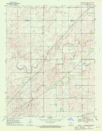 1969 Greensburg NE1971 Print · USGSKiowa and Edwards counties reveal a landscape of prairie drainage and energy development in the late sixties. Researchers can trace the path of Rattlesnake Creek and locate industrial landmarks like the Compressor Station and various oil wells.2 unique versions available
 - 1971 Map of Trousdale, 1974 Print
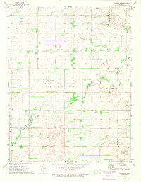 1971 Trousdale1974 Print · USGSThe prairie landscape of Trousdale was deeply shaped by energy production and early transit corridors by the 1970s. Genealogists and historians can trace family roots at Prattsburg Cem or locate the historic Old Indian Treaty Boundary.
 - 1972 Map of Belpre, 1974 Print
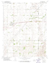 1972 Belpre1974 Print · USGSBelpre and the surrounding Kansas plains appear here in the early 1970s, as the energy economy was transforming the rural landscape. Genealogists and historians can trace the town's footprint along the Atchison Topeka and Santa Fe railroad or locate family land near Wild Horse Creek and Farmington.
 - 1972 Map of Fellsburg, 1974 Print
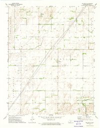 1972 Fellsburg1974 Print · USGSEdwards County farming and energy production are captured here in the early 1970s, centered on the settlement of Fellsburg. Genealogists and historians can trace the Old Indian Treaty Boundary and locate specific sites like Fellsburg Cem or scattered Oil Wells.
 - 1972 Map of Kinsley, 1974 Print
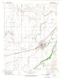 1972 Kinsley1974 Print · USGSThe Arkansas River valley in the early 1970s shows a landscape shaped by rail, ranching, and aviation. Genealogists and local historians can trace the foundations of Kinsley and Ardell, alongside sites like Old Kinsley Cem and the Kinsley Municipal Airport.
 - 1972 Map of Rozel SW, 1974 Print
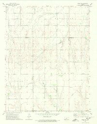 1972 Rozel SW1974 Print · USGSThe rural border of Edwards and Pawnee Counties is captured here in the early 1970s. Local researchers can trace family roots through Salem Cem or Lutheran Cem and locate community anchors like Ss Peter & Paul Ch.
 - 1972 Map of Offerle SE, 1974 Print
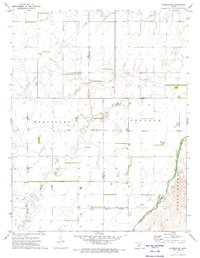 1972 Offerle SE1974 Print · USGSThe Ford and Edwards County line in the early 1970s reveals a landscape shaped by historical divisions and river geography. Researchers can locate the Old Indian Treaty Boundary and trace landmarks like the Zion Ch along Coon Creek.2 unique versions available
Showing maps 1-25 of 136
Top cities of Edwards County
Frequently asked questions
- What are the different types of historical maps available for Edwards County?
- What is the oldest map of Edwards County?
- Where can I purchase historical maps of Edwards County for my home or office?
- Where can I download high-res historical maps of Edwards County?
- Are there historical topographic maps available for Edwards County?
- Is there historical aerial imagery available for Edwards County?
- Where are historical maps of Edwards County sourced from?