1960s Maps of Ellsworth County, Kansas
Explore 6 historic maps of Ellsworth County from the 1960s. These maps offer a rare glimpse into what life looked like during the 1960s — showing old roads, neighborhoods, homes, and landmarks that have changed or disappeared over time.
Whether you're researching your family's past, planning a metal detecting trip, or studying how Ellsworth County's landscape evolved across the 1960s, these high-resolution maps are a powerful tool for exploring the history of this region.
- Focus on a specific era: All maps on this page are from the 1960s, giving you a focused view of this time period.
- See what’s changed: Compare century-old streets, trails, and buildings to today's modern landscape using overlays and satellite layers.
- Research with precision: Use these maps for genealogy, historical research, land use analysis, or educational projects.
- View, download, or print: Maps are fully viewable online in high resolution, and can be downloaded or printed for your own records.
Start exploring Ellsworth County's history through authentic maps from the 1960s. This is your window into the past.
Ellsworth County, KS maps
(6)- 1964 Map of Holyrood NW
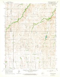 1964 Holyrood NW1964 Print · USGSMid-century Ellsworth and Barton counties reveal a landscape shaped by petroleum extraction and rural community hubs. Genealogists and historians can locate family landmarks like Palacky Cem and the Townhall alongside the Progress Oil Field.
 - 1964 Map of Holyrood, 1965 Print
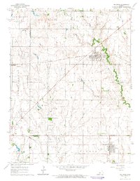 1964 Holyrood1965 Print · USGSCentral Kansas during the mid-sixties reveals a landscape defined by the convergence of major rail lines and a dense network of petroleum production. Researchers can trace the Atchison Topeka and Santa Fe tracks through Holyrood and locate the Bushton Cem near the Missouri Pacific line.
 - 1964 Map of Crawford, 1965 Print
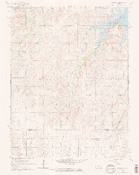 1964 Crawford1965 Print · USGSCentral Kansas agriculture meets the petroleum industry in the mid-1960s as the MISSOURI PACIFIC railroad connects rural townships. Genealogists can trace family footprints across several rural burial sites, including Scaife Cem and Forest Grove Cem, near the Click Southeast Oil Field.2 unique versions available
 - 1964 Map of Geneseo, 1965 Print
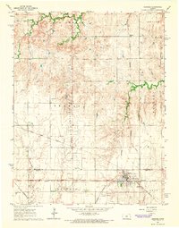 1964 Geneseo1965 Print · USGSMid-century Rice County is defined by a dense network of competing railroads and expanding energy production. Genealogists and historians can trace family roots at the Kansas Center Cem or explore the infrastructure of the Geneseo-Edwards Oil Field and the settlement at Galt.3 unique versions available
 - 1964 Map of Lorraine, 1965 Print
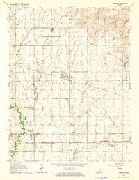 1964 Lorraine1965 Print · USGSRailroads and oil fields dominate this mid-century Kansas landscape, where the towns of Lorraine and Frederick served as vital rural hubs. Genealogists and historians can trace rail lines like the St Louis - San Francisco and locate the Lorraine Cem.2 unique versions available
 - 1964 Map of Langley, 1965 Print
 1964 Langley1965 Print · USGSThe rural borderlands of Ellsworth and McPherson counties are captured here in the mid-1960s. Genealogists can trace family footprints around the village of Langley, the Langley Sch, and the riverside Sandpits along the Smoky Hill River.2 unique versions available
End of results
Showing maps 1-6 of 6
Top cities of Ellsworth County
- Ellsworth historical maps
- Wilson historical maps
- Kanopolis historical maps
- Holyrood historical maps
- Lorraine historical maps
- Black Wolf historical maps
See more
Frequently asked questions
- What are the different types of historical maps available for Ellsworth County?
- What is the oldest map of Ellsworth County?
- Where can I purchase historical maps of Ellsworth County for my home or office?
- Where can I download high-res historical maps of Ellsworth County?
- Are there historical topographic maps available for Ellsworth County?
- Is there historical aerial imagery available for Ellsworth County?
- Where are historical maps of Ellsworth County sourced from?