1970s Maps of Sullivan Township, Kansas
Explore 5 historic maps of Sullivan Township from the 1970s. These maps offer a rare glimpse into what life looked like during the 1970s — showing old roads, neighborhoods, homes, and landmarks that have changed or disappeared over time.
Whether you're researching your family's past, planning a metal detecting trip, or studying how Sullivan Township's landscape evolved across the 1970s, these high-resolution maps are a powerful tool for exploring the history of this region.
- Focus on a specific era: All maps on this page are from the 1970s, giving you a focused view of this time period.
- See what’s changed: Compare century-old streets, trails, and buildings to today's modern landscape using overlays and satellite layers.
- Research with precision: Use these maps for genealogy, historical research, land use analysis, or educational projects.
- View, download, or print: Maps are fully viewable online in high resolution, and can be downloaded or printed for your own records.
Start exploring Sullivan Township's history through authentic maps from the 1970s. This is your window into the past.
Sullivan Township, KS maps
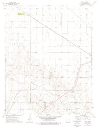
(5)- 1974 Map of Wagon Bed Spring NW, 1976 Print
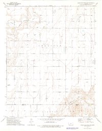 1974 Wagon Bed Spring NW1976 Print · USGSHigh Plains history and energy development converge in southwestern Kansas during the mid-seventies. Trace the historic path of the Old Santa Fe Trail and locate family landmarks like the Golden Cemetery or various Gas Well sites.
 - 1974 Map of Wagon Bed Spring, 1976 Print
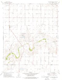 1974 Wagon Bed Spring1976 Print · USGSThe high plains of southwest Kansas meet the legacy of the western frontier in the 1970s. Trace the path of the Old Santa Fe Trail and locate family landmarks like Zionville Cem or the historic Wagon Bed Spring.
 - 1974 Map of Shore Airport NE, 1976 Print
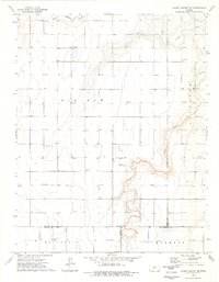 1974 Shore Airport NE1976 Print · USGSSouthwestern Kansas in the mid-1970s is shown as a productive landscape of cattle ranching and gas extraction. Trace the rural roots of Stanton County through sites like Bethel Ch, the Liverpool Cem, and the winding North Fork Cimarron River.
 - 1975 Map of Moscow NW, 1976 Print
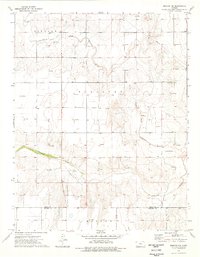 1975 Moscow NW1976 Print · USGSThe high plains of southwest Kansas meet the historic migration paths of the mid-seventies in this detailed topographic study. Trace the Santa Fe Trail and the development of the North Fork Cimarron River valley near Carter.
 - 1975 Map of Ryus, 1976 Print
 1975 Ryus1976 Print · USGSHaskell County's high plains landscape is captured in the mid-seventies, showing a region where the energy industry meets the Cimarron River. Researchers can trace the industrial footprint of the era through the Ryus settlement, the Oil and Gas Field, and the Atchison Topeka and Santa Fe railroad.
End of results
Showing maps 1-5 of 5
Top cities near Sullivan Township
Top neighborhoods of Sullivan Township
Frequently asked questions
- What are the different types of historical maps available for Sullivan Township?
- What is the oldest map of Sullivan Township?
- Where can I purchase historical maps of Sullivan Township for my home or office?
- Where can I download high-res historical maps of Sullivan Township?
- Are there historical topographic maps available for Sullivan Township?
- Is there historical aerial imagery available for Sullivan Township?
- Where are historical maps of Sullivan Township sourced from?