Old Maps of Kiowa Rural Township, Kansas for Hiking & Exploration
Hike through history with 101 historic maps of Kiowa Rural Township. Explore old trails, ghost towns, and forgotten backroads — perfect for outdoor adventurers and local explorers.
- Rediscover forgotten places: Map out old mining camps, roads, and footpaths that no longer exist on modern maps.
- Layer with modern tools: Combine with LiDAR or satellite views to plan hikes through historical terrain.
- Made for exploration: Popular among hikers, overlanders, and local history lovers.
Use these maps to find adventure and explore the hidden past of Kiowa Rural Township.
Kiowa Rural Township, KS maps
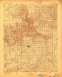
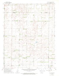
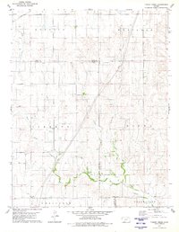
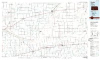
(101)- 1889 Map of Kinsley, 1962 Print
 1889 Kinsley1962 Print · USGSEdwards and Kiowa counties were in the midst of a railroad-driven expansion in the late 1880s as new townsites emerged along the prairie. Researchers can trace early township lines and settlements like Greensburg, Kinsley, and the whistle-stop at Brenham.
 - 1892 Map of Kinsley
 1892 Kinsley1892 Print · USGSThe Kansas prairie of Edwards and Kiowa counties is captured here in the late nineteenth century as new railroads transformed the plains into a network of agricultural hubs. Genealogists and historians can trace the early footprints of Greensburg and Kinsley, along with smaller sidings like Mullenville and Brenham.
 - 1892 Map of Spearville
 1892 Spearville1892 Print · USGSWestern Kansas at the peak of the railroad boom comes to life in this late nineteenth-century survey of the high plains. Genealogists and researchers can trace early town sites like Ford, Spearville, and Bucklin along the Arkansas River and competing rail lines.
 - 1892 Map of Coldwater
 1892 Coldwater1892 Print · USGSComanche County during the late nineteenth-century settlement boom shows a network of emerging prairie towns and cattle-shipping rail lines. Genealogists can trace early homestead locations near Coldwater, Nescatunga, and along the banks of Mule Creek.5 unique versions available
 - 1894 Map of Spearville
 1894 Spearville1894 Print · USGSWestern Kansas was undergoing a rail-driven boom during the late nineteenth century as new townships emerged along the prairie. Genealogists and historians can trace early trackside settlements like Spearville and Ford or follow the path of the Arkansas River and Coon Creek.4 unique versions available
 - 1894 Map of Kinsley
 1894 Kinsley1894 Print · USGSEdwards and Kiowa Counties are seen here during the rail-driven expansion of the 1890s. Genealogists can trace the early township grids and burgeoning prairie towns like Kinsley, Mullenville, and Haviland along the Arkansas River corridor.8 unique versions available
 - 1896 Map of Ashland
 1896 Ashland1896 Print · USGSClark County at the close of the nineteenth century was a landscape of expanding railroads and emerging cattle-towns. Genealogists and researchers can trace the early footprints of Ashland, locate the remote Jacobs Well, and follow the original routes of the Atchison Topeka and Santa Fe R. R.3 unique versions available
 - 1955 Map of Pratt, 1968 Print
 1955 Pratt1968 Print · USGSSouth-central Kansas during the mid-fifties presents a landscape of sprawling oil fields and critical rail junctions. Researchers can trace the paths of the Atchison Topeka and Santa Fe railroad or locate local landmarks like the Blue Ridge Community House and Camp Carlisle.3 unique versions available
 - 1959 Map of Pratt
 1959 Pratt1959 Print · USGSSouth-central Kansas thrived as a rail and agricultural hub in the late fifties, where the Arkansas River meets a vast grid of section roads. Researchers can trace the path of the Missouri Pacific railroad through settlements like Turon and Stafford, or locate family landmarks like the Prairie Oak School.2 unique versions available
 - 1968 Map of Haviland NW, 1970 Print
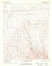
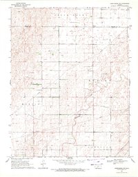
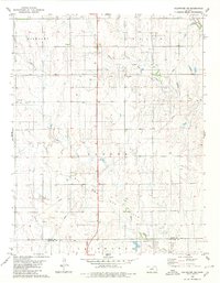
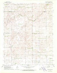 1968 Haviland NW1970 Print · USGSKiowa County's rural townships and natural drainage are frozen in time during the late sixties. Genealogists and researchers can trace township lines like Brenham and Union or locate mid-century infrastructure such as an Oil Well and several pipelines.2 unique versions available
 - 1968 Map of Belvidere, 1970 Print
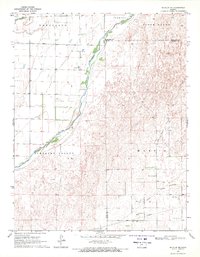
 1968 Belvidere1970 Print · USGSThe rail-and-river corridor of southeastern Kiowa County comes alive in the late sixties, centered on the settlement of Belvidere. Local historians can trace the Atchison Topeka and Santa Fe line as it follows the Medicine Lodge River past the Belvidere Cem and into the Glick Oil and Gas Field.
 - 1968 Map of Haviland, 1970 Print
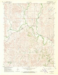
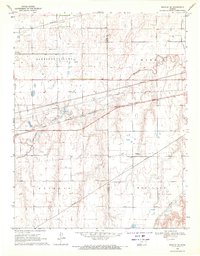
 1968 Haviland1970 Print · USGSThe Kiowa and Pratt County line in the late sixties shows a landscape of prairie settlements and growing energy infrastructure. Researchers can trace the Chicago Rock Island and Pacific rail line and locate Wellsford Cem and Boles Cem.
 - 1968 Map of Haviland NE, 1970 Print
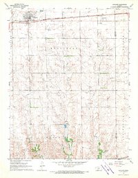
 1968 Haviland NE1970 Print · USGSKiowa and Pratt counties are captured here in the late sixties, showing a transition between vast ranch lands and active energy development. Genealogists and local historians can locate family plots at Providence Cem and Wellsford Cem or trace the extent of the Fruit Oil and Gas Field.2 unique versions available
 - 1968 Map of Brenham, 1970 Print
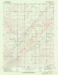
 1968 Brenham1970 Print · USGSKiowa County's rural landscape is captured here in the late sixties, showing the vital intersection of rail and ranching. Genealogists can locate family sites near Brenham, Wellsford, and Ursula, or trace the path of the Chicago Rock Island and Pacific.
 - 1969 Map of Bucklin NE, 1971 Print
 1969 Bucklin NE1971 Print · USGSThe Kansas plains south of the Arkansas River come into focus in the late sixties, where agriculture and energy production intersect. Researchers can trace the layout of the Fralick West Oil Field and the rural reaches of Pleasant Valley and South Brown.
 - 1969 Map of Bucklin SE, 1971 Print
 1969 Bucklin SE1971 Print · USGSThe Kansas prairie south of the Arkansas River comes into focus in the late sixties, showing a landscape defined by rail and energy. Trace the path of the Chicago Rock Island and Pacific and locate scattered gas wells along Rattlesnake Creek.
 - 1969 Map of Greensburg NW, 1971 Print
 1969 Greensburg NW1971 Print · USGSThe Kansas high plains at the edge of the 1970s reveal a landscape of sectioned agriculture and emerging energy infrastructure. Genealogists and local researchers can locate rural burial sites like Bethel Cem and trace the development of the Falick South Oil Field.2 unique versions available
 - 1969 Map of Greensburg, 1971 Print
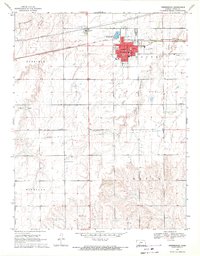 1969 Greensburg1971 Print · USGSGreensburg and its surrounding prairie townships are captured here at the close of the 1960s, showing the town at the intersection of Highway 54 and Highway 183. Genealogists and local historians can locate specific landmarks like Fairview Cemetery, Bethel Ch, and the central Courthouse.
 - 1969 Map of Mullinville, 1971 Print
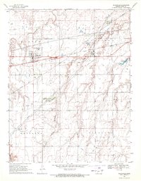 1969 Mullinville1971 Print · USGSMullinville and the surrounding Kiowa County townships are shown here in the late sixties at the height of their rail-and-road era. Researchers can trace local landmarks like Hillcrest Cem and the Chicago Rock Island and Pacific railroad line through Joy.
 - 1969 Map of Greensburg NE, 1971 Print
 1969 Greensburg NE1971 Print · USGSKiowa and Edwards counties reveal a landscape of prairie drainage and energy development in the late sixties. Researchers can trace the path of Rattlesnake Creek and locate industrial landmarks like the Compressor Station and various oil wells.2 unique versions available
 - 1979 Map of Turkey Creek, 1980 Print
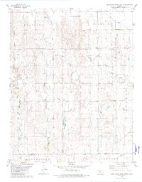
 1979 Turkey Creek1980 Print · USGSSouthwest Kansas prairie land is captured here in the late seventies, showing the intersection of several historic townships and county lines. Researchers can trace the Old Indian Treaty Boundary and locate early energy infrastructure like the Gas Well sites near West Kiowa Creek.
 - 1979 Map of East Kiowa Creek North, 1980 Print
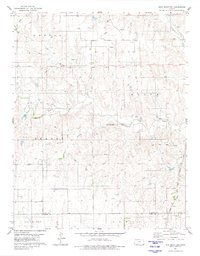
 1979 East Kiowa Creek North1980 Print · USGSSouthern Kansas ranching and energy land is captured here in the late seventies, centered on the Old Indian Treaty Boundary. Researchers can trace early infrastructure through an active Oil Field and creek networks like Mule Creek.
 - 1980 Map of Coldwater NE
 1980 Coldwater NE1980 Print · USGSThe high plains of south-central Kansas are captured here as the energy economy and old frontier lines intersect in the early 1980s. Researchers can trace the Old Indian Treaty Boundary and locate small landmarks like the settlement at Harold or several Gas Well sites.
 - 1980 Map of Iron Mountain
 1980 Iron Mountain1980 Print · USGSThe high plains of Kiowa and Comanche Counties are captured here in the late twentieth century as energy exploration reshaped the prairie. Trace the Old Indian Treaty Boundary and explore the rail corridor of the Atchison Topeka and Santa Fe near Iron Mountain.
 - 1985 Map of Kinsley
 1985 Kinsley1985 Print · USGSWestern Kansas at the peak of the mid-eighties shows a landscape defined by historic treaty lines and the dominance of the rails. Genealogists and historians can trace the Old Indian Treaty Boundary and find long-standing settlements like Fort Dodge, Greensburg, and Windhorst.2 unique versions available
Showing maps 1-25 of 101
Top cities near Kiowa Rural Township
- Greensburg historical maps
- Haviland historical maps
- Mullinville historical maps
- Wilmore historical maps
Top neighborhoods of Kiowa Rural Township
- Brenham historical maps
- Joy historical maps
- Wellsford historical maps
- Belvidere historical maps
- Greensburg historical maps
- Haviland historical maps
See more
Frequently asked questions
- What are the different types of historical maps available for Kiowa Rural Township?
- What is the oldest map of Kiowa Rural Township?
- Where can I purchase historical maps of Kiowa Rural Township for my home or office?
- Where can I download high-res historical maps of Kiowa Rural Township?
- Are there historical topographic maps available for Kiowa Rural Township?
- Is there historical aerial imagery available for Kiowa Rural Township?
- Where are historical maps of Kiowa Rural Township sourced from?