Old Maps of Norton County, Kansas
Explore 165 old maps of Norton County, spanning from 1893 to today. These high-resolution historic maps reveal how streets, neighborhoods, landmarks, and natural features evolved over time — perfect for genealogy, metal detecting, research, and local history exploration.
What you can do with these maps:
- See how Norton County changed over time: Compare historical maps to modern-day views to trace roads, homesites, rail lines & more.
- View detailed metadata: Each map includes creators, publishers, year, scale, and archive source.
- Overlay maps with satellite & LiDAR: Visualize the past alongside modern tools to explore terrain & human change.
- Trusted historical sources: Maps sourced from the USGS, Library of Congress, and other archives.
- Access maps your way: View online, download high-res files, or order prints for personal or research use.
Start exploring old maps of Norton County to uncover forgotten places, hidden landmarks, and the deep history beneath your feet.
Norton County, KS maps
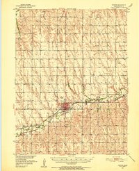
(165)- 1893 Map of Norton
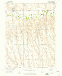
 1893 Norton1893 Print · USGSNorthwest Kansas during the mid-1890s shows a region defined by the growth of railroad towns and water-carved valleys. Genealogists and historians can trace early town sites and rail lines including Norton, Almena, and the Pacific Railroad route through Logan.4 unique versions available
 - 1896 Map of Arapahoe
 1896 Arapahoe1896 Print · USGSThe Republican River valley thrived in the 1890s as a vital railroad corridor through south-central Nebraska and northern Kansas. Genealogists and local historians can trace the early rail stops and rural precincts like Arapahoe, Oxford, and the remote Rock Falls district.3 unique versions available
 - 1898 Map of Arapahoe, 1920 Print
 1898 Arapahoe1920 Print · USGSSouthwestern Nebraska was rapidly developing at the turn of the century as railroads mirrored the river valleys. Genealogists can trace family roots in towns like Arapahoe, Beaver City, and Oxford or locate landmarks like Rock Falls.2 unique versions available
 - 1951 Map of Norton, 1952 Print
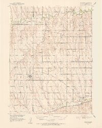
 1951 Norton1952 Print · USGSNorton and its surrounding farm townships are seen here at mid-century, during a period when the local economy was anchored by two major rail lines. Researchers can locate many now-lost landmarks, from the State Sanatorium to rural schoolhouses like Kinderhook Sch and Star Sch.3 unique versions available
 - 1951 Map of Norcatur, 1952 Print
 1951 Norcatur1952 Print · USGSThe northern Kansas high plains come into focus in the early fifties, showing a landscape defined by isolated farmsteads and rural schools. Genealogists can trace family roots through landmarks like Hudson Pillar Sch, Maple Grove Cem, and the small rail stops of Reager and Oronoque.2 unique versions available
 - 1954 Map of McCook, 1966 Print
 1954 McCook1966 Print · USGSSouthwest Nebraska in the mid-fifties reveals a landscape shaped by major water projects and the Chicago Burlington and Quincy RR. Trace ancestral roots and defunct rail stops in McCook, Wauneta, and along the shores of Swanson Lake.2 unique versions available
 - 1954 Map of Goodland, 1976 Print
 1954 Goodland1976 Print · USGSNorthwest Kansas comes into focus during the mid-1950s, showing a landscape defined by its vital river forks and thriving rail towns. Researchers can trace the path of the Union Pacific through Colby or locate historic parks like Sheridan Co State Park.
 - 1955 Map of Grand Island, 1967 Print
 1955 Grand Island1967 Print · USGSCentral Nebraska is seen here during a period of industrial and agricultural growth, centered on the vital Platte River corridor. Researchers can trace the mid-century footprints of the U S Naval Ammunition Depot and the Cornhusker Ordnance Plant.3 unique versions available
 - 1955 Map of Beloit, 1971 Print
 1955 Beloit1971 Print · USGSNorth Central Kansas in the mid-fifties shows a landscape of river-valley agriculture and expanding water infrastructure. Genealogists can trace the rail lines of the Union Pacific through towns like Nicodemus, Cawker City, and the State Sanatorium.3 unique versions available
 - 1956 Map of Goodland
 1956 Goodland1956 Print · USGSThe high plains of Northwest Kansas in the mid-fifties reveal a landscape of river-fed agriculture and expanding rail networks. Genealogists and historians can trace the development of county seats like Goodland and Atwood or locate landmarks such as the Arikaree Breaks.
 - 1957 Map of McCook
 1957 McCook1957 Print · USGSSouthwestern Nebraska in the mid-fifties is captured here during a period of significant water development and rail-based commerce. Researchers can trace the path of the Chicago Burlington and Quincy through Indianola and Bartley, or locate rural settlements like Chase Village and Ough near the Sand Hills.
 - 1957 Map of Goodland
 1957 Goodland1957 Print · USGSNorthwest Kansas in the mid-1950s shows a landscape of high plains agriculture and vital rail junctions. Researchers can trace the river-valley settlements from Goodland to Oberlin and follow the paths of the Union Pacific and Sappa Creek.2 unique versions available
 - 1957 Map of Grand Island
 1957 Grand Island1957 Print · USGSCentral Nebraska and Northern Kansas are shown here during a period of massive hydraulic and military expansion in the mid-fifties. Researchers can trace the development of the Harlan County Reservoir and the massive wartime legacy of the Cornhusker Ordnance Plant.
 - 1957 Map of Beaver City SW, 1958 Print
 1957 Beaver City SW1958 Print · USGSThe Nebraska-Kansas borderlands were defined by the paths of Beaver Creek and the Chicago Burlington and Quincy rail line in the late fifties. Genealogists can trace early rural life through Lynden Cem, Spring Green Ch, and the site of School No 96 (Abandoned).
 - 1957 Map of Shippee, 1958 Print
 1957 Shippee1958 Print · USGSThe Nebraska-Kansas borderlands come alive in this mid-century survey of the Beaver Creek valley. Genealogists and historians can trace the Chicago Burlington and Quincy rail line through Shippee and locate the rural Tyrone Cem.2 unique versions available
 - 1957 Map of Wilsonville, 1958 Print
 1957 Wilsonville1958 Print · USGSWilsonville stood as a vital rail and river hub on the Nebraska-Kansas border during the late fifties. Genealogists and historians can trace the town grid, the Chicago Burlington and Quincy rail line, and local landmarks like the Cem and Water Tank.2 unique versions available
 - 1957 Map of Precept, 1958 Print
 1957 Precept1958 Print · USGSFurnas County, Nebraska, near the Kansas state line is captured here in the late fifties as a landscape of established farmsteads and rural precincts. Genealogists can trace the exact locations of local landmarks like the Precept Sch, Bethel Ch, and Maple Creek Cem.
 - 1957 Map of Beaver City SE, 1958 Print
 1957 Beaver City SE1958 Print · USGSThe Nebraska-Kansas border comes into focus in the 1950s, showing a rural landscape defined by prairie creeks and steam-era rail lines. Researchers can trace family history through local landmarks like Needmore Sch, McCarty Sch, and the tiny settlement of Meents.
 - 1958 Map of McCook
 1958 McCook1958 Print · USGSSouthwest Nebraska during the late fifties reveals a landscape of massive new reservoirs and established rail hubs like McCook. Genealogists can trace family footprints through rural centers like St Johns Church and the many grain elevators along the Union Pacific RR.2 unique versions available
 - 1958 Map of Grand Island
 1958 Grand Island1958 Print · USGSSouth-central Nebraska thrived as a rail and industrial hub during the late fifties, shaped by the braided Platte River. Genealogists and historians can trace rail lines like the Union Pacific RR through towns such as Kearney or locate the sprawling Cornhusker Ordnance Plant.
 - 1959 Map of Beloit
 1959 Beloit1959 Print · USGSNorth Central Kansas at mid-century reveals a landscape shaped by river valleys and the expansion of massive water reservoirs. Genealogists and historians can trace the rail-town connections of Beloit and Norton or locate the site of the new Webster Dam.3 unique versions available
 - 1965 Map of Norton NW, 1966 Print
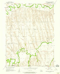
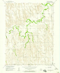
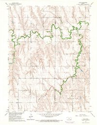
 1965 Norton NW1966 Print · USGSNorton County's rural landscape is captured here in the mid-sixties, showing the intricate network of creek drainages and township lines. Local researchers can trace the location of Grace Chapel or follow the paths of Sappa Creek and Robinson Creek.
 - 1965 Map of Lyle, 1966 Print
 1965 Lyle1966 Print · USGSDecatur County and the surrounding townships are captured in the mid-1960s, showing a landscape shaped by the Sappa Creek valley. Researchers can locate remote family landmarks like Railsback Cem, Wray Cem, and the rural community center at Lyle.
 - 1965 Map of Devizes, 1966 Print
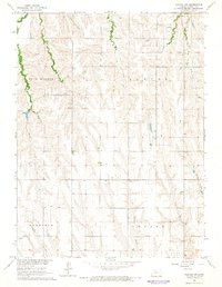
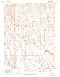
 1965 Devizes1966 Print · USGSNorton County in the mid-sixties is shown here as a landscape of rural schoolhouses and winding creek beds. Researchers can trace family roots at Devizes Cem or locate the site of the Maple Grove Ch and Fair View Sch.
 - 1967 Map of Norton NE, 1969 Print
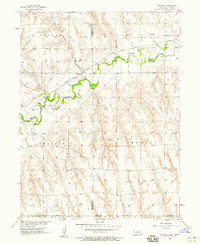
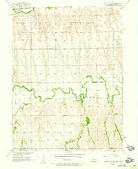
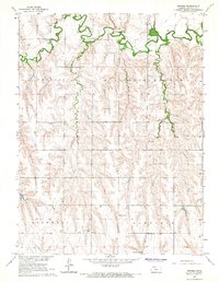
 1967 Norton NE1969 Print · USGSNorthern Norton County is captured here in the late sixties, showing the organized township grids and prairie drainages of rural Kansas. Genealogists can locate Sheley Cem and trace the paths of North Fork Prairie Dog Creek and Spring Branch.
Showing maps 1-25 of 165
Top cities of Norton County
Frequently asked questions
- What are the different types of historical maps available for Norton County?
- What is the oldest map of Norton County?
- Where can I purchase historical maps of Norton County for my home or office?
- Where can I download high-res historical maps of Norton County?
- Are there historical topographic maps available for Norton County?
- Is there historical aerial imagery available for Norton County?
- Where are historical maps of Norton County sourced from?