Old Maps of Norton County, Kansas
Explore 45 old maps of Norton County, spanning from 1893 to today. These high-resolution historic maps reveal how streets, neighborhoods, landmarks, and natural features evolved over time — perfect for genealogy, metal detecting, research, and local history exploration.
What you can do with these maps:
- See how Norton County changed over time: Compare historical maps to modern-day views to trace roads, homesites, rail lines & more.
- View detailed metadata: Each map includes creators, publishers, year, scale, and archive source.
- Overlay maps with satellite & LiDAR: Visualize the past alongside modern tools to explore terrain & human change.
- Trusted historical sources: Maps sourced from the USGS, Library of Congress, and other archives.
- Access maps your way: View online, download high-res files, or order prints for personal or research use.
Start exploring old maps of Norton County to uncover forgotten places, hidden landmarks, and the deep history beneath your feet.
Norton County, KS maps
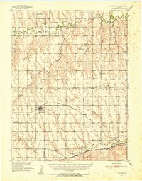
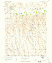
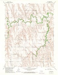
(45)- 1893 Map of Norton
 1893 Norton1893 Print · USGSCovers Norton County, including Norton, Logan, and other nearby areas4 unique versions available
 - 1896 Map of Arapahoe
 1896 Arapahoe1896 Print · USGSCovers Norton County, including Arapahoe, Oxford, and other nearby areas3 unique versions available
 - 1898 Map of Arapahoe, 1920 Print
 1898 Arapahoe1920 Print · USGSCovers Norton County, including Arapahoe, Oxford, and other nearby areas2 unique versions available
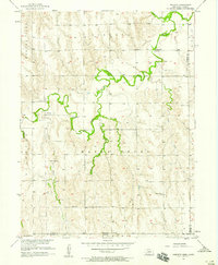
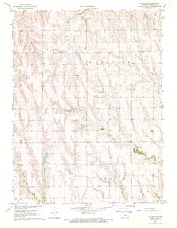
 - 1951 Map of Norcatur, 1952 Print
 1951 Norcatur1952 Print · USGSCovers Norton County, including Norcatur, Oronoque, and other nearby areas3 unique versions available
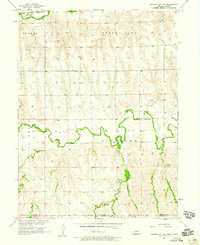
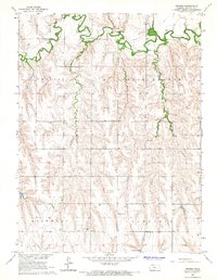
 - 1951 Map of Norton, 1952 Print
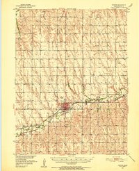 1951 Norton1952 Print · USGSCovers Norton County, including Norton, Calvert, and other nearby areas3 unique versions available
 - 1954 Map of McCook, 1966 Print
 1954 McCook1966 Print · USGSCovers Norton County, including McCook, Cozad, and other nearby areas2 unique versions available
 - 1954 Map of Goodland, 1976 Print
 1954 Goodland1976 Print · USGSCovers Norton County, including Colby, Goodland, and other nearby areas
 - 1955 Map of Grand Island, 1967 Print
 1955 Grand Island1967 Print · USGSCovers Norton County, including Grand Island, Kearney, and other nearby areas3 unique versions available
 - 1955 Map of Beloit, 1971 Print
 1955 Beloit1971 Print · USGSCovers Norton County, including Beloit, Norton, and other nearby areas3 unique versions available
 - 1956 Map of Goodland
 1956 Goodland1956 Print · USGSCovers Norton County, including Colby, Goodland, and other nearby areas
 - 1957 Map of McCook
 1957 McCook1957 Print · USGSCovers Norton County, including McCook, Cozad, and other nearby areas
 - 1957 Map of Goodland
 1957 Goodland1957 Print · USGSCovers Norton County, including Colby, Goodland, and other nearby areas2 unique versions available
 - 1957 Map of Grand Island
 1957 Grand Island1957 Print · USGSCovers Norton County, including Grand Island, Kearney, and other nearby areas
 - 1957 Map of Beaver City SW, 1958 Print
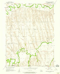 1957 Beaver City SW1958 Print · USGSCovers Norton County, including Furnas County, United States, and other nearby areas
 - 1957 Map of Shippee, 1958 Print
 1957 Shippee1958 Print · USGSCovers Norton County, including Decatur County, Furnas County, and other nearby areas2 unique versions available
 - 1957 Map of Wilsonville, 1958 Print
 1957 Wilsonville1958 Print · USGSCovers Norton County, including Wilsonville, Furnas County, and other nearby areas2 unique versions available
 - 1957 Map of Precept, 1958 Print
 1957 Precept1958 Print · USGSCovers Norton County, including Precept, Furnas County, and other nearby areas
 - 1957 Map of Beaver City SE, 1958 Print
 1957 Beaver City SE1958 Print · USGSCovers Norton County, including Furnas County, United States, and other nearby areas
 - 1958 Map of McCook
 1958 McCook1958 Print · USGSCovers Norton County, including McCook, Cozad, and other nearby areas2 unique versions available
 - 1958 Map of Grand Island
 1958 Grand Island1958 Print · USGSCovers Norton County, including Grand Island, Kearney, and other nearby areas
 - 1959 Map of Beloit
 1959 Beloit1959 Print · USGSCovers Norton County, including Beloit, Norton, and other nearby areas3 unique versions available
 - 1965 Map of Norton NW, 1966 Print
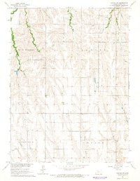 1965 Norton NW1966 Print · USGSCovers Norton County, including United States, Kansas, and other nearby areas
 - 1965 Map of Lyle, 1966 Print
 1965 Lyle1966 Print · USGSCovers Norton County, including Lyle, Decatur County, and other nearby areas
 - 1965 Map of Devizes, 1966 Print
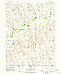
 1965 Devizes1966 Print · USGSCovers Norton County, including Devizes, United States, and other nearby areas
 - 1967 Map of Norton NE, 1969 Print
 1967 Norton NE1969 Print · USGSCovers Norton County, including United States, Kansas, and other nearby areas
Showing maps 1-25 of 45
Top cities of Norton County
Frequently asked questions
- What are the different types of historical maps available for Norton County?
- What is the oldest map of Norton County?
- Where can I purchase historical maps of Norton County for my home or office?
- Where can I download high-res historical maps of Norton County?
- Are there historical topographic maps available for Norton County?
- Is there historical aerial imagery available for Norton County?
- Where are historical maps of Norton County sourced from?