1970s Maps of Wallace County, Kansas
Explore 16 historic maps of Wallace County from the 1970s. These maps offer a rare glimpse into what life looked like during the 1970s — showing old roads, neighborhoods, homes, and landmarks that have changed or disappeared over time.
Whether you're researching your family's past, planning a metal detecting trip, or studying how Wallace County's landscape evolved across the 1970s, these high-resolution maps are a powerful tool for exploring the history of this region.
- Focus on a specific era: All maps on this page are from the 1970s, giving you a focused view of this time period.
- See what’s changed: Compare century-old streets, trails, and buildings to today's modern landscape using overlays and satellite layers.
- Research with precision: Use these maps for genealogy, historical research, land use analysis, or educational projects.
- View, download, or print: Maps are fully viewable online in high resolution, and can be downloaded or printed for your own records.
Start exploring Wallace County's history through authentic maps from the 1970s. This is your window into the past.
Wallace County, KS maps
(16)- 1979 Map of Horsethief Draw NW, 1980 Print
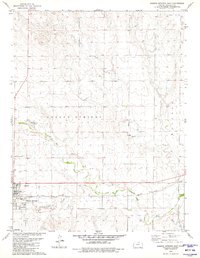
 1979 Horsethief Draw NW1980 Print · USGSSherman and Wallace counties are captured in the late seventies, showing a landscape defined by the High Plains river system. Genealogists and land researchers can locate specific sites like Turtle Creek Lake, Sappa Creek, and various Gravel Pits along the county line.
 - 1979 Map of Wallace, 1980 Print
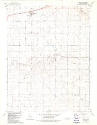
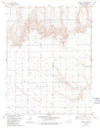
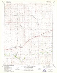 1979 Wallace1980 Print · USGSThe High Plains around Wallace are shown here in the late seventies, a landscape deeply marked by its frontier history and rail-and-river geography. Researchers can locate the Butterfield Overland Trail, the Fort Wallace (Site), and the local Wallace Cem.
 - 1979 Map of Sharon Springs West, 1980 Print
 1979 Sharon Springs West1980 Print · USGSWestern Kansas at the close of the 1970s shows a prairie landscape deeply tied to the Smoky Hill River and the railroad. Genealogists and local historians can trace the development of Sharon Springs through its original Union Pacific tracks, Lakeview Park, and Sharon Springs Cem.
 - 1979 Map of Harris Draw NE, 1980 Print
 1979 Harris Draw NE1980 Print · USGSThe High Plains of Western Kansas are documented here in the late seventies as the terrain transitions between Sherman and Wallace counties. Genealogists and local historians can locate the Mennonite Cem and trace the winding course of the North Fork Smoky Hill River and Sand Creek.
 - 1979 Map of Horsethief Draw, 1980 Print
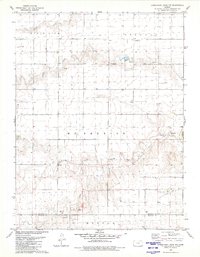
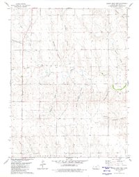
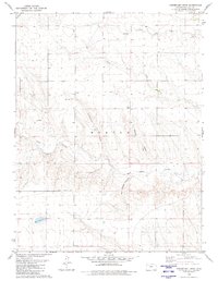 1979 Horsethief Draw1980 Print · USGSWallace County high plains are captured here in the late seventies, showing a landscape defined by deep draws and canyons. Researchers can trace land use through features like Horsethief Cave, a lone Grave, and the winding Salt Grass Canyon.
 - 1979 Map of Harris Draw East, 1980 Print
 1979 Harris Draw East1980 Print · USGSWallace County in the late seventies is captured here as a landscape of intermittent water and working prairie. Genealogists and historians can trace family land across named landmarks like Bradshaw Draw, Lake Creek, and the local Marl Pits.
 - 1979 Map of Spring Valley Ranch, 1980 Print
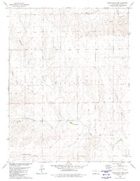
 1979 Spring Valley Ranch1980 Print · USGSWallace County ranching and water management are front and center in this late-seventies survey of the High Plains. Genealogists and local historians can locate Spring Valley Ranch and the Dover Grange Hall or trace the winding paths of Ladder Creek.
 - 1979 Map of Horsethief Draw NE, 1980 Print
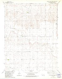
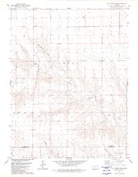
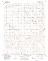
 1979 Horsethief Draw NE1980 Print · USGSSherman County at the close of the 1970s reveals a landscape defined by the confluence of the North Fork Smoky Hill River and Smoky Hill River. Researchers can trace the layout of the Sherman State Fishing Lake and Wildlife Area or locate the Fairview Cem and Soldiers Memorial County Park.
 - 1979 Map of Sharon Springs East, 1980 Print
 1979 Sharon Springs East1980 Print · USGSSharon Springs and the High Plains come into sharp focus in the late seventies, centered on the railroad-and-river corridor. Researchers can trace the path of the Union Pacific through town or locate the Sharon Springs Cem and Gravel Pits along the Smoky Hill River.
 - 1979 Map of Wild Horse Draw, 1980 Print
 1979 Wild Horse Draw1980 Print · USGSSherman and Wallace counties are shown in the late 1970s, focused on the high plains drainage systems. Researchers can trace the winding North Fork Smoky Hill River and locate historic land-use sites like the local Gravel Pits and Wild Horse Draw.
 - 1979 Map of Weskan, 1980 Print
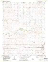
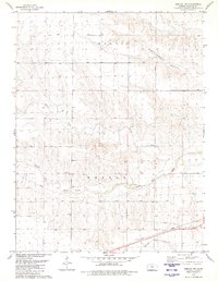
 1979 Weskan1980 Print · USGSWeskan and the surrounding Wallace County plains are captured in the late seventies as the rail-and-ranch economy persisted. Genealogists and local historians can trace the Union Pacific line, locate the Weskan Cem, and follow the breaks of Ladder Creek.
 - 1979 Map of Harris Draw West, 1980 Print
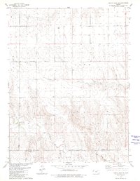
 1979 Harris Draw West1980 Print · USGSWallace County was a landscape of deep canyons and seasonal draws in the late seventies. Genealogists and historians can trace the paths of Blindman Canyon and Wildcat Canyon, or locate isolated landmarks like Big Spring and a lonely Grave.
 - 1979 Map of Harrison Flats, 1980 Print
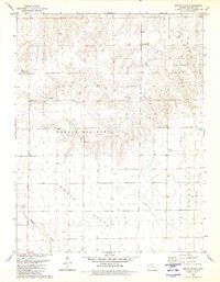
 1979 Harrison Flats1980 Print · USGSWallace County, Kansas, is documented here in the late seventies as a landscape of high plateaus and sudden breaks. Genealogists and local historians can locate the Harrison Flats Sch, Dinas Ch, and the rugged terrain of Wallace Bluffs.
 - 1979 Map of South Flats, 1980 Print
 1979 South Flats1980 Print · USGSWallace County, Kansas, is documented here in the late seventies during a period of steady agricultural use. Researchers can trace the section lines across South Flats or locate landmarks like the Walker Landing Strip and Rose Creek.
 - 1979 Map of Weskan NW, 1980 Print
 1979 Weskan NW1980 Print · USGSThe High Plains of Wallace County are captured here in the late seventies, showing the vital corridors of the Smoky Hill River and the Union Pacific railroad. Researchers can trace land divisions in Weskan and Morton or locate landmarks like Rattlesnake Gulch.
 - 1979 Map of Horsethief Draw SE, 1980 Print
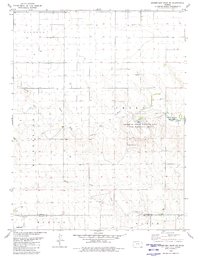
 1979 Horsethief Draw SE1980 Print · USGSWestern Kansas at the close of the seventies reveals a landscape defined by the branching waters of North Fork Lake Creek. Researchers can trace old township lines in Morton and locate the McKinley Cem among the draws and gravel works.
End of results
Showing maps 1-16 of 16
Frequently asked questions
- What are the different types of historical maps available for Wallace County?
- What is the oldest map of Wallace County?
- Where can I purchase historical maps of Wallace County for my home or office?
- Where can I download high-res historical maps of Wallace County?
- Are there historical topographic maps available for Wallace County?
- Is there historical aerial imagery available for Wallace County?
- Where are historical maps of Wallace County sourced from?