1960s Maps of Wilson County, Kansas
Explore 5 historic maps of Wilson County from the 1960s. These maps offer a rare glimpse into what life looked like during the 1960s — showing old roads, neighborhoods, homes, and landmarks that have changed or disappeared over time.
Whether you're researching your family's past, planning a metal detecting trip, or studying how Wilson County's landscape evolved across the 1960s, these high-resolution maps are a powerful tool for exploring the history of this region.
- Focus on a specific era: All maps on this page are from the 1960s, giving you a focused view of this time period.
- See what’s changed: Compare century-old streets, trails, and buildings to today's modern landscape using overlays and satellite layers.
- Research with precision: Use these maps for genealogy, historical research, land use analysis, or educational projects.
- View, download, or print: Maps are fully viewable online in high resolution, and can be downloaded or printed for your own records.
Start exploring Wilson County's history through authentic maps from the 1960s. This is your window into the past.
Wilson County, KS maps
(5)- 1963 Map of Vilas, 1964 Print
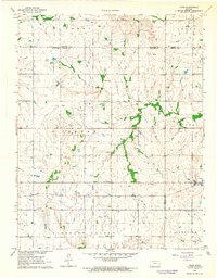 1963 Vilas1964 Print · USGSSoutheast Kansas in the early sixties was a landscape of rail-connected small towns and rural school districts. Genealogists and historians can trace family roots through sites like Vilas, the Vilas Bethel Cem, and the Union Valley Sch.
 - 1963 Map of Morehead, 1964 Print
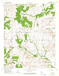
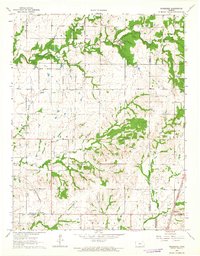 1963 Morehead1964 Print · USGSSoutheast Kansas at the start of the 1960s reveals a landscape defined by historical boundaries and the rail-and-oil economy. Researchers can trace the Old Indian Treaty Boundary or locate rural landmarks like Big Four Sch and Morehead Cem.2 unique versions available
 - 1963 Map of Lafontaine, 1964 Print
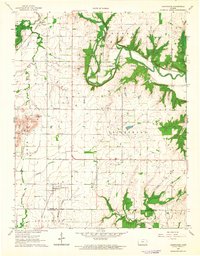 1963 Lafontaine1964 Print · USGSSoutheast Kansas in the 1960s reveals a structured landscape of railroads and river valleys along the Wilson and Montgomery County line. Trace family roots and local history through landmarks like the Bachelder Cem, Emmanuel Ch, and the path of the ATCHISON TOPEKA AND SANTA FE RAILROAD.
 - 1963 Map of Five Mounds, 1964 Print
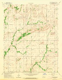 1963 Five Mounds1964 Print · USGSSoutheast Kansas at the start of the 1960s reveals a prairie landscape deeply tied to its original land surveys and small-town institutions. Genealogists and local historians can trace family locations near Pleasant Valley Cem, Crane Cem, and the historical Old Indian Treaty Boundary.2 unique versions available
 - 1964 Map of Buxton, 1965 Print
 1964 Buxton1965 Print · USGSSoutheast Kansas in the mid-1960s reveals a landscape where rail transport and early frontier boundaries still define the land. Genealogists can trace rural roots at Upola, Buxton, and family-named landmarks like West Rainbow Sch or Mount Pleasant Cem.
End of results
Showing maps 1-5 of 5
Top cities of Wilson County
- Neodesha historical maps
- Fredonia historical maps
- Altoona historical maps
- Buffalo historical maps
- Guilford historical maps
- Benedict historical maps
See more
Frequently asked questions
- What are the different types of historical maps available for Wilson County?
- What is the oldest map of Wilson County?
- Where can I purchase historical maps of Wilson County for my home or office?
- Where can I download high-res historical maps of Wilson County?
- Are there historical topographic maps available for Wilson County?
- Is there historical aerial imagery available for Wilson County?
- Where are historical maps of Wilson County sourced from?