Old Maps of Burkesville, Kentucky for Genealogy
Trace your family roots with 16 historic maps of Burkesville. These high-res maps reveal old neighborhoods, homesites, landmarks, and streets — helping you uncover where your ancestors lived and how the area evolved over time.
- Explore historic neighborhoods: Identify where your relatives may have lived in the 1800s or 1900s.
- Compare maps over time: Trace the changes in streets, buildings, and landmarks for multi-generational research.
- Perfect for genealogy & ancestry research: Used by family historians and researchers to map out lineage and migration.
These maps are an incredible resource for exploring your personal connection to Burkesville's past.
Burkesville, KY maps
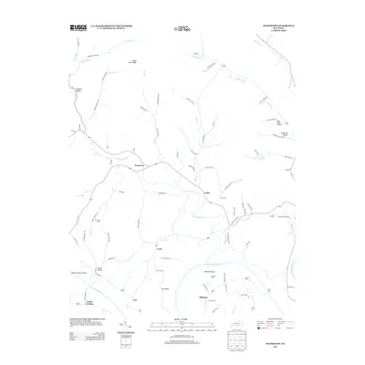
(16)- 1953 Map of Waterview, 1954 Print
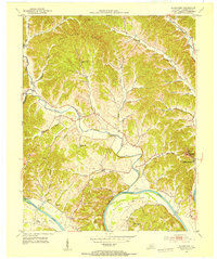 1953 Waterview1954 Print · USGSCumberland County at the mid-century remains a landscape of river-centered life and small rural school districts. Genealogists can locate Cloyds Landing, the Oliver Ferry crossing, and numerous local landmarks like Baise Chapel and Beech Grove Sch.2 unique versions available
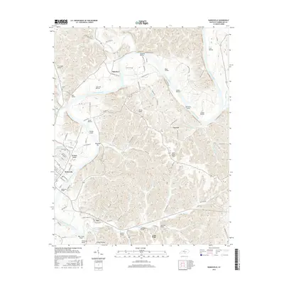
 - 1953 Map of Burkesville, 1955 Print
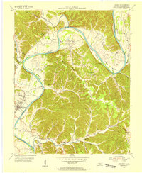 1953 Burkesville1955 Print · USGSThe Cumberland River loops through southern Kentucky in the early fifties, carving out fertile lowlands and providing a lifelines for riverside settlements. Genealogists can trace family names and local landmarks like Parrish Chapel, Dougan Town, and the Seminary Sch.2 unique versions available
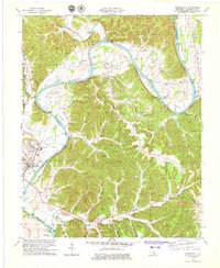
 - 1956 Map of Corbin, 1966 Print
 1956 Corbin1966 Print · USGSThe Kentucky and Tennessee borderlands are captured here in the mid-fifties, showing the region's shift toward modern interstate travel and reservoir development. Genealogists and historians can trace old community lines near Albany and Monticello or locate early rail junctions along the Southern and Tennessee Central lines.3 unique versions available
 - 1958 Map of Corbin
 1958 Corbin1958 Print · USGSThe Upper Cumberland borderlands appear in the late 1950s as massive reservoirs and early atomic-era growth reshape the region. Trace family roots and vanished landmarks near Lake Cumberland, Oak Ridge, and the Cumberland National Forest.
 - 1978 Map of Burkesville, 1979 Print
 1978 Burkesville1979 Print · USGSCumberland County during the late seventies reveals a landscape of river-bottom farms and active oil extraction. Genealogists can locate family names and burial sites at the Burkesville Cem or trace community roots at Terry Chapel and Bakerton Ch.2 unique versions available
 - 1985 Map of Tompkinsville, 1986 Print
 1985 Tompkinsville1986 Print · USGSThe Kentucky-Tennessee borderlands come into focus in the mid-1980s, showcasing a landscape of river-fed valleys and rural crossroads. Genealogists and local historians can trace family locations from Glasgow and Edmonton to the distinctively named Eighty Eight, Bugtussle, and Akersville.2 unique versions available
 - 2010 Map of Waterview, 2010 Print
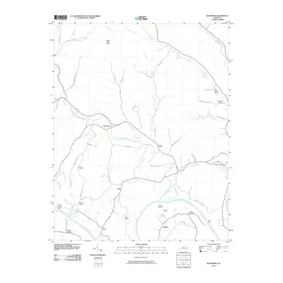 2010 Waterview2010 Print · USGSCovers Burkesville, including Leslie, Waterview, and other nearby areas
 - 2010 Map of Burkesville, 2010 Print
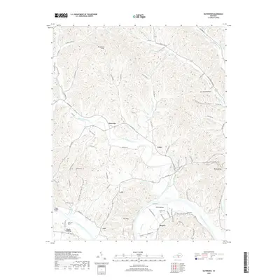
 2010 Burkesville2010 Print · USGSCovers Burkesville, including Claywell, Bakerton, and other nearby areas
 - 2013 Map of Waterview, 2013 Print
 2013 Waterview2013 Print · USGSCovers Burkesville, including Leslie, Waterview, and other nearby areas
 - 2013 Map of Burkesville, 2013 Print
 2013 Burkesville2013 Print · USGSCovers Burkesville, including Claywell, Bakerton, and other nearby areas
 - 2016 Map of Burkesville, 2016 Print
 2016 Burkesville2016 Print · USGSCovers Burkesville, including Claywell, Bakerton, and other nearby areas
 - 2016 Map of Waterview, 2016 Print
 2016 Waterview2016 Print · USGSCovers Burkesville, including Leslie, Waterview, and other nearby areas
 - 2019 Map of Waterview, 2019 Print
 2019 Waterview2019 Print · USGSCovers Burkesville, including Leslie, Waterview, and other nearby areas
 - 2019 Map of Burkesville, 2019 Print
 2019 Burkesville2019 Print · USGSCovers Burkesville, including Claywell, Bakerton, and other nearby areas
 - 2022 Map of Waterview, 2022 Print
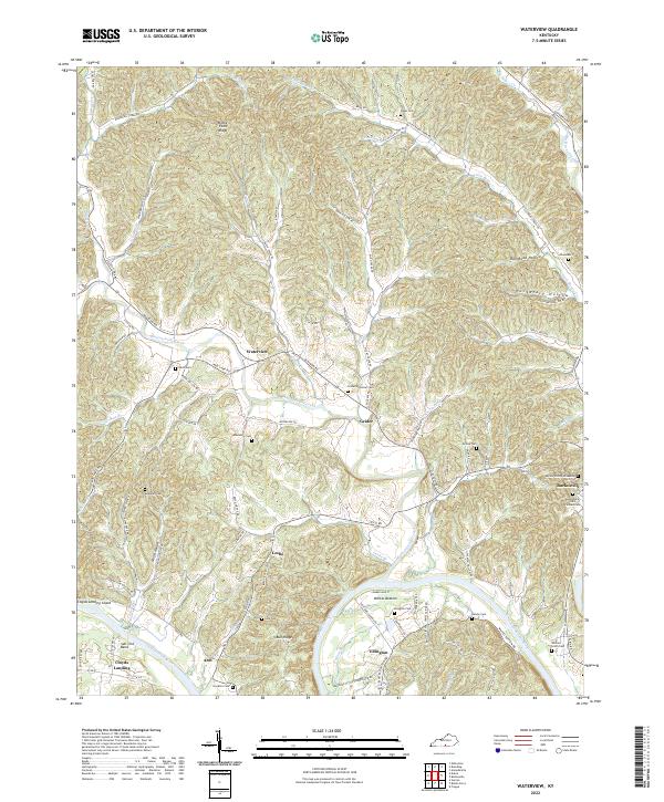 2022 Waterview2022 Print · USGSCumberland County's river-carved landscape comes into focus in this contemporary survey of the hills and hollows surrounding the Cumberland River. Researchers can trace family history through sites like the Burkesville Odd Fellows Cem and the remote Alpine Hilltop Gravesite.
 - 2022 Map of Burkesville, 2022 Print
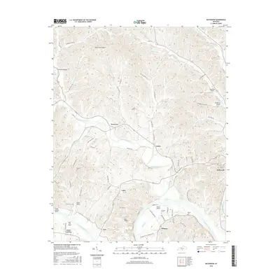
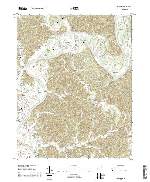 2022 Burkesville2022 Print · USGSCumberland County, Kentucky, is captured in this recent survey, showcasing the deep river bends and rural communities. Researchers can trace local history through sites like the Cumberland County Courthouse, Bakertown Cem, and the Xerxes Post Office Rd.
End of results
Showing maps 1-16 of 16
Top cities near Burkesville
Frequently asked questions
- What are the different types of historical maps available for Burkesville?
- What is the oldest map of Burkesville?
- Where can I purchase historical maps of Burkesville for my home or office?
- Where can I download high-res historical maps of Burkesville?
- Are there historical topographic maps available for Burkesville?
- Is there historical aerial imagery available for Burkesville?
- Where are historical maps of Burkesville sourced from?