Old Maps of Bruin, Kentucky for Academic Research
Study the evolution of Bruin with 11 high-resolution historic maps. Whether you're teaching, researching, or modeling changes in land use, these maps provide essential visual documentation of urban, environmental, and geographic change.
- Analyze long-term change: Track patterns in development, transportation, and natural features.
- Ideal for environmental or urban studies: Support academic projects with primary historical map data.
- Use in the classroom or lab: Educators and researchers rely on these maps to bring historical context to life.
These maps are a powerful tool for teaching, research, and visualizing how Bruin has changed over the decades.
Bruin, KY maps
(11)- 1950 Map of Bruin, 1952 Print
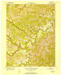 1950 Bruin1952 Print · USGSElliott and Carter counties in the early fifties show a landscape of deep hollows and winding creek-bottom settlements. Researchers can locate many family cemeteries and rural school sites such as Ibex Waddell Sch and Flannery Cem along the Little Sandy River.
 - 1957 Map of Huntington, 1966 Print
 1957 Huntington1966 Print · USGSThe industrial heart of the Ohio River valley is captured here in the mid-sixties, showing the growth of Huntington and Ashland. Researchers can trace the extensive rail networks of the Chesapeake and Ohio RR and locate sites like the Chief Cornstalk Hunting Ground.3 unique versions available
 - 1960 Map of Huntington
 1960 Huntington1960 Print · USGSThe tri-state river valley thrived in the late fifties as a hub of heavy industry and Appalachian rail transit. Genealogists and historians can trace the connection between river towns like Ashland and Portsmouth or locate family homesteads near Coleman Ridge.
 - 1962 Map of Bruin, 1966 Print
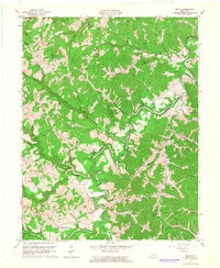 1962 Bruin1966 Print · USGSEastern Kentucky's hill country is recorded here in the early sixties, showing a landscape of small creek-side settlements and upland ridges. Researchers can trace family sites like Carroll Cem or locate historic rural schoolhouses such as Providence Sch and Lower Stark Sch.
 - 1971 Map of Bruin, 1972 Print
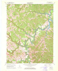 1971 Bruin1972 Print · USGSThe headwaters of Grayson Lake in the early 1970s reveal a landscape of rural crossroads and narrow river hollers. Researchers can trace family homesteads near Ibex, Newfoundland, and the Pine Springs Ch, or locate old industrial sites like the Mines and Oil Wells along the ridges.2 unique versions available
 - 1982 Map of Morehead, 1983 Print
 1982 Morehead1983 Print · USGSThe foothills of northeastern Kentucky come alive in the early eighties, showcasing a landscape defined by timber, limestone caves, and major reservoirs. Local researchers can trace the development of Morehead State University or locate old crossings at Plummers Mill and Salt Lick.
 - 2010 Map of Bruin, 2010 Print
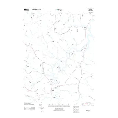
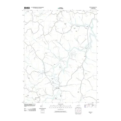 2010 Bruin2010 Print · USGSCovers Bruin, including Ibex, Newfoundland, and other nearby areas
 - 2013 Map of Bruin, 2013 Print
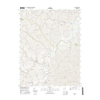
 2013 Bruin2013 Print · USGSCovers Bruin, including Ibex, Newfoundland, and other nearby areas
 - 2016 Map of Bruin, 2016 Print
 2016 Bruin2016 Print · USGSCovers Bruin, including Ibex, Newfoundland, and other nearby areas
 - 2019 Map of Bruin, 2019 Print
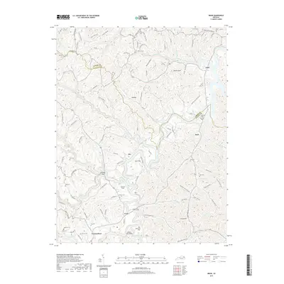 2019 Bruin2019 Print · USGSCovers Bruin, including Ibex, Newfoundland, and other nearby areas
 - 2022 Map of Bruin, 2022 Print
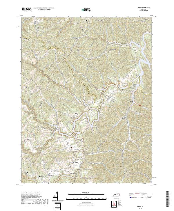 2022 Bruin2022 Print · USGSElliott County's rugged ridges and river bottoms are captured here in the early twenty-first century, showing a landscape deeply tied to family landholdings. Researchers can locate numerous family burial sites like Simmons Cem and King Cem near settlements such as Newfoundland and Bruin.
End of results
Showing maps 1-11 of 11
Top cities near Bruin
Frequently asked questions
- What are the different types of historical maps available for Bruin?
- What is the oldest map of Bruin?
- Where can I purchase historical maps of Bruin for my home or office?
- Where can I download high-res historical maps of Bruin?
- Are there historical topographic maps available for Bruin?
- Is there historical aerial imagery available for Bruin?
- Where are historical maps of Bruin sourced from?