Old Maps of Lansdowne, Lexington for Academic Research
Study the evolution of Lansdowne with 28 high-resolution historic maps. Whether you're teaching, researching, or modeling changes in land use, these maps provide essential visual documentation of urban, environmental, and geographic change.
- Analyze long-term change: Track patterns in development, transportation, and natural features.
- Ideal for environmental or urban studies: Support academic projects with primary historical map data.
- Use in the classroom or lab: Educators and researchers rely on these maps to bring historical context to life.
These maps are a powerful tool for teaching, research, and visualizing how Lansdowne has changed over the decades.
Lansdowne, Lexington maps
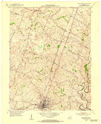
(28)- 1892 Map of Richmond
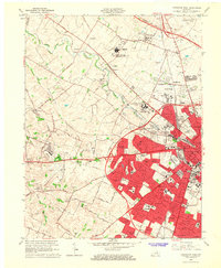
 1892 Richmond1892 Print · USGSCovers Lansdowne, including Lexington, Richmond, and other nearby areas
 - 1897 Map of Richmond
 1897 Richmond1897 Print · USGSCovers Lansdowne, including Lexington, Richmond, and other nearby areas5 unique versions available
 - 1905 Map of Harrodsburg
 1905 Harrodsburg1905 Print · USGSCovers Lansdowne, including Lexington, Nicholasville, and other nearby areas3 unique versions available
 - 1906 Map of Georgetown, 1954 Print
 1906 Georgetown1954 Print · USGSCovers Lansdowne, including Lexington, Georgetown, and other nearby areas
 - 1908 Map of Georgetown
 1908 Georgetown1908 Print · USGSCovers Lansdowne, including Lexington, Georgetown, and other nearby areas2 unique versions available
 - 1927 Map of Lexington
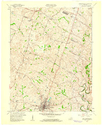
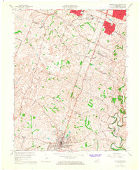
 1927 Lexington1927 Print · USGSCovers Lansdowne, including Lexington, Paris, and other nearby areas
 - 1929 Map of Lexington
 1929 Lexington1929 Print · USGSCovers Lansdowne, including Lexington, Paris, and other nearby areas2 unique versions available
 - 1950 Map of Lexington East, 1952 Print
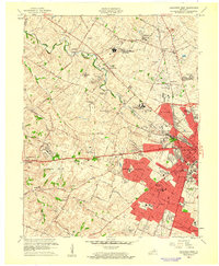
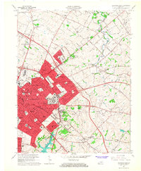
 1950 Lexington East1952 Print · USGSCovers Lansdowne, including Lexington, Chevy Chase, and other nearby areas
 - 1950 Map of Lexington West, 1952 Print
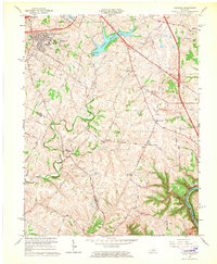
 1950 Lexington West1952 Print · USGSCovers Lansdowne, including Lexington, Highlands, and other nearby areas
 - 1952 Map of Nicholasville, 1953 Print
 1952 Nicholasville1953 Print · USGSCovers Lansdowne, including Lexington, Nicholasville, and other nearby areas
 - 1952 Map of Coletown, 1953 Print
 1952 Coletown1953 Print · USGSCovers Lansdowne, including Lexington, Southeastern Hills, and other nearby areas
 - 1954 Map of Lexington East, 1955 Print
 1954 Lexington East1955 Print · USGSCovers Lansdowne, including Lexington, Chevy Chase, and other nearby areas
 - 1955 Map of Lexington West, 1956 Print
 1955 Lexington West1956 Print · USGSCovers Lansdowne, including Lexington, Highlands, and other nearby areas
 - 1956 Map of Louisville, 1971 Print
 1956 Louisville1971 Print · USGSCovers Lansdowne, including Louisville, Lexington, and other nearby areas2 unique versions available
 - 1957 Map of Winchester, 1968 Print
 1957 Winchester1968 Print · USGSCovers Lansdowne, including Louisville, Lexington, and other nearby areas3 unique versions available
 - 1959 Map of Lexington East, 1960 Print
 1959 Lexington East1960 Print · USGSCovers Lansdowne, including Lexington, Chevy Chase, and other nearby areas
 - 1959 Map of Coletown, 1960 Print
 1959 Coletown1960 Print · USGSCovers Lansdowne, including Lexington, Southeastern Hills, and other nearby areas
 - 1959 Map of Nicholasville, 1960 Print
 1959 Nicholasville1960 Print · USGSCovers Lansdowne, including Lexington, Nicholasville, and other nearby areas
 - 1959 Map of Lexington West, 1961 Print
 1959 Lexington West1961 Print · USGSCovers Lansdowne, including Lexington, Highlands, and other nearby areas
 - 1960 Map of Winchester
 1960 Winchester1960 Print · USGSCovers Lansdowne, including Louisville, Lexington, and other nearby areas
 - 1964 Map of Louisville
 1964 Louisville1964 Print · USGSCovers Lansdowne, including Louisville, Lexington, and other nearby areas
 - 1965 Map of Coletown, 1966 Print
 1965 Coletown1966 Print · USGSCovers Lansdowne, including Lexington, Southeastern Hills, and other nearby areas5 unique versions available
 - 1965 Map of Lexington West, 1967 Print
 1965 Lexington West1967 Print · USGSCovers Lansdowne, including Lexington, Highlands, and other nearby areas5 unique versions available
 - 1965 Map of Nicholasville, 1967 Print
 1965 Nicholasville1967 Print · USGSCovers Lansdowne, including Lexington, Nicholasville, and other nearby areas4 unique versions available
 - 1965 Map of Lexington East, 1967 Print
 1965 Lexington East1967 Print · USGSCovers Lansdowne, including Lexington, Chevy Chase, and other nearby areas6 unique versions available
Showing maps 1-25 of 28
Frequently asked questions
- What are the different types of historical maps available for Lansdowne?
- What is the oldest map of Lansdowne?
- Where can I purchase historical maps of Lansdowne for my home or office?
- Where can I download high-res historical maps of Lansdowne?
- Are there historical topographic maps available for Lansdowne?
- Is there historical aerial imagery available for Lansdowne?
- Where are historical maps of Lansdowne sourced from?