2020s Maps of Taylor Mill, Kentucky
Explore 4 historic maps of Taylor Mill from the 2020s. These maps offer a rare glimpse into what life looked like during the 2020s — showing old roads, neighborhoods, homes, and landmarks that have changed or disappeared over time.
Whether you're researching your family's past, planning a metal detecting trip, or studying how Taylor Mill's landscape evolved across the 2020s, these high-resolution maps are a powerful tool for exploring the history of this region.
- Focus on a specific era: All maps on this page are from the 2020s, giving you a focused view of this time period.
- See what’s changed: Compare century-old streets, trails, and buildings to today's modern landscape using overlays and satellite layers.
- Research with precision: Use these maps for genealogy, historical research, land use analysis, or educational projects.
- View, download, or print: Maps are fully viewable online in high resolution, and can be downloaded or printed for your own records.
Start exploring Taylor Mill's history through authentic maps from the 2020s. This is your window into the past.
Taylor Mill, KY maps
(4)- 2022 Map of Newport, 2022 Print
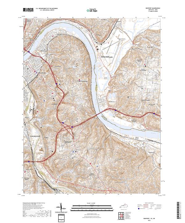 2022 Newport2022 Print · USGSThe riverfront communities of Northern Kentucky and Southern Ohio are shown in detail at the start of the 2020s. Researchers can trace family history through numerous burial grounds like Saint Stephens Cem or locate landmarks such as Daymar College Newport.
 - 2022 Map of Independence, 2022 Print
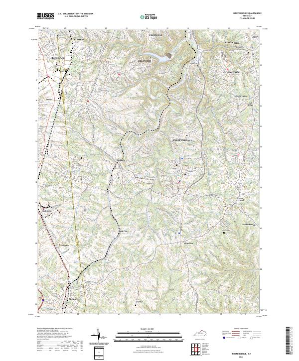 2022 Independence2022 Print · USGSNorthern Kentucky's suburban landscape is documented here in the early twenty-first century, spanning the border of Boone and Kenton counties. Family historians can trace local burial sites like Saint Cecilias Cem and old settlements such as Ricedale and Staffordsburg.
 - 2022 Map of Covington, 2022 Print
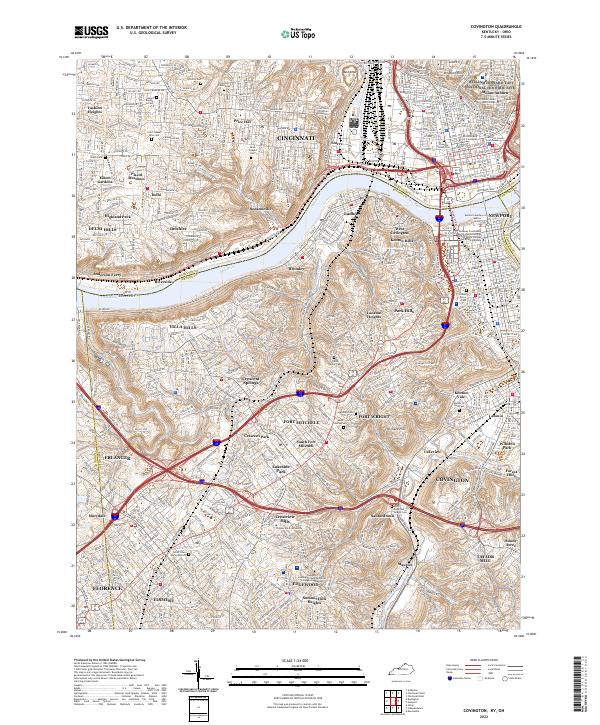 2022 Covington2022 Print · USGSNorthern Kentucky and Cincinnati meet along the Ohio River in this detailed survey of the 2020s. Trace your family roots through the Linden Grove Cem, visit the William Howard Taft National Historic Site, or locate the historic Anderson Ferry.
 - 2022 Map of Alexandria, 2022 Print
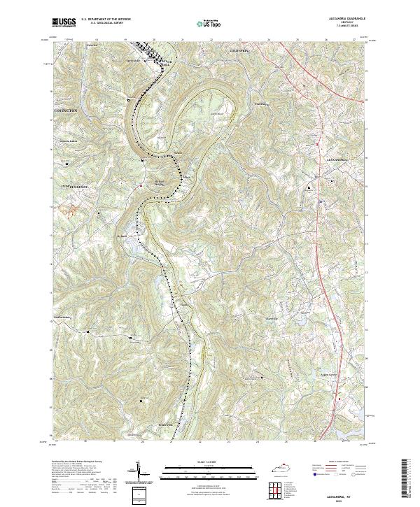 2022 Alexandria2022 Print · USGSNorthern Kentucky in the early 2020s shows a landscape of deep river bends and high ridges spanning the Kenton and Campbell county lines. Family history researchers can locate several rural burial grounds such as Culbertson Cem, Rapp Cem, and the Alexandria Cem.
End of results
Showing maps 1-4 of 4
Top cities near Taylor Mill
- Cincinnati historical maps
- Covington historical maps
- Florence historical maps
- Independence historical maps
- Norwood historical maps
- Erlanger historical maps
See more
Top neighborhoods of Taylor Mill
- Springdale historical maps
- Forest Hills historical maps
- Sunny Acres historical maps
- DeCoursey historical maps
Frequently asked questions
- What are the different types of historical maps available for Taylor Mill?
- What is the oldest map of Taylor Mill?
- Where can I purchase historical maps of Taylor Mill for my home or office?
- Where can I download high-res historical maps of Taylor Mill?
- Are there historical topographic maps available for Taylor Mill?
- Is there historical aerial imagery available for Taylor Mill?
- Where are historical maps of Taylor Mill sourced from?