Old Maps of Lowmansville, Kentucky for Academic Research
Study the evolution of Lowmansville with 15 high-resolution historic maps. Whether you're teaching, researching, or modeling changes in land use, these maps provide essential visual documentation of urban, environmental, and geographic change.
- Analyze long-term change: Track patterns in development, transportation, and natural features.
- Ideal for environmental or urban studies: Support academic projects with primary historical map data.
- Use in the classroom or lab: Educators and researchers rely on these maps to bring historical context to life.
These maps are a powerful tool for teaching, research, and visualizing how Lowmansville has changed over the decades.
Lowmansville, KY maps
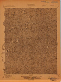
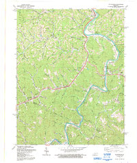
(15)- 1886 Map of Prestonsburg
 1886 Prestonsburg1886 Print · USGSEastern Kentucky's river-and-rail economy is captured here in the late nineteenth century as steam power reached deep into the mountains. Genealogists can trace family homesteads near Prestonburgh, Paintsville, and early settlements like Peach Orchard or Boon's Camp.
 - 1892 Map of Prestonsburg
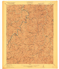
 1892 Prestonsburg1892 Print · USGSEastern Kentucky is shown in the late nineteenth century as a landscape of river-centered trade and early mountain settlement. Genealogists and historians can trace family-named locations like Laynesville, Oil Spring, and the post office at Eden (Inez P.O.).4 unique versions available
 - 1914 Map of Inez
 1914 Inez1914 Print · USGSThe Big Sandy River valley in the early twentieth century was a landscape of coal-country settlements and riverside rail stops. Researchers can trace the development of small communities like Whitehouse and Inez or locate vanished landmarks like Wells Chapel and Graves Shoals Sta.
 - 1916 Map of Inez
 1916 Inez1916 Print · USGSMartin and Lawrence Counties are shown here during a period of rural growth and river-based transport. Genealogists can locate specific homesteads near Wells Chapel, track old post offices like Graves Shoals, or find local landmarks such as Sandlick School.3 unique versions available
 - 1954 Map of Richardson, 1955 Print
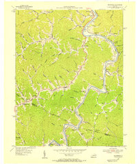 1954 Richardson1955 Print · USGSEastern Kentucky during the mid-fifties is captured here along the Levisa Fork as rail life flourished. Genealogists can trace family landmarks like Belles Chapel, the Chesapeake and Ohio line, and the rural Lost Creek Sch.2 unique versions available
 - 1957 Map of Jenkins, 1974 Print
 1957 Jenkins1974 Print · USGSThe Cumberland Plateau in the mid-twentieth century reveals a complex landscape of winding river valleys and deep-seated industry. Genealogists and historians can trace the development of Hazard, Jenkins, and Pikeville alongside extensive Numerous Oil and Gas Fields and the routes of the Chesapeake & Ohio Railway.
 - 1960 Map of Jenkins
 1960 Jenkins1960 Print · USGSEastern Kentucky and the West Virginia borderlands are captured at a mid-century peak of the coal and rail era. Trace the industrial corridors of the Chesapeake and Ohio RR through mountain hubs like Hazard and Jenkins.
 - 1971 Map of Richardson, 1973 Print
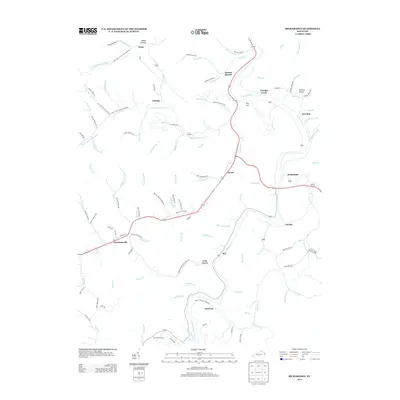
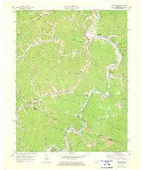 1971 Richardson1973 Print · USGSThe Levisa Fork valley in the early 1970s shows a landscape shaped by the coal industry and the Chesapeake and Ohio railroad. Researchers can trace rural lineages through settlements like Richardson, Charley, and Lowmansville, alongside numerous Cemeteries and local landmarks like Chestnut Grove Ch.2 unique versions available
 - 1982 Map of Williamson, 1983 Print
 1982 Williamson1983 Print · USGSThe Central Appalachian coalfields of West Virginia and Kentucky come into sharp focus here during the early eighties. Genealogists and researchers can trace the valley rail networks of the Norfolk and Western RR through Matewan, Williamson, and Blackberry City.
 - 1992 Map of Richardson
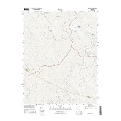
 1992 Richardson1992 Print · USGSEastern Kentucky's river valleys and coal-rich hills are documented here in the early 1990s, near the Lawrence and Johnson county line. Researchers can locate remote family cemeteries and rural landmarks like Borders Chapel, Lowmansville, and the riverside community of Richardson.
 - 2010 Map of Richardson, 2010 Print
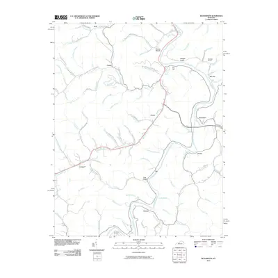 2010 Richardson2010 Print · USGSCovers Lowmansville, including Richardson, Ulysses, and other nearby areas
 - 2013 Map of Richardson, 2013 Print
 2013 Richardson2013 Print · USGSCovers Lowmansville, including Richardson, Ulysses, and other nearby areas
 - 2016 Map of Richardson, 2016 Print
 2016 Richardson2016 Print · USGSCovers Lowmansville, including Richardson, Ulysses, and other nearby areas
 - 2019 Map of Richardson, 2019 Print
 2019 Richardson2019 Print · USGSCovers Lowmansville, including Richardson, Ulysses, and other nearby areas
 - 2022 Map of Richardson, 2022 Print
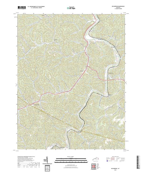 2022 Richardson2022 Print · USGSEastern Kentucky's narrow valleys and ridge-top borders come into focus in this recent survey. Genealogists and local historians can trace family-named landmarks from Butcher Cem to settlements like Lowmansville and Richardson.
End of results
Showing maps 1-15 of 15
Top cities near Lowmansville
- Paintsville historical maps
- Prestonsburg historical maps
- Louisa historical maps
- Van Lear historical maps
- Fort Gay historical maps
- West Van Lear historical maps
See more
Frequently asked questions
- What are the different types of historical maps available for Lowmansville?
- What is the oldest map of Lowmansville?
- Where can I purchase historical maps of Lowmansville for my home or office?
- Where can I download high-res historical maps of Lowmansville?
- Are there historical topographic maps available for Lowmansville?
- Is there historical aerial imagery available for Lowmansville?
- Where are historical maps of Lowmansville sourced from?