1900s (20th Century) Maps of Carbon Glow, Kentucky
Explore 7 historic maps of Carbon Glow from the 1900s (20th Century). These maps offer a rare glimpse into what life looked like during the 1900s — showing old roads, neighborhoods, homes, and landmarks that have changed or disappeared over time.
Whether you're researching your family's past, planning a metal detecting trip, or studying how Carbon Glow's landscape evolved across the 1900s, these high-resolution maps are a powerful tool for exploring the history of this region.
- Focus on a specific era: All maps on this page are from the 1900s, giving you a focused view of this time period.
- See what’s changed: Compare century-old streets, trails, and buildings to today's modern landscape using overlays and satellite layers.
- Research with precision: Use these maps for genealogy, historical research, land use analysis, or educational projects.
- View, download, or print: Maps are fully viewable online in high resolution, and can be downloaded or printed for your own records.
Start exploring Carbon Glow's history through authentic maps from the 1900s. This is your window into the past.
Carbon Glow, KY maps
(7)- 1913 Map of Oven Fork
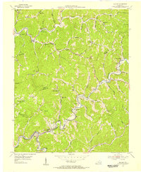
 1913 Oven Fork1913 Print · USGSLetcher County's steep ridges and narrow hollows are shown here in the early twentieth century, just as the Lexington and Eastern Ry arrived. Genealogists can trace family settlements from Whitesburg to Blackey, and locate early schools and landmarks like Campbranch Chapel or Pound Gap.
 - 1915 Map of Whitesburg
 1915 Whitesburg1915 Print · USGSLetcher County at the start of the twentieth century shows a landscape of deep hollows and growing rail towns. Genealogists can trace family roots through numerous numbered schoolhouses and settlements like Whitesburg, Blackey, and Indian Bottom.4 unique versions available
 - 1954 Map of Blackey, 1956 Print
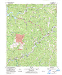
 1954 Blackey1956 Print · USGSCumberland Plateau coal towns and hollows are captured here in the mid-1950s as the railroad and creeks still dictated the rhythm of daily life. Researchers can trace family roots through numerous country schools and landmarks like Carbon Glow, Hot Spot, and Indian Bottom Ch.4 unique versions available
 - 1957 Map of Jenkins, 1974 Print
 1957 Jenkins1974 Print · USGSThe Cumberland Plateau in the mid-twentieth century reveals a complex landscape of winding river valleys and deep-seated industry. Genealogists and historians can trace the development of Hazard, Jenkins, and Pikeville alongside extensive Numerous Oil and Gas Fields and the routes of the Chesapeake & Ohio Railway.
 - 1960 Map of Jenkins
 1960 Jenkins1960 Print · USGSEastern Kentucky and the West Virginia borderlands are captured at a mid-century peak of the coal and rail era. Trace the industrial corridors of the Chesapeake and Ohio RR through mountain hubs like Hazard and Jenkins.
 - 1977 Map of Pikeville, 1983 Print
 1977 Pikeville1983 Print · USGSThe Central Appalachian coalfields and the rugged borders of Kentucky and Virginia come into focus during the late seventies. Researchers can trace the rail networks of the C & O and L & N through towns like Jenkins, Whitesburg, and Pikeville.
 - 1992 Map of Blackey
 1992 Blackey1992 Print · USGSEastern Kentucky's coal country and the winding North Fork river valleys are captured here in the early nineties. Researchers can locate the Letcher Co High Sch, trace family sites near Carcassonne, and see the impact of the strip mine at Carbon Glow.
End of results
Showing maps 1-7 of 7
Top cities near Carbon Glow
- Hazard historical maps
- Cumberland historical maps
- Whitesburg historical maps
- Wheelwright historical maps
- Lynch historical maps
- Hindman historical maps
See more
Frequently asked questions
- What are the different types of historical maps available for Carbon Glow?
- What is the oldest map of Carbon Glow?
- Where can I purchase historical maps of Carbon Glow for my home or office?
- Where can I download high-res historical maps of Carbon Glow?
- Are there historical topographic maps available for Carbon Glow?
- Is there historical aerial imagery available for Carbon Glow?
- Where are historical maps of Carbon Glow sourced from?