Old Maps of Belton, Kentucky
Explore 14 old maps of Belton, spanning from 1911 to today. These high-resolution historic maps reveal how streets, neighborhoods, landmarks, and natural features evolved over time — perfect for genealogy, metal detecting, research, and local history exploration.
What you can do with these maps:
- See how Belton changed over time: Compare historical maps to modern-day views to trace roads, homesites, rail lines & more.
- View detailed metadata: Each map includes creators, publishers, year, scale, and archive source.
- Overlay maps with satellite & LiDAR: Visualize the past alongside modern tools to explore terrain & human change.
- Trusted historical sources: Maps sourced from the USGS, Library of Congress, and other archives.
- Access maps your way: View online, download high-res files, or order prints for personal or research use.
Start exploring old maps of Belton to uncover forgotten places, hidden landmarks, and the deep history beneath your feet.
Belton, KY maps
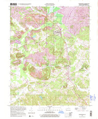
(14)- 1911 Map of Drakesboro
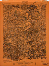 1911 Drakesboro1911 Print · USGSMuhlenberg County was a landscape of dense rural school districts and emerging rail towns just before the Great War. Genealogists can trace family names through landmarks like Mays Store, Rhodes Chapel, and the uniquely named settlement of Lickskillet.
 - 1913 Map of Drakesboro
 1913 Drakesboro1913 Print · USGSMuhlenberg County in the early twentieth century was a bustling intersection of coal mining and major rail lines. Genealogists and historians can trace dozens of early rural schools and crossroads stores like Liberty Hill School, Belton Jost PO, and Dixon's Store.2 unique versions available
 - 1953 Map of Drakesboro, 1954 Print
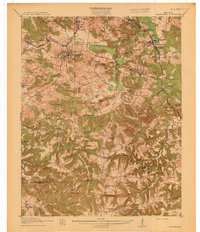
 1953 Drakesboro1954 Print · USGSIn the early 1950s, the Muhlenberg County coal and rail economy was in full swing around Drakesboro. Genealogists and historians can trace family cemeteries like Wilcox Cem alongside industrial markers like the Strip Mine and Louisville and Nashville railroad lines.
 - 1954 Map of Evansville
 1954 Evansville1954 Print · USGSThe Ohio River borderlands between Indiana and Kentucky appear here during a period of robust industrial and military growth. Genealogists and researchers can trace the rail corridors of the Illinois Central and find landmarks like US Lock and Dam No 48 or Camp Breckinridge.
 - 1957 Map of Evansville, 1969 Print
 1957 Evansville1969 Print · USGSIndiana and Kentucky meet along the Ohio River in this mid-century survey of a vital industrial and transport corridor. Genealogists and historians can trace the development of river towns like Owensboro and Newburgh or locate old rail lines like the Southern Ry.3 unique versions available
 - 1961 Map of Evansville
 1961 Evansville1961 Print · USGSThe Ohio River valley and its surrounding coalfields are captured here during the late fifties and early sixties. Trace the industrial rail networks of the Illinois Central RR and explore regional landmarks like Mammoth Cave National Park and Angel Mounds State Memorial.2 unique versions available
 - 1963 Map of Drakesboro, 1965 Print
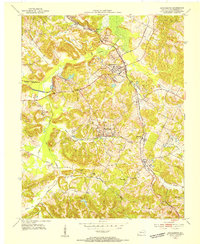
 1963 Drakesboro1965 Print · USGSMuhlenberg County was a hub of coal production and rail activity in the early sixties. Researchers can trace the intersection of industry and community at Drakesboro, located near numerous Strip Mines, Leigh Chapel, and the Ennis Cem.3 unique versions available
 - 1983 Map of Madisonville, 1984 Print
 1983 Madisonville1984 Print · USGSThe Western Kentucky coalfields and river valleys come into focus in the early eighties as the rail-and-river economy matured. Genealogists can trace family footprints across Dawson Springs, Mortons Gap, and Slaughters, or locate landmarks like Shake Rag Hills and Lake Malone.
 - 1997 Map of Drakesboro, 2001 Print
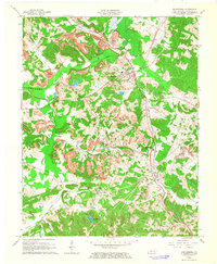
 1997 Drakesboro2001 Print · USGSMuhlenberg County's coal-mining landscape is preserved here as it appeared in the late twentieth century, centered on the hub of Drakesboro. Genealogists and historians can trace industrial sites like the Tipple alongside local landmarks such as Ennis Cem and Hazel Creek Ch.
 - 2010 Map of Drakesboro, 2010 Print
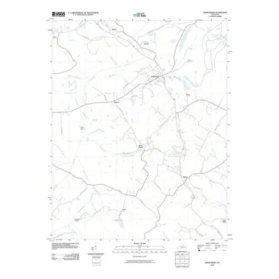 2010 Drakesboro2010 Print · USGSCovers Belton, including Drakesboro, Beech Creek, and other nearby areas
 - 2013 Map of Drakesboro, 2013 Print
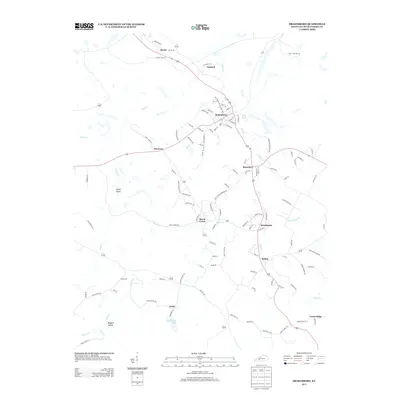 2013 Drakesboro2013 Print · USGSCovers Belton, including Drakesboro, Beech Creek, and other nearby areas
 - 2016 Map of Drakesboro, 2016 Print
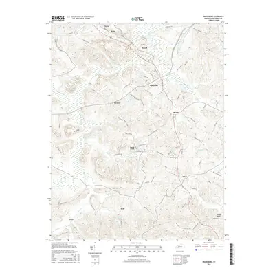 2016 Drakesboro2016 Print · USGSCovers Belton, including Drakesboro, Beech Creek, and other nearby areas
 - 2019 Map of Drakesboro, 2019 Print
 2019 Drakesboro2019 Print · USGSCovers Belton, including Drakesboro, Beech Creek, and other nearby areas
 - 2022 Map of Drakesboro, 2022 Print
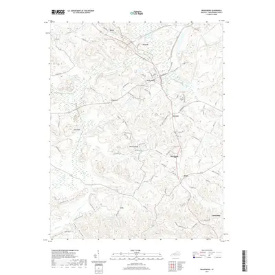
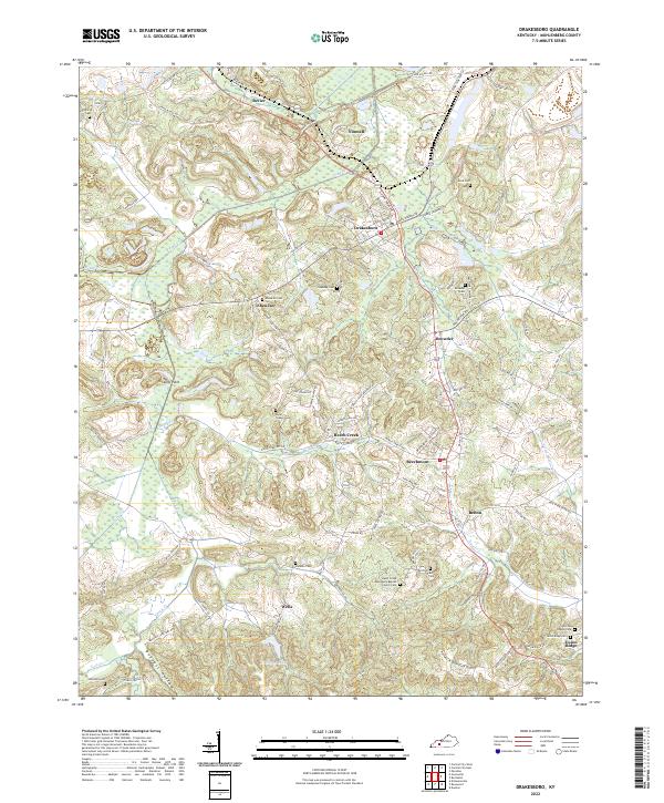 2022 Drakesboro2022 Print · USGSMuhlenberg County's musical and industrial heartland is detailed here in the early twenty-first century. Researchers can trace family lines through Ebenezer Cem and Johnston Cem or locate regional landmarks like Kirkwood Lake.
End of results
Showing maps 1-14 of 14
Top cities near Belton
- Central City historical maps
- Greenville historical maps
- Beaver Dam historical maps
- Lewisburg historical maps
- Powderly historical maps
- Drakesboro historical maps
See more
Frequently asked questions
- What are the different types of historical maps available for Belton?
- What is the oldest map of Belton?
- Where can I purchase historical maps of Belton for my home or office?
- Where can I download high-res historical maps of Belton?
- Are there historical topographic maps available for Belton?
- Is there historical aerial imagery available for Belton?
- Where are historical maps of Belton sourced from?