Old Maps of Mossy Bottom, Coal Run Village for Genealogy
Trace your family roots with 11 historic maps of Mossy Bottom. These high-res maps reveal old neighborhoods, homesites, landmarks, and streets — helping you uncover where your ancestors lived and how the area evolved over time.
- Explore historic neighborhoods: Identify where your relatives may have lived in the 1800s or 1900s.
- Compare maps over time: Trace the changes in streets, buildings, and landmarks for multi-generational research.
- Perfect for genealogy & ancestry research: Used by family historians and researchers to map out lineage and migration.
These maps are an incredible resource for exploring your personal connection to Mossy Bottom's past.
Mossy Bottom, Coal Run Village maps
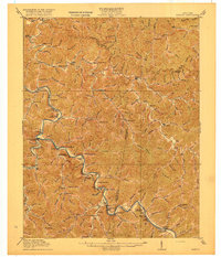
(11)- 1886 Map of Prestonsburg
 1886 Prestonsburg1886 Print · USGSCovers Mossy Bottom, including Pikeville, Paintsville, and other nearby areas
 - 1892 Map of Prestonsburg
 1892 Prestonsburg1892 Print · USGSCovers Mossy Bottom, including Pikeville, Paintsville, and other nearby areas4 unique versions available
 - 1914 Map of Laynesville
 1914 Laynesville1914 Print · USGSCovers Mossy Bottom, including Pikeville, Prestonsburg, and other nearby areas
 - 1916 Map of Harold
 1916 Harold1916 Print · USGSCovers Mossy Bottom, including Pikeville, Prestonsburg, and other nearby areas3 unique versions available
 - 1954 Map of Broad Bottom, 1955 Print
 1954 Broad Bottom1955 Print · USGSCovers Mossy Bottom, including Pikeville, Coal Run Village, and other nearby areas
 - 1957 Map of Jenkins, 1974 Print
 1957 Jenkins1974 Print · USGSCovers Mossy Bottom, including Pikeville, Hazard, and other nearby areas
 - 1960 Map of Jenkins
 1960 Jenkins1960 Print · USGSCovers Mossy Bottom, including Pikeville, Hazard, and other nearby areas
 - 1979 Map of Broad Bottom
 1979 Broad Bottom1979 Print · USGSCovers Mossy Bottom, including Pikeville, Coal Run Village, and other nearby areas
 - 1982 Map of Williamson, 1983 Print
 1982 Williamson1983 Print · USGSCovers Mossy Bottom, including Pikeville, Paintsville, and other nearby areas
 - 1992 Map of Broad Bottom
 1992 Broad Bottom1992 Print · USGSCovers Mossy Bottom, including Pikeville, Coal Run Village, and other nearby areas
 - 2022 Map of Broad Bottom, 2022 Print
 2022 Broad Bottom2022 Print · USGSCovers Mossy Bottom, including Pikeville, Coal Run Village, and other nearby areas
End of results
Showing maps 1-11 of 11
Top cities near Mossy Bottom
- Pikeville historical maps
- Prestonsburg historical maps
- Coal Run Village historical maps
- Wheelwright historical maps
- Elkhorn City historical maps
- Auxier historical maps
See more
Frequently asked questions
- What are the different types of historical maps available for Mossy Bottom?
- What is the oldest map of Mossy Bottom?
- Where can I purchase historical maps of Mossy Bottom for my home or office?
- Where can I download high-res historical maps of Mossy Bottom?
- Are there historical topographic maps available for Mossy Bottom?
- Is there historical aerial imagery available for Mossy Bottom?
- Where are historical maps of Mossy Bottom sourced from?