Old Maps of Powell County, Kentucky
Explore 79 old maps of Powell County, spanning from 1892 to today. These high-resolution historic maps reveal how streets, neighborhoods, landmarks, and natural features evolved over time — perfect for genealogy, metal detecting, research, and local history exploration.
What you can do with these maps:
- See how Powell County changed over time: Compare historical maps to modern-day views to trace roads, homesites, rail lines & more.
- View detailed metadata: Each map includes creators, publishers, year, scale, and archive source.
- Overlay maps with satellite & LiDAR: Visualize the past alongside modern tools to explore terrain & human change.
- Trusted historical sources: Maps sourced from the USGS, Library of Congress, and other archives.
- Access maps your way: View online, download high-res files, or order prints for personal or research use.
Start exploring old maps of Powell County to uncover forgotten places, hidden landmarks, and the deep history beneath your feet.
Powell County, KY maps
(79)- 1892 Map of Richmond
 1892 Richmond1892 Print · USGSMadison and Clark counties are mapped here in the late nineteenth century, centered on the growing railroad hub of Richmond. Genealogists can trace family land and travel routes through historic crossings like Boonesboro, river towns like Ford, and high points such as Combs Mtn.
 - 1892 Map of Beattyville
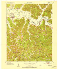
 1892 Beattyville1892 Print · USGSThe Kentucky River and its headwaters define this late nineteenth-century survey of the rugged Cumberland Plateau. Researchers can trace the early industrial sites of Estill Furnace and Fitchburg Furnace alongside the path of the Kentucky Union Railroad.6 unique versions available
 - 1897 Map of Richmond
 1897 Richmond1897 Print · USGSMadison and Clark counties are mapped here during a decade of rapid railroad expansion and river-based commerce. Genealogists can trace family names and extinct locales from Boonesboro to the industrial Stone Quarry and the hub at Winchester.5 unique versions available
 - 1950 Map of Levee, 1954 Print
 1950 Levee1954 Print · USGSThe foothills of the Cumberland Plateau come alive in this mid-century survey of the Montgomery and Powell county line. Genealogists and historians can trace family locations near the Westbend Ch, Willoughby Cem, and the community of Indian Fields.
 - 1952 Map of Palmer, 1953 Print
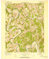 1952 Palmer1953 Print · USGSThe Kentucky River meanders through the limestone ridges of Estill, Madison, and Clark Counties during the early fifties. Genealogists can trace family landmarks and schools including The Bend Sch, the Alexander Sch, and dozens of family plots like the Gatman Cem.3 unique versions available
 - 1952 Map of Clay City, 1953 Print
 1952 Clay City1953 Print · USGSThe Red River valley and the foothills of the Cumberland plateau are captured here in the early fifties. Genealogists can trace family names at Vaughns Mill, McKinney Cemetery, and rural landmarks like the Marbleyard School.
 - 1952 Map of Frenchburg, 1953 Print
 1952 Frenchburg1953 Print · USGSFrenchburg and the surrounding Menifee County ridges are captured here in the early 1950s during a period of active natural gas and oil extraction. Local historians can trace family roots through numerous remote landmarks like Refitt Cem, Dog Trot Sch, and the community at Goosetown.2 unique versions available
 - 1952 Map of Stanton, 1953 Print
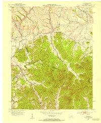
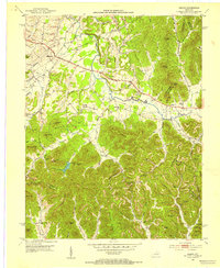
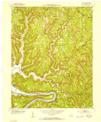
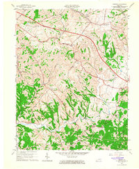
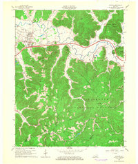
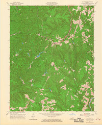
 1952 Stanton1953 Print · USGSPowell County's river valley and mountain ridges are captured in the early fifties as they were shaped by rural industry and timber. Genealogists can locate family landmarks like the Arthur Cem, Morris Creek Ch, and the school at Furnace.
 - 1952 Map of Means, 1953 Print
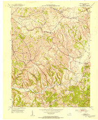
 1952 Means1953 Print · USGSIn the early 1950s, this area of Kentucky was a land of tight-knit valley communities and dense timbered knobs. Genealogists can trace family footprints through numerous rural landmarks like Jeffersonville, Means, Myers Cem, and several one-room schools like Morris Creek Sch.2 unique versions available
 - 1952 Map of Levee, 1954 Print
 1952 Levee1954 Print · USGSThe Montgomery County foothills in the early fifties show a landscape of deep hollows and high points. Genealogists can trace family names and local sites from Kiddville to Camargo, including the Westbend School and the McKee Boy Scout Camp.
 - 1952 Map of Slade, 1954 Print
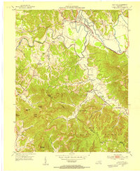
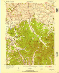
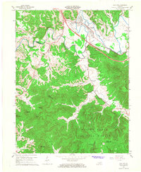
 1952 Slade1954 Print · USGSThe Red River Gorge region in the early fifties shows a landscape defined by deep hollows and the early development of Natural Bridge State Park. Researchers can trace the path of the Abandoned RR Tunnel and locate old rural schools like Tin Town Sch and Walnut Grove Sch.
 - 1952 Map of Cobhill, 1954 Print
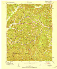
 1952 Cobhill1954 Print · USGSThe hills of Estill and Lee County in the early fifties show a landscape of remote settlements and ridge-top life. Genealogists can locate family landmarks like Gum Springs Cem, Mt Sinai Ch, and numerous rural schools from Durbin Sch to Sparks Sch.3 unique versions available
 - 1952 Map of Hedges, 1954 Print
 1952 Hedges1954 Print · USGSCentral Kentucky’s rural landscape is captured here in the early fifties as small farming communities thrived alongside major rail lines. Genealogists and local historians can trace family sites like Rupert Cem and old crossroads such as Schollsville and Rabbit Town.
 - 1953 Map of Zachariah, 1956 Print
 1953 Zachariah1956 Print · USGSThe hills of Eastern Kentucky appear in the early fifties as a landscape of remote ridges and tight-knit hollows. Genealogists can trace family roots through Townsend Cem and Thacker Cem or locate old schoolhouses like Mt Paran Sch.2 unique versions available
 - 1957 Map of Winchester, 1968 Print
 1957 Winchester1968 Print · USGSCentral Kentucky's landscape in the mid-twentieth century features the sprawling Fort Knox and the early parkway system. Genealogists and historians can trace rail lines like the Southern Railway and find landmarks from Bernheim Forest to Pilot Knob.3 unique versions available
 - 1957 Map of Jenkins, 1974 Print
 1957 Jenkins1974 Print · USGSThe Cumberland Plateau in the mid-twentieth century reveals a complex landscape of winding river valleys and deep-seated industry. Genealogists and historians can trace the development of Hazard, Jenkins, and Pikeville alongside extensive Numerous Oil and Gas Fields and the routes of the Chesapeake & Ohio Railway.
 - 1960 Map of Jenkins
 1960 Jenkins1960 Print · USGSEastern Kentucky and the West Virginia borderlands are captured at a mid-century peak of the coal and rail era. Trace the industrial corridors of the Chesapeake and Ohio RR through mountain hubs like Hazard and Jenkins.
 - 1960 Map of Winchester
 1960 Winchester1960 Print · USGSCentral Kentucky's diverse landscape is shown here at mid-century, from the bluegrass plains to the rugged Pottsville Escarpment. Genealogists and historians can trace the rail-and-river network connecting towns like Bardstown and Stanford alongside landmarks like Lake Cumberland.
 - 1965 Map of Levee, 1966 Print
 1965 Levee1966 Print · USGSMid-century Montgomery and Clark counties are captured here as traditional farming communities meet the sharp hills of the Knobs. Researchers can trace ancestral locations like Kiddville, Indian Fields, and the Willoughby Cem near Camargo.
 - 1965 Map of Hedges, 1966 Print
 1965 Hedges1966 Print · USGSEastern Clark County's ridge-and-hollow settlements are captured here in the mid-1960s as modern infrastructure began to cross traditional farmland. Genealogists can trace family connections through numerous named cemeteries and country churches like Ephesus Ch, or locate vanished post offices at Rightangle, Rabbit Town, and Schollsville.2 unique versions available
 - 1966 Map of Stanton, 1968 Print
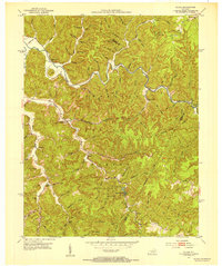
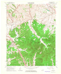
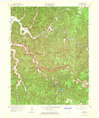
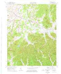
 1966 Stanton1968 Print · USGSThe Red River valley in the mid-sixties shows a landscape transitioning between its pioneer industrial past and modern infrastructure. Genealogists and historians can trace family-named landmarks like Rogers Chapel, the Estill Furnace Ruins, and small settlements such as Furnace or Rosslyn.3 unique versions available
 - 1966 Map of Clay City, 1968 Print
 1966 Clay City1968 Print · USGSClay City and the Red River valley are shown in the mid-sixties as the new Mountain Parkway began reshaping the local landscape. Researchers can trace rural lineages through sites like Vaughns Mill, the Cottage Furnace Ruins, and the Eaton Cem.2 unique versions available
 - 1966 Map of Slade, 1968 Print
 1966 Slade1968 Print · USGSThe Red River Gorge region comes alive in the mid-1960s as new highways began to meet traditional mountain settlements. Genealogists and hikers can trace old homesites near Nada, locate the Middle Fork Ch, or follow the path of the Mountain Central Railroad.2 unique versions available
 - 1966 Map of Zachariah, 1968 Print
 1966 Zachariah1968 Print · USGSKentucky's mountain frontier comes into focus during the mid-sixties, where the borders of Lee, Wolfe, Estill, and Powell counties converge. Researchers can trace rural genealogy and land use through landmarks like Townsend Cem, Fixer, and the local Oil Field.2 unique versions available
 - 1975 Map of Means, 1977 Print
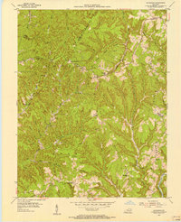
 1975 Means1977 Print · USGSJeffersonville and the surrounding Kentucky hills are captured here in the mid-seventies as agriculture and energy extraction shaped the land. Genealogists and historians can trace family roots through landmarks like Old Salem Ch, Pine Hill Sch, and Easter Ch.
Showing maps 1-25 of 79
Top cities of Powell County
Frequently asked questions
- What are the different types of historical maps available for Powell County?
- What is the oldest map of Powell County?
- Where can I purchase historical maps of Powell County for my home or office?
- Where can I download high-res historical maps of Powell County?
- Are there historical topographic maps available for Powell County?
- Is there historical aerial imagery available for Powell County?
- Where are historical maps of Powell County sourced from?