Old Maps of Barkley Shores, Kentucky
Explore 10 old maps of Barkley Shores, spanning from 1953 to today. These high-resolution historic maps reveal how streets, neighborhoods, landmarks, and natural features evolved over time — perfect for genealogy, metal detecting, research, and local history exploration.
What you can do with these maps:
- See how Barkley Shores changed over time: Compare historical maps to modern-day views to trace roads, homesites, rail lines & more.
- View detailed metadata: Each map includes creators, publishers, year, scale, and archive source.
- Overlay maps with satellite & LiDAR: Visualize the past alongside modern tools to explore terrain & human change.
- Trusted historical sources: Maps sourced from the USGS, Library of Congress, and other archives.
- Access maps your way: View online, download high-res files, or order prints for personal or research use.
Start exploring old maps of Barkley Shores to uncover forgotten places, hidden landmarks, and the deep history beneath your feet.
Barkley Shores, KY maps
(10)- 1953 Map of Canton, 1954 Print
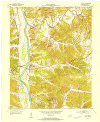 1953 Canton1954 Print · USGSTrigg County's riverfront is captured here in the early 1950s, showing the land just before the landscape was altered by massive reservoir projects. Local historians can trace family roots through sites like Canton, Peals Chapel, and the Heindrick Cem.
 - 1956 Map of Nashville, 1971 Print
 1956 Nashville1971 Print · USGSThe Tennessee-Kentucky borderlands come into focus in the mid-1960s as major reservoir projects transformed the Cumberland and Tennessee river valleys. Researchers can trace the rail networks of the Louisville and Nashville and visit sites like Fort Campbell and Fort Donelson National Military Park.2 unique versions available
 - 1959 Map of Nashville
 1959 Nashville1959 Print · USGSMiddle Tennessee and Southern Kentucky come into focus during the late fifties, showing the region's transition into a modern transportation and military hub. Researchers can trace the sprawling Fort Campbell Military Reservation or locate historic rail stops along the Tennessee Central Ry and Illinois Central RR.
 - 1967 Map of Canton, 1968 Print
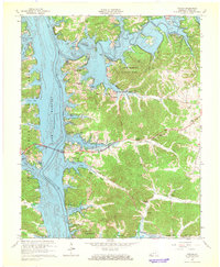 1967 Canton1968 Print · USGSLake Barkley and the Cumberland River define Trigg County in the late sixties as new shoreline developments emerge. Genealogists can trace family names at Liberty Point Cem, McIntire Cem, and rural congregations like Mt Pleasant Ch.2 unique versions available
 - 1980 Map of Hopkinsville, 1983 Print
 1980 Hopkinsville1983 Print · USGSThe Kentucky and Tennessee borderlands appear here at the start of the 1980s, centered on the massive Fort Campbell Military Reservation. Trace the impact of the Cumberland River impoundment at Lake Barkley or locate rail hubs like Guthrie and Elkton.
 - 2010 Map of Canton, 2010 Print
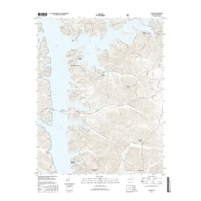
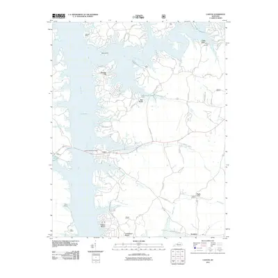 2010 Canton2010 Print · USGSCovers Barkley Shores, including Cedar Point, Cumberland Shores, and other nearby areas
 - 2013 Map of Canton, 2013 Print
 2013 Canton2013 Print · USGSCovers Barkley Shores, including Cedar Point, Cumberland Shores, and other nearby areas
 - 2016 Map of Canton, 2016 Print
 2016 Canton2016 Print · USGSCovers Barkley Shores, including Cedar Point, Cumberland Shores, and other nearby areas
 - 2019 Map of Canton, 2019 Print
 2019 Canton2019 Print · USGSCovers Barkley Shores, including Cedar Point, Cumberland Shores, and other nearby areas
 - 2022 Map of Canton, 2022 Print
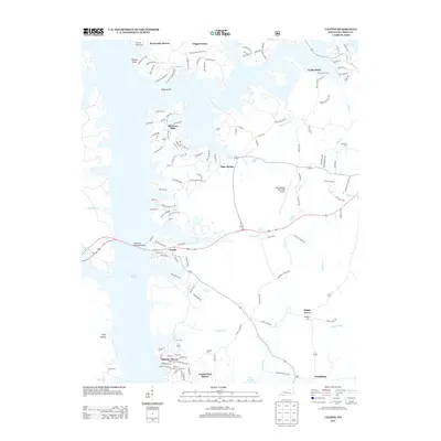
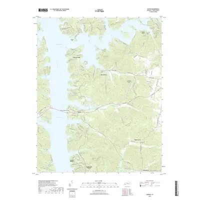
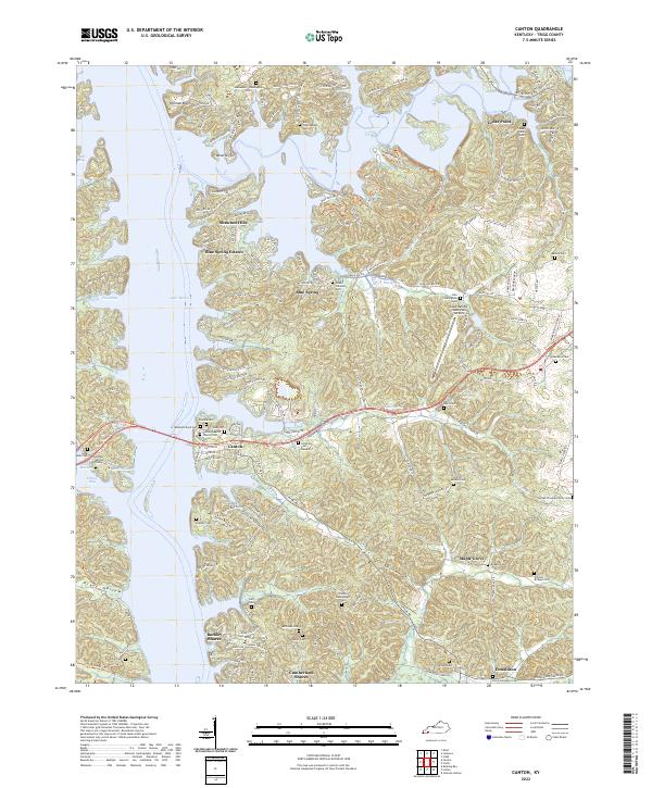 2022 Canton2022 Print · USGSCanton and the Trigg County shoreline come into focus in this contemporary survey of the Lake Barkley region. Genealogists can trace family heritage through numerous burial sites like the Abraham Boyd Cem, Jefferson Cem Number 2, and Atwood Cem.
End of results
Showing maps 1-10 of 10
Top cities near Barkley Shores
Frequently asked questions
- What are the different types of historical maps available for Barkley Shores?
- What is the oldest map of Barkley Shores?
- Where can I purchase historical maps of Barkley Shores for my home or office?
- Where can I download high-res historical maps of Barkley Shores?
- Are there historical topographic maps available for Barkley Shores?
- Is there historical aerial imagery available for Barkley Shores?
- Where are historical maps of Barkley Shores sourced from?