Old Maps of Linton, Kentucky
Explore 12 old maps of Linton, spanning from 1951 to today. These high-resolution historic maps reveal how streets, neighborhoods, landmarks, and natural features evolved over time — perfect for genealogy, metal detecting, research, and local history exploration.
What you can do with these maps:
- See how Linton changed over time: Compare historical maps to modern-day views to trace roads, homesites, rail lines & more.
- View detailed metadata: Each map includes creators, publishers, year, scale, and archive source.
- Overlay maps with satellite & LiDAR: Visualize the past alongside modern tools to explore terrain & human change.
- Trusted historical sources: Maps sourced from the USGS, Library of Congress, and other archives.
- Access maps your way: View online, download high-res files, or order prints for personal or research use.
Start exploring old maps of Linton to uncover forgotten places, hidden landmarks, and the deep history beneath your feet.
Linton, KY maps
(12)- 1951 Map of Model, 1953 Print
 1951 Model1953 Print · USGSThe Kentucky-Tennessee state line follows the ridge tops and river bends of the 1950s Cumberland Valley. Genealogists can trace family names through dozens of hilltop burial sites like Bethlehem Cem and rural centers such as Model and Tobaccoport.
 - 1956 Map of Nashville, 1971 Print
 1956 Nashville1971 Print · USGSThe Tennessee-Kentucky borderlands come into focus in the mid-1960s as major reservoir projects transformed the Cumberland and Tennessee river valleys. Researchers can trace the rail networks of the Louisville and Nashville and visit sites like Fort Campbell and Fort Donelson National Military Park.2 unique versions available
 - 1957 Map of Model, 1960 Print
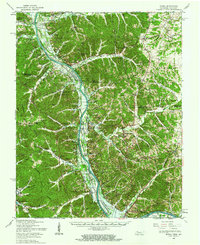
 1957 Model1960 Print · USGSThe Cumberland River valley is caught in a moment of transition during the late fifties as the rising waters of Lake Barkley begin to reshape the state line. Genealogists can trace family landmarks like Tobacconport, the Mt Vernon School, and the Watkins Cemetery before the local geography was permanently altered.
 - 1957 Map of Model, 1963 Print
 1957 Model1963 Print · USGSThe Tennessee and Kentucky borderlands meet here in the late fifties as the Cumberland River valley prepares for the rising waters of Lake Barkley. Genealogists can trace family landmarks like the Gatlin Cem or explore the rural hubs of Bumpus Mills and Tobaccoport.
 - 1959 Map of Nashville
 1959 Nashville1959 Print · USGSMiddle Tennessee and Southern Kentucky come into focus during the late fifties, showing the region's transition into a modern transportation and military hub. Researchers can trace the sprawling Fort Campbell Military Reservation or locate historic rail stops along the Tennessee Central Ry and Illinois Central RR.
 - 1967 Map of Linton, 1970 Print
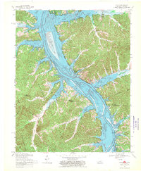 1967 Linton1970 Print · USGSThe Kentucky and Tennessee borderlands appear here in the late sixties as the newly formed Lake Barkley reshaped the river valley. Researchers can trace the layout of Linton, Model, and Tobaccoport alongside landmarks like Big Joe Spring and Fox Ridge.2 unique versions available
 - 1980 Map of Hopkinsville, 1983 Print
 1980 Hopkinsville1983 Print · USGSThe Kentucky and Tennessee borderlands appear here at the start of the 1980s, centered on the massive Fort Campbell Military Reservation. Trace the impact of the Cumberland River impoundment at Lake Barkley or locate rail hubs like Guthrie and Elkton.
 - 2011 Map of Linton, 2011 Print
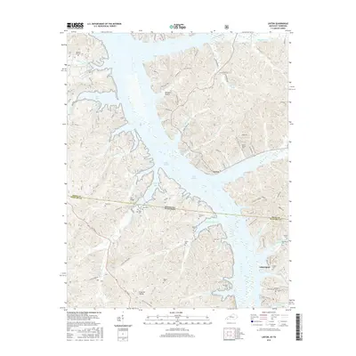
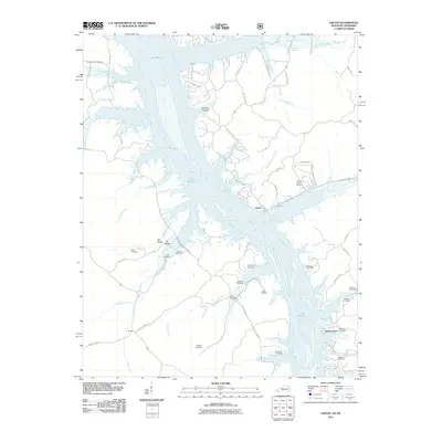 2011 Linton2011 Print · USGSCovers Linton, including Tobaccoport, Trigg County, and other nearby areas
 - 2013 Map of Linton, 2013 Print
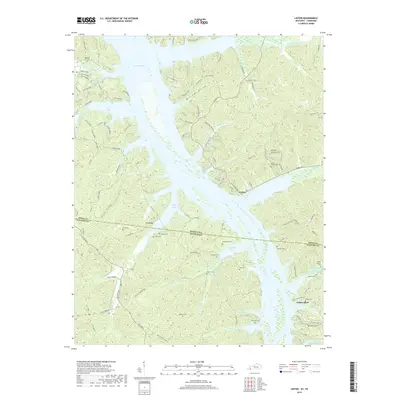
 2013 Linton2013 Print · USGSCovers Linton, including Tobaccoport, Trigg County, and other nearby areas
 - 2016 Map of Linton, 2016 Print
 2016 Linton2016 Print · USGSCovers Linton, including Tobaccoport, Trigg County, and other nearby areas
 - 2019 Map of Linton, 2019 Print
 2019 Linton2019 Print · USGSCovers Linton, including Tobaccoport, Trigg County, and other nearby areas
 - 2022 Map of Linton, 2022 Print
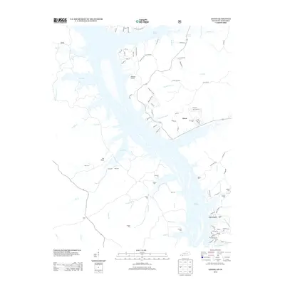
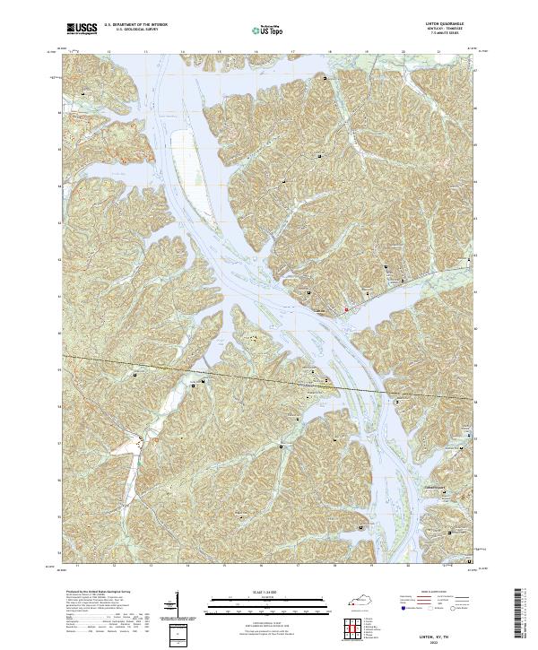 2022 Linton2022 Print · USGSThe Kentucky-Tennessee state line divides this riverside region during the early twenty-first century as Lake Barkley shapes the local geography. Genealogists can locate numerous family burial sites like Sholar-Rogers Cem and Kingins-Brandon Cem near the historic Linton settlement.
End of results
Showing maps 1-12 of 12
Top cities near Linton
Frequently asked questions
- What are the different types of historical maps available for Linton?
- What is the oldest map of Linton?
- Where can I purchase historical maps of Linton for my home or office?
- Where can I download high-res historical maps of Linton?
- Are there historical topographic maps available for Linton?
- Is there historical aerial imagery available for Linton?
- Where are historical maps of Linton sourced from?