Old Maps of Shawnee Hills, Kentucky for Academic Research
Study the evolution of Shawnee Hills with 10 high-resolution historic maps. Whether you're teaching, researching, or modeling changes in land use, these maps provide essential visual documentation of urban, environmental, and geographic change.
- Analyze long-term change: Track patterns in development, transportation, and natural features.
- Ideal for environmental or urban studies: Support academic projects with primary historical map data.
- Use in the classroom or lab: Educators and researchers rely on these maps to bring historical context to life.
These maps are a powerful tool for teaching, research, and visualizing how Shawnee Hills has changed over the decades.
Shawnee Hills, KY maps
(10)- 1953 Map of Canton, 1954 Print
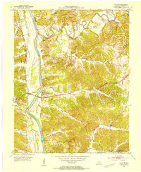 1953 Canton1954 Print · USGSTrigg County's riverfront is captured here in the early 1950s, showing the land just before the landscape was altered by massive reservoir projects. Local historians can trace family roots through sites like Canton, Peals Chapel, and the Heindrick Cem.
 - 1956 Map of Nashville, 1971 Print
 1956 Nashville1971 Print · USGSThe Tennessee-Kentucky borderlands come into focus in the mid-1960s as major reservoir projects transformed the Cumberland and Tennessee river valleys. Researchers can trace the rail networks of the Louisville and Nashville and visit sites like Fort Campbell and Fort Donelson National Military Park.2 unique versions available
 - 1959 Map of Nashville
 1959 Nashville1959 Print · USGSMiddle Tennessee and Southern Kentucky come into focus during the late fifties, showing the region's transition into a modern transportation and military hub. Researchers can trace the sprawling Fort Campbell Military Reservation or locate historic rail stops along the Tennessee Central Ry and Illinois Central RR.
 - 1967 Map of Canton, 1968 Print
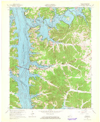 1967 Canton1968 Print · USGSLake Barkley and the Cumberland River define Trigg County in the late sixties as new shoreline developments emerge. Genealogists can trace family names at Liberty Point Cem, McIntire Cem, and rural congregations like Mt Pleasant Ch.2 unique versions available
 - 1980 Map of Hopkinsville, 1983 Print
 1980 Hopkinsville1983 Print · USGSThe Kentucky and Tennessee borderlands appear here at the start of the 1980s, centered on the massive Fort Campbell Military Reservation. Trace the impact of the Cumberland River impoundment at Lake Barkley or locate rail hubs like Guthrie and Elkton.
 - 2010 Map of Canton, 2010 Print
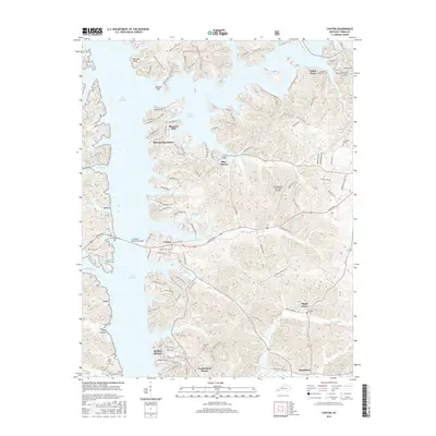
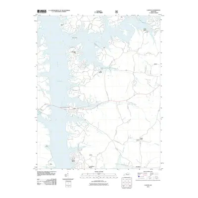 2010 Canton2010 Print · USGSCovers Shawnee Hills, including Cedar Point, Cumberland Shores, and other nearby areas
 - 2013 Map of Canton, 2013 Print
 2013 Canton2013 Print · USGSCovers Shawnee Hills, including Cedar Point, Cumberland Shores, and other nearby areas
 - 2016 Map of Canton, 2016 Print
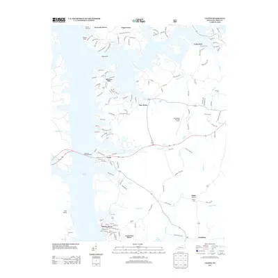
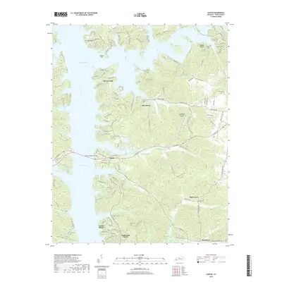
 2016 Canton2016 Print · USGSCovers Shawnee Hills, including Cedar Point, Cumberland Shores, and other nearby areas
 - 2019 Map of Canton, 2019 Print
 2019 Canton2019 Print · USGSCovers Shawnee Hills, including Cedar Point, Cumberland Shores, and other nearby areas
 - 2022 Map of Canton, 2022 Print
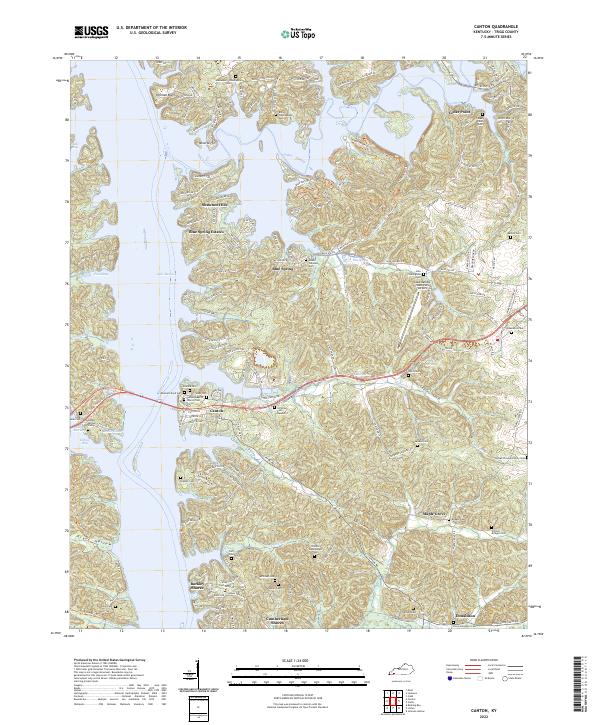 2022 Canton2022 Print · USGSCanton and the Trigg County shoreline come into focus in this contemporary survey of the Lake Barkley region. Genealogists can trace family heritage through numerous burial sites like the Abraham Boyd Cem, Jefferson Cem Number 2, and Atwood Cem.
End of results
Showing maps 1-10 of 10
Top cities near Shawnee Hills
Frequently asked questions
- What are the different types of historical maps available for Shawnee Hills?
- What is the oldest map of Shawnee Hills?
- Where can I purchase historical maps of Shawnee Hills for my home or office?
- Where can I download high-res historical maps of Shawnee Hills?
- Are there historical topographic maps available for Shawnee Hills?
- Is there historical aerial imagery available for Shawnee Hills?
- Where are historical maps of Shawnee Hills sourced from?