1960s Maps of Vortex, Kentucky
Explore 2 historic maps of Vortex from the 1960s. These maps offer a rare glimpse into what life looked like during the 1960s — showing old roads, neighborhoods, homes, and landmarks that have changed or disappeared over time.
Whether you're researching your family's past, planning a metal detecting trip, or studying how Vortex's landscape evolved across the 1960s, these high-resolution maps are a powerful tool for exploring the history of this region.
- Focus on a specific era: All maps on this page are from the 1960s, giving you a focused view of this time period.
- See what’s changed: Compare century-old streets, trails, and buildings to today's modern landscape using overlays and satellite layers.
- Research with precision: Use these maps for genealogy, historical research, land use analysis, or educational projects.
- View, download, or print: Maps are fully viewable online in high resolution, and can be downloaded or printed for your own records.
Start exploring Vortex's history through authentic maps from the 1960s. This is your window into the past.
Vortex, KY maps
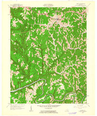
(2)- 1960 Map of Jenkins
 1960 Jenkins1960 Print · USGSEastern Kentucky and the West Virginia borderlands are captured at a mid-century peak of the coal and rail era. Trace the industrial corridors of the Chesapeake and Ohio RR through mountain hubs like Hazard and Jenkins.
 - 1961 Map of Campton, 1963 Print
 1961 Campton1963 Print · USGSWolfe County settlement and the meandering NORTH FORK KENTUCKY RIVER take center stage in the early sixties. Genealogists can trace family landmarks like Quillins Chapel Sch, Booth Ridge, and Bethesda Mission across this dissected landscape.
End of results
Showing maps 1-2 of 2
Top cities near Vortex
Frequently asked questions
- What are the different types of historical maps available for Vortex?
- What is the oldest map of Vortex?
- Where can I purchase historical maps of Vortex for my home or office?
- Where can I download high-res historical maps of Vortex?
- Are there historical topographic maps available for Vortex?
- Is there historical aerial imagery available for Vortex?
- Where are historical maps of Vortex sourced from?