Old Maps of Grand Isle, Louisiana
Explore 37 old maps of Grand Isle, spanning from 1892 to today. These high-resolution historic maps reveal how streets, neighborhoods, landmarks, and natural features evolved over time — perfect for genealogy, metal detecting, research, and local history exploration.
What you can do with these maps:
- See how Grand Isle changed over time: Compare historical maps to modern-day views to trace roads, homesites, rail lines & more.
- View detailed metadata: Each map includes creators, publishers, year, scale, and archive source.
- Overlay maps with satellite & LiDAR: Visualize the past alongside modern tools to explore terrain & human change.
- Trusted historical sources: Maps sourced from the USGS, Library of Congress, and other archives.
- Access maps your way: View online, download high-res files, or order prints for personal or research use.
Start exploring old maps of Grand Isle to uncover forgotten places, hidden landmarks, and the deep history beneath your feet.
Grand Isle, LA maps
(37)- 1892 Map of Cheniere Caminada
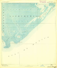 1892 Cheniere Caminada1892 Print · USGSLouisiana's gulf coast appears in the early 1890s, shortly before a catastrophic hurricane forever changed the local landscape. Genealogists can trace the footprint of Cheniere Caminada and the early layout of Grand Isle near Caminada Pass.4 unique versions available
 - 1893 Map of Fort Livingston
 1893 Fort Livingston1893 Print · USGSThe Louisiana coast in the early 1890s is captured here as a sprawling network of tidal bayous and strategic passes. Local historians can trace maritime markers like Ft. Livingston and the Light on Grand Isle amid a maze of islands.3 unique versions available
 - 1945 Map of New Orleans
 1945 New Orleans1945 Print · USGSCoastal Louisiana and the Mississippi delta are captured here just after the war, showing the region's transition into a modern industrial and transit hub. Genealogists can trace family settlements along Bayou Teche or identify rail stops for the Illinois Central and Texas & Pacific lines.
 - 1947 Map of Caminada Pass
 1947 Caminada Pass1947 Print · USGSThe Louisiana coast at the end of the 1940s reveals a fragile world of barrier islands and marshlands along the Gulf. Researchers can trace the early path of State Highway No 620 across Cheniere Caminada and locate a local Cemetery near the shore.
 - 1948 Map of Fort Livingston, 1950 Print
 1948 Fort Livingston1950 Print · USGSCoastal Plaquemines Parish in the late 1940s reveals a maritime landscape transitioning from fishing camps to industrial resource extraction. Researchers can trace the layout of Grand Isle and locate historic sites like Ft Livingston and the Barataria Lighthouse.
 - 1949 Map of Barataria Pass
 1949 Barataria Pass1949 Print · USGSCoastal Jefferson Parish appears in this mid-century survey as a complex network of barrier islands and tidal passes. Researchers can trace the early footprint of Grand Isle and locate historical landmarks like Ft Livingston and the Barataria L. H.
 - 1954 Map of Caminada Pass
 1954 Caminada Pass1954 Print · USGSThe barrier islands and bayous of coastal Louisiana are captured here in the mid-1950s before significant modern shoreline erosion. Genealogists and local historians can trace the early layout of Grand Isle, locate a secluded Cemetery, and study the old path of the State Highway through Cheniere Caminada.
 - 1957 Map of Caminada Pass, 1959 Print
 1957 Caminada Pass1959 Print · USGSThe Louisiana coast in the mid-fifties reveals a landscape of shifting tides and marshland settlements along the Gulf. Researchers can trace the layout of Cheniere Caminada, find specific Ruins by the pass, and map the intricate drainage of Thunder Bayou.3 unique versions available
 - 1957 Map of Breton Sound, 1967 Print
 1957 Breton Sound1967 Print · USGSThe Mississippi River delta is captured here in the mid-fifties, showing the fragile marshlands and river-dependent towns of the Louisiana coast. Genealogists and historians can trace riverside settlements like Pointe a la Hache, Pilottown, and Port Sulphur.3 unique versions available
 - 1961 Map of Breton Sound
 1961 Breton Sound1961 Print · USGSThe Louisiana delta and the outer marshes of Plaquemines Parish are captured here at the start of the 1960s. Researchers can trace the river settlements from Davant to Venice, locate isolated stations like Port Eads, and find old sites such as Fort Jackson.
 - 1963 Map of New Orleans
 1963 New Orleans1963 Print · USGSCoastal Louisiana in the mid-twentieth century reveals a complex world of bayou settlements, expanding oil fields, and vital rail networks. Genealogists and historians can trace family roots through river towns like Thibodaux or follow the Southern Pacific line through Franklin and Patterson.4 unique versions available
 - 1966 Map of New Orleans
 1966 New Orleans1966 Print · USGSCoastal Louisiana in the mid-1960s reveals a transition from traditional bayou life to an intensive offshore oil and gas economy. Researchers can trace the rail lines of the Southern Pacific RR through Morgan City or locate the Eugene Island Lighthouse among the delta's shifting marshes.
 - 1973 Map of Grand Isle, 1976 Print
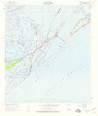
 1973 Grand Isle1976 Print · USGSGrand Isle and the Jefferson Parish coast are captured here in the early seventies, a time when the energy industry transformed the shoreline. Maritime researchers can trace the Barataria Bay Waterway and offshore platforms in the Block 16 Oil and Gas Field.
 - 1973 Map of Barataria Pass, 1976 Print
 1973 Barataria Pass1976 Print · USGSCoastal Jefferson Parish in the early 1970s reveals a unique intersection of military history and the offshore energy industry. Researchers can locate the Ft Livingston Ruins, trace the developed waterfront of Grand Isle, and identify maritime landmarks like the Queen Bess Island Oil and Gas Field.2 unique versions available
 - 1983 Map of Terrebonne Bay
 1983 Terrebonne Bay1983 Print · USGSThe Louisiana coast in the early 1980s reveals a labyrinth of bayous and barrier islands before decades of significant shoreline change. Researchers can trace the development of the energy industry and coastal settlements like Galliano and Montegut alongside the Isles Dernieres.
 - 1983 Map of Mississippi River Delta
 1983 Mississippi River Delta1983 Print · USGSThe lower Mississippi delta in the early eighties shows the thin line of human habitation clinging to the river levee between the vast marshes and the gulf. Genealogists and historians can trace the riverside communities of Empire, Triumph, and Nairn alongside the industrial Sulphur Mining Area.2 unique versions available
 - 1993 Map of Barataria Pass, 1994 Print
 1993 Barataria Pass1994 Print · USGSCoastal Jefferson Parish in the early nineties reveals a landscape where maritime history meets the energy industry. Researchers can trace the layout of Grand Isle, locate the Ft Livingston Ruins, and identify the structures within the Queen Bess Island Oil and Gas Field.
 - 1994 Map of Caminada Pass
 1994 Caminada Pass1994 Print · USGSThe barrier islands and wetlands of southern Louisiana come to life in this mid-nineties survey of the Gulf coast. Trace family history and maritime industry through labels for Grand Isle, the Cem at Cheniere Caminada, and the Block 16 Oil and Gas Field.
 - 1998 Map of Grand Isle, 2002 Print
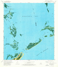
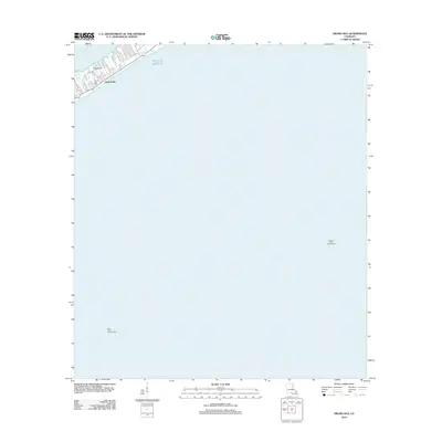
 1998 Grand Isle2002 Print · USGSGrand Isle sits at the edge of the Gulf in the late nineties, showing a landscape defined by barrier island life and offshore energy. Genealogists and historians can trace the town layout and its Cem near Bayou Rigaud or locate the various Platforms in the Block 18 Oil and Gas Field.
 - 2012 Map of Grand Isle, 2012 Print
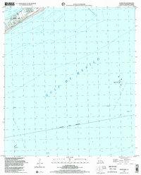
 2012 Grand Isle2012 Print · USGSCovers Grand Isle, including Jefferson Parish, Plaquemines Parish, and other nearby areas
 - 2012 Map of Caminada Pass, 2012 Print
 2012 Caminada Pass2012 Print · USGSCovers Grand Isle, including Cheniere Caminada, Jefferson Parish, and other nearby areas
 - 2012 Map of Barataria Pass, 2012 Print
 2012 Barataria Pass2012 Print · USGSCovers Grand Isle, including Bassa Bassa, Jefferson Parish, and other nearby areas
 - 2015 Map of Grand Isle, 2015 Print
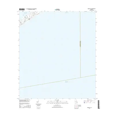 2015 Grand Isle2015 Print · USGSCovers Grand Isle, including Jefferson Parish, Plaquemines Parish, and other nearby areas
 - 2015 Map of Caminada Pass, 2015 Print
 2015 Caminada Pass2015 Print · USGSCovers Grand Isle, including Cheniere Caminada, Jefferson Parish, and other nearby areas
 - 2015 Map of Barataria Pass, 2015 Print
 2015 Barataria Pass2015 Print · USGSCovers Grand Isle, including Bassa Bassa, Jefferson Parish, and other nearby areas
Showing maps 1-25 of 37
Top neighborhoods of Grand Isle
Frequently asked questions
- What are the different types of historical maps available for Grand Isle?
- What is the oldest map of Grand Isle?
- Where can I purchase historical maps of Grand Isle for my home or office?
- Where can I download high-res historical maps of Grand Isle?
- Are there historical topographic maps available for Grand Isle?
- Is there historical aerial imagery available for Grand Isle?
- Where are historical maps of Grand Isle sourced from?