Old Maps of Slidell, Louisiana
Explore 26 old maps of Slidell, spanning from 1892 to today. These high-resolution historic maps reveal how streets, neighborhoods, landmarks, and natural features evolved over time — perfect for genealogy, metal detecting, research, and local history exploration.
What you can do with these maps:
- See how Slidell changed over time: Compare historical maps to modern-day views to trace roads, homesites, rail lines & more.
- View detailed metadata: Each map includes creators, publishers, year, scale, and archive source.
- Overlay maps with satellite & LiDAR: Visualize the past alongside modern tools to explore terrain & human change.
- Trusted historical sources: Maps sourced from the USGS, Library of Congress, and other archives.
- Access maps your way: View online, download high-res files, or order prints for personal or research use.
Start exploring old maps of Slidell to uncover forgotten places, hidden landmarks, and the deep history beneath your feet.
Slidell, LA maps
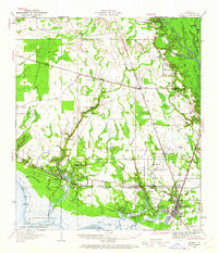
(26)- 1892 Map of Chef Menteur
 1892 Chef Menteur1892 Print · USGSCovers Slidell, including New Orleans, Howze Beach, and other nearby areas5 unique versions available
 - 1914 Map of Nicholson, 1957 Print
 1914 Nicholson1957 Print · USGSCovers Slidell, including Picayune, Logtown, and other nearby areas2 unique versions available
 - 1921 Map of Nicholson
 1921 Nicholson1921 Print · USGSCovers Slidell, including Picayune, Logtown, and other nearby areas
 - 1935 Map of Slidell
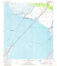
 1935 Slidell1935 Print · USGSCovers Slidell, including Pearl River, Huntington Estates, and other nearby areas3 unique versions available
 - 1936 Map of North Shore
 1936 North Shore1936 Print · USGSCovers Slidell, including New Orleans, Howze Beach, and other nearby areas
 - 1936 Map of Chef Menteur, 1938 Print
 1936 Chef Menteur1938 Print · USGSCovers Slidell, including New Orleans, Howze Beach, and other nearby areas2 unique versions available
 - 1939 Map of Slidell
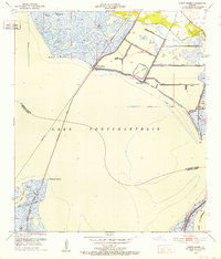
 1939 Slidell1939 Print · USGSCovers Slidell, including Pearl River, Huntington Estates, and other nearby areas
 - 1950 Map of Haaswood
 1950 Haaswood1950 Print · USGSCovers Slidell, including Pearl River, Morgan Bluff, and other nearby areas
 - 1950 Map of Slidell, 1962 Print
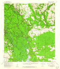
 1950 Slidell1962 Print · USGSCovers Slidell, including Pearl River, Huntington Estates, and other nearby areas2 unique versions available
 - 1951 Map of North Shore, 1952 Print
 1951 North Shore1952 Print · USGSCovers Slidell, including New Orleans, Howze Beach, and other nearby areas2 unique versions available
 - 1953 Map of Mobile, 1968 Print
 1953 Mobile1968 Print · USGSCovers Slidell, including New Orleans, Mobile, and other nearby areas3 unique versions available
 - 1954 Map of Haaswood
 1954 Haaswood1954 Print · USGSCovers Slidell, including Pearl River, Morgan Bluff, and other nearby areas
 - 1957 Map of Mobile
 1957 Mobile1957 Print · USGSCovers Slidell, including New Orleans, Mobile, and other nearby areas3 unique versions available
 - 1959 Map of Nicholson, 1960 Print
 1959 Nicholson1960 Print · USGSCovers Slidell, including Picayune, Logtown, and other nearby areas3 unique versions available
 - 1959 Map of Haaswood, 1960 Print
 1959 Haaswood1960 Print · USGSCovers Slidell, including Pearl River, Morgan Bluff, and other nearby areas4 unique versions available
 - 1960 Map of Mobile
 1960 Mobile1960 Print · USGSCovers Slidell, including New Orleans, Mobile, and other nearby areas
 - 1963 Map of Mobile
 1963 Mobile1963 Print · USGSCovers Slidell, including New Orleans, Mobile, and other nearby areas
 - 1965 Map of Mobile
 1965 Mobile1965 Print · USGSCovers Slidell, including New Orleans, Mobile, and other nearby areas
 - 1967 Map of North Shore, 1968 Print
 1967 North Shore1968 Print · USGSCovers Slidell, including New Orleans, Howze Beach, and other nearby areas5 unique versions available
 - 1969 Map of Chef Menteur, 1970 Print
 1969 Chef Menteur1970 Print · USGSCovers Slidell, including New Orleans, Howze Beach, and other nearby areas
 - 1971 Map of Slidell, 1972 Print
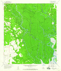
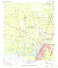 1971 Slidell1972 Print · USGSCovers Slidell, including Pearl River, Huntington Estates, and other nearby areas5 unique versions available
 - 1982 Map of Gulfport, 1983 Print
 1982 Gulfport1983 Print · USGSCovers Slidell, including New Orleans, Gulfport, and other nearby areas2 unique versions available
 - 1984 Map of Mobile
 1984 Mobile1984 Print · USGSCovers Slidell, including New Orleans, Mobile, and other nearby areas3 unique versions available
 - 1993 Map of Haaswood, 1995 Print
 1993 Haaswood1995 Print · USGSCovers Slidell, including Pearl River, Morgan Bluff, and other nearby areas2 unique versions available
 - 1998 Map of Haaswood, 2000 Print
 1998 Haaswood2000 Print · USGSCovers Slidell, including Pearl River, Morgan Bluff, and other nearby areas
Showing maps 1-25 of 26
Top cities near Slidell
Top neighborhoods of Slidell
- Eastridge historical maps
- Pearl Acres historical maps
- Country Manor historical maps
- Pine Shadows historical maps
- Pinecrest historical maps
- Delwood historical maps
See more
Frequently asked questions
- What are the different types of historical maps available for Slidell?
- What is the oldest map of Slidell?
- Where can I purchase historical maps of Slidell for my home or office?
- Where can I download high-res historical maps of Slidell?
- Are there historical topographic maps available for Slidell?
- Is there historical aerial imagery available for Slidell?
- Where are historical maps of Slidell sourced from?