Old Maps of Brusly, Louisiana
Explore 18 old maps of Brusly, spanning from 1908 to today. These high-resolution historic maps reveal how streets, neighborhoods, landmarks, and natural features evolved over time — perfect for genealogy, metal detecting, research, and local history exploration.
What you can do with these maps:
- See how Brusly changed over time: Compare historical maps to modern-day views to trace roads, homesites, rail lines & more.
- View detailed metadata: Each map includes creators, publishers, year, scale, and archive source.
- Overlay maps with satellite & LiDAR: Visualize the past alongside modern tools to explore terrain & human change.
- Trusted historical sources: Maps sourced from the USGS, Library of Congress, and other archives.
- Access maps your way: View online, download high-res files, or order prints for personal or research use.
Start exploring old maps of Brusly to uncover forgotten places, hidden landmarks, and the deep history beneath your feet.
Brusly, LA maps
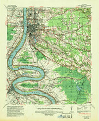
(18)- 1908 Map of Baton Rouge, 1921 Print
 1908 Baton Rouge1921 Print · USGSCovers Brusly, including Baton Rouge, St. George, and other nearby areas2 unique versions available
 - 1939 Map of Baton Rouge, 1947 Print
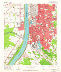
 1939 Baton Rouge1947 Print · USGSCovers Brusly, including Baton Rouge, St. George, and other nearby areas4 unique versions available
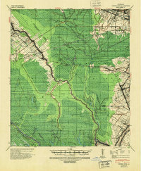
 - 1940 Map of Grosse Tete, 1950 Print
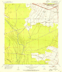
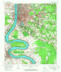
 1940 Grosse Tete1950 Print · USGSCovers Brusly, including Plaquemine, Addis, and other nearby areas
 - 1953 Map of Baton Rouge West, 1954 Print
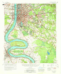
 1953 Baton Rouge West1954 Print · USGSCovers Brusly, including Baton Rouge, Port Allen, and other nearby areas
 - 1953 Map of Lobdell, 1954 Print
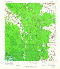
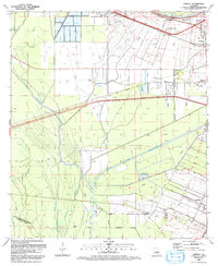
 1953 Lobdell1954 Print · USGSCovers Brusly, including Addis, Choctaw, and other nearby areas5 unique versions available
 - 1954 Map of Baton Rouge, 1974 Print
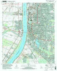
 1954 Baton Rouge1974 Print · USGSCovers Brusly, including New Orleans, Baton Rouge, and other nearby areas2 unique versions available
 - 1956 Map of Baton Rouge
 1956 Baton Rouge1956 Print · USGSCovers Brusly, including New Orleans, Baton Rouge, and other nearby areas
 - 1961 Map of Baton Rouge, 1966 Print
 1961 Baton Rouge1966 Print · USGSCovers Brusly, including New Orleans, Baton Rouge, and other nearby areas
 - 1962 Map of Baton Rouge
 1962 Baton Rouge1962 Print · USGSCovers Brusly, including New Orleans, Baton Rouge, and other nearby areas
 - 1962 Map of Grosse Tete, 1965 Print
 1962 Grosse Tete1965 Print · USGSCovers Brusly, including Plaquemine, Addis, and other nearby areas2 unique versions available
 - 1963 Map of Baton Rouge West, 1964 Print
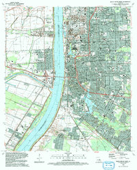
 1963 Baton Rouge West1964 Print · USGSCovers Brusly, including Baton Rouge, Port Allen, and other nearby areas5 unique versions available
 - 1963 Map of Baton Rouge, 1967 Print
 1963 Baton Rouge1967 Print · USGSCovers Brusly, including Baton Rouge, St. George, and other nearby areas2 unique versions available
 - 1965 Map of Baton Rouge
 1965 Baton Rouge1965 Print · USGSCovers Brusly, including Baton Rouge, St. George, and other nearby areas
 - 1984 Map of Baton Rouge
 1984 Baton Rouge1984 Print · USGSCovers Brusly, including Baton Rouge, Lafayette, and other nearby areas2 unique versions available
 - 1992 Map of Baton Rouge West
 1992 Baton Rouge West1992 Print · USGSCovers Brusly, including Baton Rouge, Port Allen, and other nearby areas2 unique versions available
 - 1992 Map of Lobdell
 1992 Lobdell1992 Print · USGSCovers Brusly, including Addis, Choctaw, and other nearby areas
 - 1995 Map of Baton Rouge West, 1998 Print
 1995 Baton Rouge West1998 Print · USGSCovers Brusly, including Baton Rouge, Port Allen, and other nearby areas
 - 1998 Map of Lobdell, 2000 Print
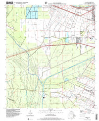 1998 Lobdell2000 Print · USGSCovers Brusly, including Addis, Choctaw, and other nearby areas
End of results
Showing maps 1-18 of 18
Top cities near Brusly
- Baton Rouge historical maps
- St. George historical maps
- Central historical maps
- Baker historical maps
- Zachary historical maps
- Plaquemine historical maps
See more
Top neighborhoods of Brusly
Frequently asked questions
- What are the different types of historical maps available for Brusly?
- What is the oldest map of Brusly?
- Where can I purchase historical maps of Brusly for my home or office?
- Where can I download high-res historical maps of Brusly?
- Are there historical topographic maps available for Brusly?
- Is there historical aerial imagery available for Brusly?
- Where are historical maps of Brusly sourced from?