1900s (20th Century) Maps of Scarborough, Maine
Explore 38 historic maps of Scarborough from the 1900s (20th Century). These maps offer a rare glimpse into what life looked like during the 1900s — showing old roads, neighborhoods, homes, and landmarks that have changed or disappeared over time.
Whether you're researching your family's past, planning a metal detecting trip, or studying how Scarborough's landscape evolved across the 1900s, these high-resolution maps are a powerful tool for exploring the history of this region.
- Focus on a specific era: All maps on this page are from the 1900s, giving you a focused view of this time period.
- See what’s changed: Compare century-old streets, trails, and buildings to today's modern landscape using overlays and satellite layers.
- Research with precision: Use these maps for genealogy, historical research, land use analysis, or educational projects.
- View, download, or print: Maps are fully viewable online in high resolution, and can be downloaded or printed for your own records.
Start exploring Scarborough's history through authentic maps from the 1900s. This is your window into the past.
Scarborough, ME maps
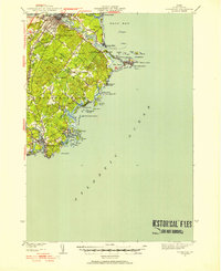
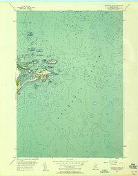
(38)- 1914 Map of Portland
 1914 Portland1914 Print · USGSCovers Scarborough, including Portland, South Portland, and other nearby areas
 - 1914 Map of Casco Bay
 1914 Casco Bay1914 Print · USGSCovers Scarborough, including Portland, South Portland, and other nearby areas
 - 1916 Map of Portland
 1916 Portland1916 Print · USGSCovers Scarborough, including Portland, South Portland, and other nearby areas7 unique versions available
 - 1916 Map of Casco Bay
 1916 Casco Bay1916 Print · USGSCovers Scarborough, including Portland, South Portland, and other nearby areas8 unique versions available
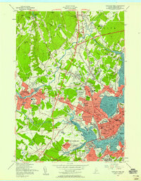
 - 1916 Map of Portland And Vicinity
 1916 Portland And Vicinity1916 Print · USGSCovers Scarborough, including Portland, South Portland, and other nearby areas
 - 1918 Map of Portland And Vicinity, 1926 Print
 1918 Portland And Vicinity1926 Print · USGSCovers Scarborough, including Portland, South Portland, and other nearby areas
 - 1941 Map of Casco Bay
 1941 Casco Bay1941 Print · USGSCovers Scarborough, including Portland, South Portland, and other nearby areas
 - 1941 Map of Portland
 1941 Portland1941 Print · USGSCovers Scarborough, including Portland, South Portland, and other nearby areas
 - 1941 Map of Biddeford, 1952 Print
 1941 Biddeford1952 Print · USGSCovers Scarborough, including Biddeford, Saco, and other nearby areas2 unique versions available
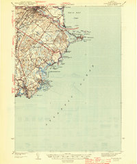
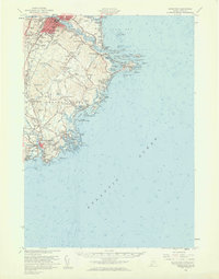
 - 1944 Map of Prouts Neck
 1944 Prouts Neck1944 Print · USGSCovers Scarborough, including South Portland, Saco, and other nearby areas
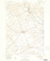
 - 1944 Map of Gorham
 1944 Gorham1944 Print · USGSCovers Scarborough, including Westbrook, Windham, and other nearby areas
 - 1944 Map of Biddeford
 1944 Biddeford1944 Print · USGSCovers Scarborough, including Biddeford, Saco, and other nearby areas2 unique versions available
 - 1944 Map of Cape Elizabeth
 1944 Cape Elizabeth1944 Print · USGSCovers Scarborough, including Portland, South Portland, and other nearby areas
 - 1944 Map of Old Orchard Beach
 1944 Old Orchard Beach1944 Print · USGSCovers Scarborough, including Biddeford, Saco, and other nearby areas
 - 1944 Map of Portland West, 1948 Print
 1944 Portland West1948 Print · USGSCovers Scarborough, including Portland, South Portland, and other nearby areas
 - 1948 Map of Portland West
 1948 Portland West1948 Print · USGSCovers Scarborough, including Portland, South Portland, and other nearby areas
 - 1949 Map of Portland
 1949 Portland1949 Print · USGSCovers Scarborough, including Manchester, Portland, and other nearby areas3 unique versions available
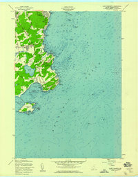
 - 1949 Map of Biddeford Pool
 1949 Biddeford Pool1949 Print · USGSCovers Scarborough, including Biddeford, Saco, and other nearby areas
 - 1950 Map of Gorham
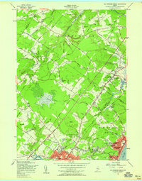
 1950 Gorham1950 Print · USGSCovers Scarborough, including Westbrook, Windham, and other nearby areas2 unique versions available
 - 1956 Map of Old Orchard Beach, 1958 Print
 1956 Old Orchard Beach1958 Print · USGSCovers Scarborough, including Biddeford, Saco, and other nearby areas4 unique versions available
 - 1956 Map of Biddeford Pool, 1958 Print
 1956 Biddeford Pool1958 Print · USGSCovers Scarborough, including Biddeford, Saco, and other nearby areas3 unique versions available
 - 1956 Map of Portland West, 1958 Print
 1956 Portland West1958 Print · USGSCovers Scarborough, including Portland, South Portland, and other nearby areas6 unique versions available
 - 1956 Map of Biddeford, 1960 Print
 1956 Biddeford1960 Print · USGSCovers Scarborough, including Biddeford, Saco, and other nearby areas2 unique versions available
 - 1956 Map of Portland, 1963 Print
 1956 Portland1963 Print · USGSCovers Scarborough, including Manchester, Portland, and other nearby areas4 unique versions available
 - 1957 Map of Cape Elizabeth, 1958 Print
 1957 Cape Elizabeth1958 Print · USGSCovers Scarborough, including Portland, South Portland, and other nearby areas3 unique versions available
Showing maps 1-25 of 38
Top cities near Scarborough
- Portland historical maps
- South Portland historical maps
- Biddeford historical maps
- Westbrook historical maps
- Saco historical maps
- Windham historical maps
See more
Top neighborhoods of Scarborough
- Oak Hill historical maps
- Dunstan historical maps
- North Scarborough historical maps
- Pleasant Hill historical maps
- Blue Point historical maps
- Eight Corners historical maps
See more
Frequently asked questions
- What are the different types of historical maps available for Scarborough?
- What is the oldest map of Scarborough?
- Where can I purchase historical maps of Scarborough for my home or office?
- Where can I download high-res historical maps of Scarborough?
- Are there historical topographic maps available for Scarborough?
- Is there historical aerial imagery available for Scarborough?
- Where are historical maps of Scarborough sourced from?