1930s Maps of Township 6 North of Weld, Maine
Explore 4 historic maps of Township 6 North of Weld from the 1930s. These maps offer a rare glimpse into what life looked like during the 1930s — showing old roads, neighborhoods, homes, and landmarks that have changed or disappeared over time.
Whether you're researching your family's past, planning a metal detecting trip, or studying how Township 6 North of Weld's landscape evolved across the 1930s, these high-resolution maps are a powerful tool for exploring the history of this region.
- Focus on a specific era: All maps on this page are from the 1930s, giving you a focused view of this time period.
- See what’s changed: Compare century-old streets, trails, and buildings to today's modern landscape using overlays and satellite layers.
- Research with precision: Use these maps for genealogy, historical research, land use analysis, or educational projects.
- View, download, or print: Maps are fully viewable online in high resolution, and can be downloaded or printed for your own records.
Start exploring Township 6 North of Weld's history through authentic maps from the 1930s. This is your window into the past.
Township 6 North of Weld, ME maps
(4)- 1930 Map of Rumford
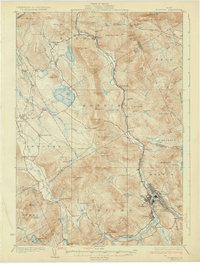 1930 Rumford1930 Print · USGSRumford and the Androscoggin River valley are shown here just before the Great Depression, highlighting a bustling landscape of rail and industry. Genealogists and historians can trace local families through many district schools like Woodrow Sch and landmarks like Stockbridge Cem or Rumford Falls.5 unique versions available
 - 1932 Map of Phillips
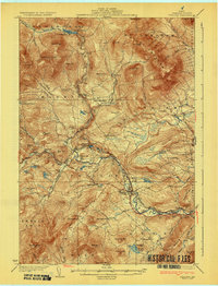 1932 Phillips1932 Print · USGSFranklin County's mountain-and-valley landscape is captured here in the late twenties, centered on the Sandy River rail corridor. Trace the path of the Rangeley Lakes and Berlin Mills RR past old schoolhouses like Cushman Sch and Avon Valley Sch.4 unique versions available
 - 1933 Map of Rangeley
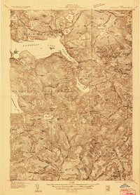 1933 Rangeley1933 Print · USGSThe Rangeley Lakes region is shown here in the early 1930s, capturing a landscape of timber townships and mountain peaks. Genealogists and historians can locate rural schoolhouses like the Lakeside School, the Dallas station railroad stop, and the abandoned Flagg Dam.2 unique versions available
 - 1939 Map of Rangeley
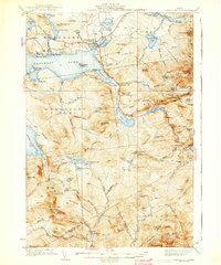 1939 Rangeley1939 Print · USGSRangeley and the surrounding Maine high country are shown here in the years before the Second World War. Researchers can trace the original path of the Appalachian Trail past Saddleback Mtn and locate old rural landmarks like Lakeside Sch.5 unique versions available
End of results
Showing maps 1-4 of 4
Top cities near Township 6 North of Weld
- Jay historical maps
- Rumford historical maps
- Wilton historical maps
- Mexico historical maps
- Dixfield historical maps
- Rangeley historical maps
See more
Frequently asked questions
- What are the different types of historical maps available for Township 6 North of Weld?
- What is the oldest map of Township 6 North of Weld?
- Where can I purchase historical maps of Township 6 North of Weld for my home or office?
- Where can I download high-res historical maps of Township 6 North of Weld?
- Are there historical topographic maps available for Township 6 North of Weld?
- Is there historical aerial imagery available for Township 6 North of Weld?
- Where are historical maps of Township 6 North of Weld sourced from?