Old Maps of Bristol, Maine
Explore 72 old maps of Bristol, spanning from 1893 to today. These high-resolution historic maps reveal how streets, neighborhoods, landmarks, and natural features evolved over time — perfect for genealogy, metal detecting, research, and local history exploration.
What you can do with these maps:
- See how Bristol changed over time: Compare historical maps to modern-day views to trace roads, homesites, rail lines & more.
- View detailed metadata: Each map includes creators, publishers, year, scale, and archive source.
- Overlay maps with satellite & LiDAR: Visualize the past alongside modern tools to explore terrain & human change.
- Trusted historical sources: Maps sourced from the USGS, Library of Congress, and other archives.
- Access maps your way: View online, download high-res files, or order prints for personal or research use.
Start exploring old maps of Bristol to uncover forgotten places, hidden landmarks, and the deep history beneath your feet.
Bristol, ME maps
(72)- 1893 Map of Wiscasset
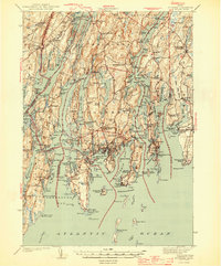
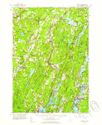
 1893 Wiscasset1893 Print · USGSThe coastal and inland reaches of Lincoln County come alive in the 1890s, centered on the shipping and rail hub of Wiscasset. Trace the paths of the Maine Central Railroad and find early settlements like Head Tide, Dresden Mills, and Damariscotta Mills.7 unique versions available
 - 1893 Map of Boothbay
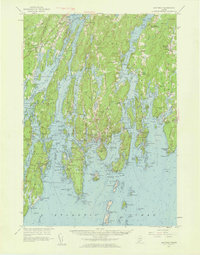
 1893 Boothbay1893 Print · USGSThe Lincoln County coast in the 1890s is shown in remarkable detail, from the rail lines of the north to the light stations of the Atlantic. Genealogists and historians can trace family-named points and early settlements like Boothbay Harbor, Pemaquid, and Southport.11 unique versions available
 - 1904 Map of Monhegan, 1958 Print
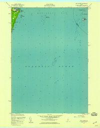
 1904 Monhegan1958 Print · USGSThe Maine coast near Muscongus Bay is captured here during the heyday of coastal steamboats and lighthouse keepers. Genealogists and historians can trace families across Louds Island, Bremen Long Island, and the remote fishing community on Monhegan.
 - 1906 Map of Monhegan
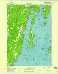
 1906 Monhegan1906 Print · USGSThe Maine coast at the turn of the century reveals a seafaring landscape of island outposts and sheltered harbors. Trace early maritime routes and family-named landmarks from Port Clyde to the isolated Monhegan Island.5 unique versions available
 - 1913 Map of Waldoboro
 1913 Waldoboro1913 Print · USGSCoastal Lincoln and Knox counties come alive in this pre-war survey, showing a landscape of tightly-knit villages and rural school districts connected by the river and rail. Researchers can trace ancestral footprints at the Old Dutch Church, Winslows Mills, and the Benners Corner Cem.2 unique versions available
 - 1915 Map of Waldoboro
 1915 Waldoboro1915 Print · USGSCoastal Lincoln County is surveyed here in the early twentieth century, showing a landscape defined by tidal rivers and small farming hamlets. Genealogists can locate family-named sites like Flanders Corner and rural institutions such as the Branch School and Broad Cove PO.5 unique versions available
 - 1941 Map of Waldoboro
 1941 Waldoboro1941 Print · USGSThe Medomak River valley and its surrounding coastal hills are captured here just as the war began. You can trace early twentieth-century rail connections at Glendon Station, find family-named crossroads like Whitney Corner, and locate local landmarks such as Winslows Mills.
 - 1941 Map of Boothbay, 1955 Print
 1941 Boothbay1955 Print · USGSThe Maine Midcoast is captured in the early 1940s, showing a world of interconnected peninsulas and working waterfronts. Genealogists and historians can trace family roots through sites like Woodlawn Cem, Bristol Mills, and the Roosevelt Sch.
 - 1943 Map of Boothbay, 1949 Print
 1943 Boothbay1949 Print · USGSMid-century Lincoln County comes to life in this detailed view of the Maine coast before modern development changed these island communities. Genealogists and historians can trace family locations near Bristol Mills, Christmas Cove, or the historic Fort Edgecomb.
 - 1944 Map of Wiscasset
 1944 Wiscasset1944 Print · USGSThe Sheepscot and Damariscotta rivers define this mid-coast Maine region in the 1940s as the rail and river economy persists. Trace family history at Head Tide, the Whitefield Memorial Hospital, or early schoolhouses like Alna Center Sch.4 unique versions available
 - 1944 Map of Boothbay
 1944 Boothbay1944 Print · USGSCoastal Lincoln County is charted here during the early years of the war, revealing the intricate maritime geography of the midcoast peninsulas. Genealogists and historians can trace old homesteads and landmarks from Wiscasset to Boothbay Harbor, including sites like Oaklawn Cem and Pemaquid Beach.2 unique versions available
 - 1948 Map of Bangor
 1948 Bangor1948 Print · USGSThe Maine coast and its industrial river valleys are captured here shortly after the war, showing the vital shipping and rail hubs of the late 1940s. Genealogists and historians can trace the tracks of the Maine Central RR connecting Bangor, Augusta, and Old Town.
 - 1948 Map of Bath
 1948 Bath1948 Print · USGSMid-coast Maine’s intricate shoreline and island outposts are captured here just after the war. Researchers can trace historic maritime settlements from Bath to Friendship and locate remote landmarks like Monhegan Island and Pemaquid Point.2 unique versions available
 - 1950 Map of Waldoboro
 1950 Waldoboro1950 Print · USGSThe Medomak River valley and the coastal hills of Lincoln County are captured here in the mid-century, prior to modern suburban expansion. Genealogists and historians can locate old landmarks like Nobleboro Station, Winslow Mills, and numerous neighborhood schools like Duckpuddle Sch.
 - 1955 Map of New Harbor, 1958 Print
 1955 New Harbor1958 Print · USGSThe Maine coast near New Harbor is captured here in the mid-1950s, showing the intersection of maritime life and land-based settlement. Researchers can trace the rocky shoreline of Pemaquid Neck and identify offshore landmarks like Eastern Egg Rock and Moser Ledge.3 unique versions available
 - 1955 Map of Louds Island, 1959 Print
 1955 Louds Island1959 Print · USGSCoastal Lincoln County is charted here in the mid-fifties, showing the deep-rooted maritime life between Muscongus and New Harbor. Researchers can trace families at Ocean Hill Cem, locate the island settlement of Loudville, and explore the docks of Round Pond.5 unique versions available
 - 1955 Map of Monhegan, 1959 Print
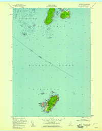 1955 Monhegan1959 Print · USGSThe outer Maine coast comes to life in the mid-1950s, centered on the historic fishing and maritime hub of Monhegan. Local historians and genealogists can trace the isolated settlement's footprint, including the Lighthouse, the U S Coast Guard Reservation, and landmarks like Black Head.4 unique versions available
 - 1956 Map of Bangor, 1966 Print
 1956 Bangor1966 Print · USGSMid-century Maine comes alive in this survey of the rugged coast and river valleys during the 1950s. Genealogists and historians can trace the vital rail corridors of the Maine Central RR connecting timber towns like Old Town to the coast at Bar Harbor.3 unique versions available
 - 1956 Map of Bath, 1974 Print
 1956 Bath1974 Print · USGSCoastal Maine in the mid-fifties reveals a landscape of deep-water harbors and island outposts as the region transitioned from industrial roots to a summer destination. Genealogists can trace maritime families in Boothbay Harbor, Tenants Harbor, and on remote Monhegan Island.
 - 1957 Map of Bath
 1957 Bath1957 Print · USGSThe Maine coast in the mid-fifties is captured here, from the shipbuilding hubs of Bath and Brunswick to the granite reaches of Rockland. Researchers can trace the Maine Central RR line and remote island outposts like Monhegan Island and Matinicus Isle.
 - 1957 Map of Wiscasset, 1959 Print
 1957 Wiscasset1959 Print · USGSThe Sheepscot and Damariscotta river valleys are shown in the late 1950s, a landscape of tidal flats and inland ponds. Genealogists can trace family landmarks like Goodspeed Cem, St Denis Ch, and the old settlements at Head Tide or Dresden Mills.4 unique versions available
 - 1957 Map of Boothbay, 1959 Print
 1957 Boothbay1959 Print · USGSThe Maine coastline around the Sheepscot and Damariscotta rivers is shown here during a period of established maritime commerce and coastal growth. Genealogists can trace family names at the Harrington Ch Cem or explore the sites of Fort Edgecomb and Bristol Mills.7 unique versions available
 - 1958 Map of Bath
 1958 Bath1958 Print · USGSCoastal Maine in the late fifties reveals a landscape of industrial river towns and remote island outposts. Genealogists and historians can trace the Maine Central RR through Bath, explore the islands of Muscongus Bay, or locate seafaring families at Pemaquid Point.
 - 1960 Map of Bangor
 1960 Bangor1960 Print · USGSCentral Maine in the sixties reveals a landscape of river-powered industry and sprawling coastal island chains. Researchers can trace the rail corridors of the Maine Central or locate mid-century aviation landmarks like Dow Air Force Base.
 - 1961 Map of Bangor
 1961 Bangor1961 Print · USGSMid-century Maine comes alive through its busy river ports and rocky archipelagoes during a period of steady maritime and rail commerce. Researchers can trace the path of the Maine Central railroad and locate coastal landmarks from Acadia National Park to Vinalhaven Island.
Showing maps 1-25 of 72
Top cities near Bristol
- Warren historical maps
- Wiscasset historical maps
- Boothbay historical maps
- Saint George historical maps
- Jefferson historical maps
- Damariscotta historical maps
See more
Top neighborhoods of Bristol
- Pemaquid historical maps
- Round Pond historical maps
- Chamberlain historical maps
- New Harbor historical maps
- Louds Island historical maps
- Yellow Head historical maps
See more
Frequently asked questions
- What are the different types of historical maps available for Bristol?
- What is the oldest map of Bristol?
- Where can I purchase historical maps of Bristol for my home or office?
- Where can I download high-res historical maps of Bristol?
- Are there historical topographic maps available for Bristol?
- Is there historical aerial imagery available for Bristol?
- Where are historical maps of Bristol sourced from?