Old Maps of Bowdoinham, Maine
Explore 46 old maps of Bowdoinham, spanning from 1892 to today. These high-resolution historic maps reveal how streets, neighborhoods, landmarks, and natural features evolved over time — perfect for genealogy, metal detecting, research, and local history exploration.
What you can do with these maps:
- See how Bowdoinham changed over time: Compare historical maps to modern-day views to trace roads, homesites, rail lines & more.
- View detailed metadata: Each map includes creators, publishers, year, scale, and archive source.
- Overlay maps with satellite & LiDAR: Visualize the past alongside modern tools to explore terrain & human change.
- Trusted historical sources: Maps sourced from the USGS, Library of Congress, and other archives.
- Access maps your way: View online, download high-res files, or order prints for personal or research use.
Start exploring old maps of Bowdoinham to uncover forgotten places, hidden landmarks, and the deep history beneath your feet.
Bowdoinham, ME maps
(46)- 1892 Map of Gardiner
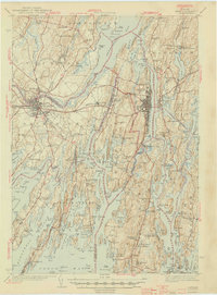
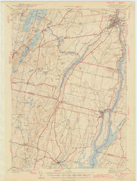
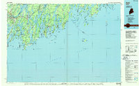
 1892 Gardiner1892 Print · USGSThe Kennebec River valley in the 1890s was a bustling corridor of rail and river commerce. Genealogists and historians can trace old homesteads and landings from Gardiner down to Bowdoinham, including points like Ship Yard Pt and the grounds of the Richmond Campmeeting.7 unique versions available
 - 1894 Map of Bath
 1894 Bath1894 Print · USGSCoastal Maine at the height of the maritime era is captured in this survey of the river-linked communities of Bath and Brunswick. Genealogists and historians can trace the foundations of local shipping and rail at Winnegance, Parker Head, and along the M. C. R. R. lines.9 unique versions available
 - 1920 Map of Bath
 1920 Bath1920 Print · USGSCoastal Maine at the height of the rail era is captured here, showing the intricate tidal waters surrounding Bath and Brunswick. Genealogists and local historians can trace family locations near Nequasset Falls, Cundy Harbor, and the Quaker church.2 unique versions available
 - 1943 Map of Gardiner
 1943 Gardiner1943 Print · USGSThe Kennebec River valley in the early 1940s reveals a landscape of riverside industry and inland farming communities. Researchers can trace ancestral roots through dozens of local schoolhouses like J F Stevens Sch and family crossroads such as Spears Cor or Starbird Cor.4 unique versions available
 - 1945 Map of Bath
 1945 Bath1945 Print · USGSThe mid-coast Maine shoreline and Kennebec River shipping corridor are preserved here just as the war was ending. Genealogists and historians can trace the locations of family burial grounds like Winnegance Cem, rural schoolhouses like Littlefield Sch, and the industrial footprint of the Dana Mill.2 unique versions available
 - 1948 Map of Bangor
 1948 Bangor1948 Print · USGSThe Maine coast and its industrial river valleys are captured here shortly after the war, showing the vital shipping and rail hubs of the late 1940s. Genealogists and historians can trace the tracks of the Maine Central RR connecting Bangor, Augusta, and Old Town.
 - 1948 Map of Bath
 1948 Bath1948 Print · USGSMid-coast Maine’s intricate shoreline and island outposts are captured here just after the war. Researchers can trace historic maritime settlements from Bath to Friendship and locate remote landmarks like Monhegan Island and Pemaquid Point.2 unique versions available
 - 1956 Map of Bangor, 1966 Print
 1956 Bangor1966 Print · USGSMid-century Maine comes alive in this survey of the rugged coast and river valleys during the 1950s. Genealogists and historians can trace the vital rail corridors of the Maine Central RR connecting timber towns like Old Town to the coast at Bar Harbor.3 unique versions available
 - 1956 Map of Bath, 1974 Print
 1956 Bath1974 Print · USGSCoastal Maine in the mid-fifties reveals a landscape of deep-water harbors and island outposts as the region transitioned from industrial roots to a summer destination. Genealogists can trace maritime families in Boothbay Harbor, Tenants Harbor, and on remote Monhegan Island.
 - 1957 Map of Bath
 1957 Bath1957 Print · USGSThe Maine coast in the mid-fifties is captured here, from the shipbuilding hubs of Bath and Brunswick to the granite reaches of Rockland. Researchers can trace the Maine Central RR line and remote island outposts like Monhegan Island and Matinicus Isle.
 - 1957 Map of Gardiner, 1959 Print
 1957 Gardiner1959 Print · USGSThe Kennebec River valley in the late fifties shows a landscape of riverfront industry and rural crossroads. Genealogists and historians can trace family-named sites like Batchelders Crossing or Litchfield Academy and explore the complex waters of Swan Island.3 unique versions available
 - 1957 Map of Bath, 1960 Print
 1957 Bath1960 Print · USGSThe mid-coast of Maine is captured here during a period of military and industrial growth along the Kennebec River. Genealogists and historians can trace the foundations of Bath and Brunswick, identifying family plots like Maple Grove Cem and the historic Bowdoin College campus.4 unique versions available
 - 1958 Map of Bath
 1958 Bath1958 Print · USGSCoastal Maine in the late fifties reveals a landscape of industrial river towns and remote island outposts. Genealogists and historians can trace the Maine Central RR through Bath, explore the islands of Muscongus Bay, or locate seafaring families at Pemaquid Point.
 - 1960 Map of Bangor
 1960 Bangor1960 Print · USGSCentral Maine in the sixties reveals a landscape of river-powered industry and sprawling coastal island chains. Researchers can trace the rail corridors of the Maine Central or locate mid-century aviation landmarks like Dow Air Force Base.
 - 1961 Map of Bangor
 1961 Bangor1961 Print · USGSMid-century Maine comes alive through its busy river ports and rocky archipelagoes during a period of steady maritime and rail commerce. Researchers can trace the path of the Maine Central railroad and locate coastal landmarks from Acadia National Park to Vinalhaven Island.
 - 1963 Map of Bath
 1963 Bath1963 Print · USGSThe Maine Midcoast in the early sixties remains a world of tidal rivers and jagged peninsulas tied to the sea. Genealogy and local history researchers can trace the rail lines of the Maine Central RR and locate offshore communities like Matinicus Island and Monhegan.2 unique versions available
 - 1965 Map of Bath
 1965 Bath1965 Print · USGSThe Midcoast Maine shoreline and its archipelago come alive in the mid-1960s, showing the region's deep reliance on river and rail. Researchers can trace historic harbor towns like Boothbay Harbor and Damariscotta, and locate coastal landmarks from Pemaquid Point to the Fort Popham Military Res.
 - 1980 Map of Richmond
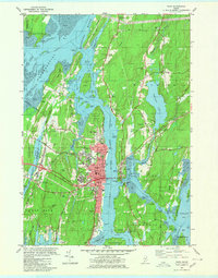
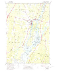 1980 Richmond1980 Print · USGSThe Kennebec River corridor comes alive in the early 1980s, documenting a landscape of tidal flats and riverfront settlements. Researchers can trace family lines through numerous burial grounds like Maple Grove Cem or locate the historic river crossings near Iceboro and Swan Island.2 unique versions available
 - 1980 Map of Brunswick
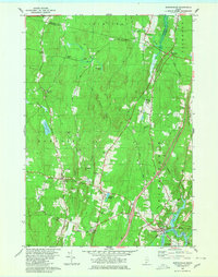
 1980 Brunswick1980 Print · USGSCoastal Maine transitions from the academic halls of Brunswick to the tidal flats of Merrymeeting Bay in the early eighties. Genealogists and historians can trace family plots at Riverside Cem or locate the sprawling Brunswick Naval Air Station.3 unique versions available
 - 1980 Map of Bath
 1980 Bath1980 Print · USGSMid-coast Maine’s maritime heritage is on full display here in the early eighties, centered on the historic shipbuilding hub of BATH. Researchers can trace old family names at Oak Grove Cem or locate former school sites like Dike Sch and Morse High Sch.3 unique versions available
 - 1980 Map of Bowdoinham
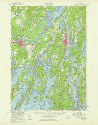
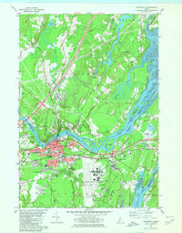
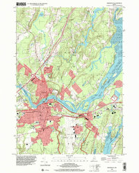
 1980 Bowdoinham1980 Print · USGSCoastal Sagadahoc County remains a network of tight-knit crossroads and river valleys as the 1980s began. Genealogists and local historians can trace the locations of family burial grounds like Coombs Cem and schools such as Bowdoin Sch alongside the active Maine Central Railroad.2 unique versions available
 - 1980 Map of Gardiner, 1991 Print
 1980 Gardiner1991 Print · USGSMid-century Kennebec County comes alive in this 1940s survey of the river-and-rail corridor. Genealogists can trace family landmarks like Hathorn Hill, locate small rural schools such as Adams Sch, and find ancestors in Evergreen Cem.
 - 1984 Map of Augusta
 1984 Augusta1984 Print · USGSMid-coast and central Maine were undergoing steady change in the mid-eighties as traditional river and coastal industries met expanding recreation. You can trace the Maine Central RR through Augusta or explore the rugged shoreline from Rockland Harbor up to Mount Megunticook.
 - 1985 Map of Bath, 1986 Print
 1985 Bath1986 Print · USGSMidcoast Maine in the mid-eighties shows a landscape of deep-water harbors and strategic military installations. Researchers can trace the coastal rail lines of the Maine Central RR and locate landmarks from Popham Beach to the remote Monhegan Plantation.2 unique versions available
 - 1996 Map of Brunswick, 2001 Print
 1996 Brunswick2001 Print · USGSCoastal Maine in the mid-nineties shows a mix of collegiate tradition and military readiness at the junction of the Androscoggin River. Genealogists and historians can trace family plots at Riverside Cem or study the campus layout of Bowdoin College.
Showing maps 1-25 of 46
Top cities near Bowdoinham
- Brunswick historical maps
- Lisbon historical maps
- Yarmouth historical maps
- Topsham historical maps
- Freeport historical maps
- Bath historical maps
See more
Frequently asked questions
- What are the different types of historical maps available for Bowdoinham?
- What is the oldest map of Bowdoinham?
- Where can I purchase historical maps of Bowdoinham for my home or office?
- Where can I download high-res historical maps of Bowdoinham?
- Are there historical topographic maps available for Bowdoinham?
- Is there historical aerial imagery available for Bowdoinham?
- Where are historical maps of Bowdoinham sourced from?