Old Maps of Litchfield, Maine
Explore 49 old maps of Litchfield, spanning from 1892 to today. These high-resolution historic maps reveal how streets, neighborhoods, landmarks, and natural features evolved over time — perfect for genealogy, metal detecting, research, and local history exploration.
What you can do with these maps:
- See how Litchfield changed over time: Compare historical maps to modern-day views to trace roads, homesites, rail lines & more.
- View detailed metadata: Each map includes creators, publishers, year, scale, and archive source.
- Overlay maps with satellite & LiDAR: Visualize the past alongside modern tools to explore terrain & human change.
- Trusted historical sources: Maps sourced from the USGS, Library of Congress, and other archives.
- Access maps your way: View online, download high-res files, or order prints for personal or research use.
Start exploring old maps of Litchfield to uncover forgotten places, hidden landmarks, and the deep history beneath your feet.
Litchfield, ME maps
(49)- 1892 Map of Gardiner
 1892 Gardiner1892 Print · USGSThe Kennebec River valley in the 1890s was a bustling corridor of rail and river commerce. Genealogists and historians can trace old homesteads and landings from Gardiner down to Bowdoinham, including points like Ship Yard Pt and the grounds of the Richmond Campmeeting.7 unique versions available
 - 1908 Map of Lewiston
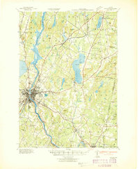
 1908 Lewiston1908 Print · USGSAndroscoggin County at the start of the century shows a thriving industrial corridor centered on the twin cities and the river. Genealogists can trace family farms and local institutions near Sabattus Pond, Bates College, and Lisbon Falls.6 unique versions available
 - 1942 Map of Lewiston
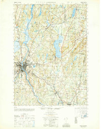
 1942 Lewiston1942 Print · USGSLewiston and the Androscoggin River valley are shown in detail during the early 1940s, capturing the area's transition from industrial hubs to rural crossroads. Researchers can locate early schoolhouses like No Name Sch, the campus of Bates College, and vanished rail stops at Golder Siding and Leeds Junc.
 - 1943 Map of Gardiner
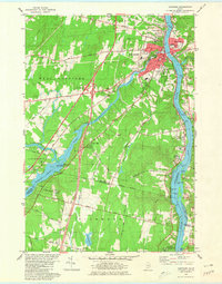
 1943 Gardiner1943 Print · USGSThe Kennebec River valley in the early 1940s reveals a landscape of riverside industry and inland farming communities. Researchers can trace ancestral roots through dozens of local schoolhouses like J F Stevens Sch and family crossroads such as Spears Cor or Starbird Cor.4 unique versions available
 - 1948 Map of Bangor
 1948 Bangor1948 Print · USGSThe Maine coast and its industrial river valleys are captured here shortly after the war, showing the vital shipping and rail hubs of the late 1940s. Genealogists and historians can trace the tracks of the Maine Central RR connecting Bangor, Augusta, and Old Town.
 - 1950 Map of Lewiston
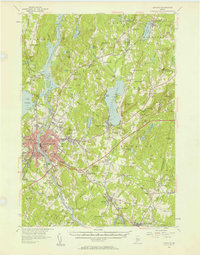
 1950 Lewiston1950 Print · USGSAndroscoggin County at mid-century shows a landscape of busy industrial centers and quiet crossroad hamlets connected by the river. Genealogists can trace family names at Jordan Corners or Blake Corners and locate rural landmarks like Sprague Mill and Ridge Sch.
 - 1950 Map of Lewiston
 1950 Lewiston1950 Print · USGSThe Maine and New Hampshire borderlands come alive in this post-war survey of the White Mountains and Androscoggin valley. Genealogists and historians can trace rail lines like the Maine Central Railroad and find high-altitude landmarks from Mount Washington to Bretton Woods.2 unique versions available
 - 1956 Map of Lewiston, 1958 Print
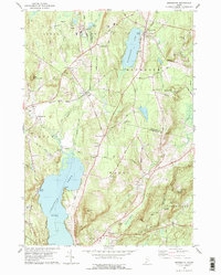
 1956 Lewiston1958 Print · USGSThe industrial twin cities of Lewiston and Auburn thrive along the Androscoggin River during the mid-fifties. Genealogists and historians can trace the legacy of Bates College, the busy Maine Central Railroad corridors, and dozens of rural burying grounds like St Peters Cem.4 unique versions available
 - 1956 Map of Bangor, 1966 Print
 1956 Bangor1966 Print · USGSMid-century Maine comes alive in this survey of the rugged coast and river valleys during the 1950s. Genealogists and historians can trace the vital rail corridors of the Maine Central RR connecting timber towns like Old Town to the coast at Bar Harbor.3 unique versions available
 - 1956 Map of Lewiston, 1975 Print
 1956 Lewiston1975 Print · USGSThe Northern New England interior is documented here in the mid-fifties, from the industrial Androscoggin River to the high peaks of the White Mountains. Trace the Grand Trunk Railway through mountain passes or locate family landmarks near Sabbathday Lake and Bretton Woods.
 - 1957 Map of Gardiner, 1959 Print
 1957 Gardiner1959 Print · USGSThe Kennebec River valley in the late fifties shows a landscape of riverfront industry and rural crossroads. Genealogists and historians can trace family-named sites like Batchelders Crossing or Litchfield Academy and explore the complex waters of Swan Island.3 unique versions available
 - 1960 Map of Bangor
 1960 Bangor1960 Print · USGSCentral Maine in the sixties reveals a landscape of river-powered industry and sprawling coastal island chains. Researchers can trace the rail corridors of the Maine Central or locate mid-century aviation landmarks like Dow Air Force Base.
 - 1961 Map of Bangor
 1961 Bangor1961 Print · USGSMid-century Maine comes alive through its busy river ports and rocky archipelagoes during a period of steady maritime and rail commerce. Researchers can trace the path of the Maine Central railroad and locate coastal landmarks from Acadia National Park to Vinalhaven Island.
 - 1961 Map of Lewiston
 1961 Lewiston1961 Print · USGSWestern Maine and the White Mountains appear here during the early sixties, showing the industrial river towns and vast timberlands before the modern interstate era. Genealogists and historians can trace the Grand Trunk RR through Berlin or locate landmarks like Old Speck Mountain and Elephant Mountain.
 - 1962 Map of Lewiston
 1962 Lewiston1962 Print · USGSThe industrial river valleys and high peaks of Maine and New Hampshire define the region in the early sixties. Trace the rail-and-river network from Lewiston to the White Mountains, passing through mill towns like Berlin and Rumford.
 - 1969 Map of Lewiston
 1969 Lewiston1969 Print · USGSThe northern New England highlands come into focus during the mid-fifties, showing the vital rail and river networks connecting industrial centers to the deep woods. Researchers can trace the path of the Grand Trunk RR or locate landmarks like Mt Washington and Rangeley Lake.
 - 1979 Map of Monmouth
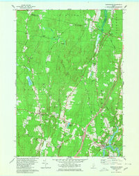
 1979 Monmouth1979 Print · USGSAndroscoggin and Kennebec Counties are shown in the late seventies as a landscape of interconnected ponds, ridges, and small rail-side hamlets. Genealogists can locate family sites near Leeds Plain Cem, the old Sprague Mill, or the community hub at Wales Corner.
 - 1979 Map of Lisbon Falls North
 1979 Lisbon Falls North1979 Print · USGSLisbon and Sabattus appear at a crossroads of industry and tradition in the late seventies as the river-driven economy continued to shape the county. Researchers can trace family roots through numerous small burial grounds like Furbush Cem and Spear Cem or locate the old Webster School.3 unique versions available
 - 1980 Map of Gardiner
 1980 Gardiner1980 Print · USGSGardiner and the Kennebec River valley are captured in the early 1980s as modern turnpike travel intersected with traditional riverfront industry. Genealogists can locate several burial grounds like St Josephs Cem and trace historical sites such as the Colburn House State Mem.3 unique versions available
 - 1980 Map of Purgatory
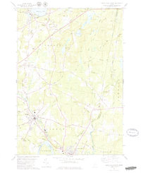
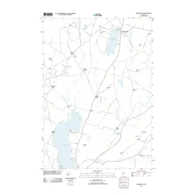
 1980 Purgatory1980 Print · USGSThe interconnected waters of Kennebec County are captured here in the early eighties, from the shores of Cobbosseecontee Lake to the rural hills of Litchfield. Researchers can trace family roots through landmarks like the Libby-Tozier Sch, Batchelders Crossing, and Plains Cem.
 - 1980 Map of Bowdoinham
 1980 Bowdoinham1980 Print · USGSCoastal Sagadahoc County remains a network of tight-knit crossroads and river valleys as the 1980s began. Genealogists and local historians can trace the locations of family burial grounds like Coombs Cem and schools such as Bowdoin Sch alongside the active Maine Central Railroad.2 unique versions available
 - 1980 Map of Gardiner, 1991 Print
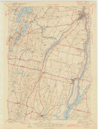 1980 Gardiner1991 Print · USGSMid-century Kennebec County comes alive in this 1940s survey of the river-and-rail corridor. Genealogists can trace family landmarks like Hathorn Hill, locate small rural schools such as Adams Sch, and find ancestors in Evergreen Cem.
 - 1984 Map of Augusta
 1984 Augusta1984 Print · USGSMid-coast and central Maine were undergoing steady change in the mid-eighties as traditional river and coastal industries met expanding recreation. You can trace the Maine Central RR through Augusta or explore the rugged shoreline from Rockland Harbor up to Mount Megunticook.
 - 1986 Map of Lewiston
 1986 Lewiston1986 Print · USGSMaine’s industrial river valleys and western mountain foothills are captured here in the mid-eighties as rail and road networks tied the region together. Genealogists and historians can trace the development of mill towns and lakefront settlements from Lisbon to Bethel, following the Androscoggin River and the path of the Maine Central Railroad.2 unique versions available
 - 2011 Map of Monmouth, 2011 Print
 2011 Monmouth2011 Print · USGSCovers Litchfield, including Lewiston, Sabattus, and other nearby areas
Showing maps 1-25 of 49
Top cities near Litchfield
- Lewiston historical maps
- Brunswick historical maps
- Augusta historical maps
- Lisbon historical maps
- Topsham historical maps
- Bath historical maps
See more
Top neighborhoods of Litchfield
- Batchelders Crossing historical maps
- Litchfield Plains historical maps
- Purgatory historical maps
- Ring Hill historical maps
- Litchfield Corners historical maps
Frequently asked questions
- What are the different types of historical maps available for Litchfield?
- What is the oldest map of Litchfield?
- Where can I purchase historical maps of Litchfield for my home or office?
- Where can I download high-res historical maps of Litchfield?
- Are there historical topographic maps available for Litchfield?
- Is there historical aerial imagery available for Litchfield?
- Where are historical maps of Litchfield sourced from?