Old Maps of Sandwich Academy Grant Township, Maine
Explore 60 old maps of Sandwich Academy Grant Township, spanning from 1921 to today. These high-resolution historic maps reveal how streets, neighborhoods, landmarks, and natural features evolved over time — perfect for genealogy, metal detecting, research, and local history exploration.
What you can do with these maps:
- See how Sandwich Academy Grant Township changed over time: Compare historical maps to modern-day views to trace roads, homesites, rail lines & more.
- View detailed metadata: Each map includes creators, publishers, year, scale, and archive source.
- Overlay maps with satellite & LiDAR: Visualize the past alongside modern tools to explore terrain & human change.
- Trusted historical sources: Maps sourced from the USGS, Library of Congress, and other archives.
- Access maps your way: View online, download high-res files, or order prints for personal or research use.
Start exploring old maps of Sandwich Academy Grant Township to uncover forgotten places, hidden landmarks, and the deep history beneath your feet.
Sandwich Academy Grant Township, ME maps
(60)- 1921 Map of Brassua Lake
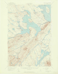
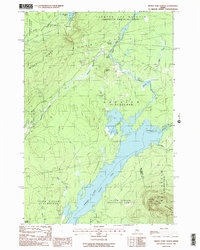
 1921 Brassua Lake1921 Print · USGSThe North Maine Woods come alive in the 1920s at the intersection of the Canadian Pacific and Maine Central railroads. Genealogists and historians can trace logging-era life at Somerset Junction, Blaine School, and numerous seasonal sites like Depot Camp.3 unique versions available
 - 1922 Map of Long Pond, 1955 Print
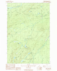
 1922 Long Pond1955 Print · USGSThe Maine north woods in the early twenties reveals a landscape defined by the Canadian Pacific rail line and the timber industry. Genealogists and historians can trace family-named sites like Fogg Farm, Mackamp, and Jackman Mill.5 unique versions available
 - 1923 Map of Brassua Lake
 1923 Brassua Lake1923 Print · USGSRailroads and river routes intersect in the Maine north woods at the start of the 1920s. Genealogists and historians can trace the junction of the Canadian Pacific at Somerset Junction Tarratine PO and locate remote outposts like Blaine School and Cornish Farm.4 unique versions available
 - 1924 Map of Long Pond
 1924 Long Pond1924 Print · USGSSomerset County’s timber and rail landscape is captured here in the early twenties as the logging and sporting industries thrived. Trace the Canadian Pacific rail line through Jackman Station to remote outposts like Mackamp and the Whipple Farm.5 unique versions available
 - 1944 Map of Brassua Lake
 1944 Brassua Lake1944 Print · USGSCentral Maine was a landscape of remote sporting camps and logging rail lines in the mid-1940s. Genealogists and historians can trace old homesteads and landmarks like Somerset Junction, Blaine Sch, and Cornish Farm.
 - 1944 Map of Long Pond
 1944 Long Pond1944 Print · USGSSomerset County's timber and rail corridor is captured here during the mid-forties as the north woods economy thrived. Genealogists and historians can trace family locations at Whipple Farm or follow the Canadian Pacific line to Jackman Station and Mackamp.
 - 1949 Map of Jackman
 1949 Jackman1949 Print · USGSThe Quebec and Maine borderlands are shown in great detail during the late 1940s, highlighting the industrial and natural geography of the region. Trace old rail lines like the Canadian Pacific and locate settlements from Sherbrooke to Scotstown.2 unique versions available
 - 1954 Map of Millinocket, 1968 Print
 1954 Millinocket1968 Print · USGSMaine's North Woods and the Penobscot Valley are captured here during the mid-century era of logging and rail dominance. You can trace the path of the Bangor and Aroostook Railroad through timber towns like Millinocket, Mattawamkeag, and Silver Ridge.3 unique versions available
 - 1957 Map of Brassua Lake, 1959 Print
 1957 Brassua Lake1959 Print · USGSThe northern Maine woods around Rockwood are captured here during the late 1950s, a time of transition for the region's rail and river systems. Genealogists and historians can locate family-named clearings like Milliken Farm, local institutions such as Blaine Sch, and the winding path of the Canadian Pacific Railroad.5 unique versions available
 - 1958 Map of Millinocket
 1958 Millinocket1958 Print · USGSMaine's North Woods and the Penobscot river valley are captured here in the mid-1950s, showing a landscape of timber, rail, and wild waters. Researchers can trace the legacy of the Canadian Pacific railroad and find historic settlements like Millinocket, Sherman Station, and Mattawamkeag.
 - 1960 Map of Millinocket
 1960 Millinocket1960 Print · USGSThe Maine North Woods and Penobscot River valley are captured at mid-century during the height of the paper milling era. Researchers can trace the Appalachian Trail near Mount Katardin or locate family roots in towns like Dover-Foxcroft and Milo.3 unique versions available
 - 1963 Map of Jackman
 1963 Jackman1963 Print · USGSThe international borderlands of Maine and Quebec come alive in the mid-twentieth century, showing a landscape of timber towns and rail connections. Genealogists and historians can trace the paths of the Canadian Pacific Railway through Jackman or locate families in Sherbrooke and Megantic.
 - 1966 Map of Sherbrooke
 1966 Sherbrooke1966 Print · USGSThe borderlands of Quebec and Maine come alive in the mid-1960s, documenting the industrial towns and deep woods of the Northeast. Genealogists can trace family lines through Sherbrooke and Coaticook, or locate remote logging outposts along the Moose River and Flagstaff Lake.
 - 1976 Map of Sherbrooke
 1976 Sherbrooke1976 Print · USGSThe northern Maine woods and Quebec’s Eastern Townships meet in this mid-century survey of the rugged international borderlands. Genealogists and historians can trace rail-and-river connections through Thetford Mines, follow the Dead River to Flagstaff Lake, or locate small border crossings at Stanhope and Beecher Falls.2 unique versions available
 - 1977 Map of Misery Knob, 1981 Print
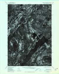
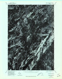 1977 Misery Knob1981 Print · USGSThe Maine woods in the late seventies are documented in this detailed aerial study of Somerset County. Trace the wild water systems of Moose River, Misery Pond, and the terrain surrounding Misery Knob.
 - 1977 Map of Brassua Lake East, 1981 Print
 1977 Brassua Lake East1981 Print · USGSThe Maine North Woods and the settlement of Rockwood are shown here in the late seventies. Trace the water system from Brassua Lake along the Moose River to Moosehead Lake and the shores of Farm Island.
 - 1977 Map of Brassua Lake West, 1981 Print
 1977 Brassua Lake West1981 Print · USGSThe Maine North Woods in the late seventies come into focus in this detailed orthophotoquad showing the timberlands around Brassua Lake. Researchers can study the historical hydrology and forest cover near Moose River and Tom Fletcher Hill.
 - 1977 Map of Indian Pond North, 1981 Print
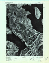
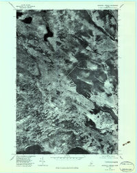
 1977 Indian Pond North1981 Print · USGSSomerset County, Maine, is captured in the late 1970s as a landscape of timber and wild water. Researchers can trace the rail and river history of Tarratine and Somerset Junction or locate the headwaters of the Kennebec River.
 - 1979 Map of Churchill Stream, 1983 Print
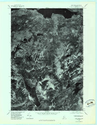
 1979 Churchill Stream1983 Print · USGSSomerset County's dense timberlands and waterways are captured in detail at the close of the seventies. Researchers can trace the precise flow of Churchill Stream and the northern reaches of Long Pond across this aerial orthophoto.
 - 1979 Map of Long Pond, 1983 Print
 1979 Long Pond1983 Print · USGSThe deep woods of Somerset County are seen from above in the late seventies, documenting the remote lake country of northern Maine. Researchers can trace the wild shorelines of Lake Parlin and Long Pond or locate the small clearing at Mackamp.
 - 1985 Map of Moosehead Lake, 1986 Print
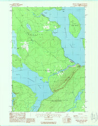
 1985 Moosehead Lake1986 Print · USGSThe Maine North Woods in the 1980s remain a landscape of vast timberlands, railroads, and the sprawling waters of the state's largest lake. Researchers can trace the Canadian Pacific line through Rockwood or locate historical townships from Seboomook to Kokadjo.
 - 1986 Map of Megantic
 1986 Megantic1986 Print · USGSSettlement and industry along the international border define this mid-1980s survey of the Maine north woods. Genealogists and historians can trace the Canadian Pacific rail line through Jackman Station, Lowelltown, and the Jackman Mill.
 - 1988 Map of Brassua Lake East
 1988 Brassua Lake East1988 Print · USGSMaine's North Woods are captured in the late eighties as they bridge the gap between two major lake systems. Researchers can trace the boundaries of the Tomhegan Game Sanctuary and find local landmarks like the Masonry Dam or Rockwood.2 unique versions available
 - 1988 Map of Indian Pond North
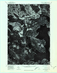
 1988 Indian Pond North1988 Print · USGSSomerset County in the late eighties was a landscape of timber-townships and essential riverways. Genealogists and historians can trace the rail history at Somerset Junction, locate the small settlement at Tarratine, and follow the OLD RAILROAD GRADE through MISERY GORE.2 unique versions available
 - 1988 Map of Misery Knob
 1988 Misery Knob1988 Print · USGSSomerset County, Maine, is shown in the late 1980s as a vast network of timberlands and unorganized townships. Local historians can trace the isolated outpost of Mackamp or explore the uniquely named terrain of Misery Gore and Misery Knob.
Showing maps 1-25 of 60
Top cities near Sandwich Academy Grant Township
Top neighborhoods of Sandwich Academy Grant Township
Frequently asked questions
- What are the different types of historical maps available for Sandwich Academy Grant Township?
- What is the oldest map of Sandwich Academy Grant Township?
- Where can I purchase historical maps of Sandwich Academy Grant Township for my home or office?
- Where can I download high-res historical maps of Sandwich Academy Grant Township?
- Are there historical topographic maps available for Sandwich Academy Grant Township?
- Is there historical aerial imagery available for Sandwich Academy Grant Township?
- Where are historical maps of Sandwich Academy Grant Township sourced from?