2020s Maps of Arundel, Maine
Explore 6 historic maps of Arundel from the 2020s. These maps offer a rare glimpse into what life looked like during the 2020s — showing old roads, neighborhoods, homes, and landmarks that have changed or disappeared over time.
Whether you're researching your family's past, planning a metal detecting trip, or studying how Arundel's landscape evolved across the 2020s, these high-resolution maps are a powerful tool for exploring the history of this region.
- Focus on a specific era: All maps on this page are from the 2020s, giving you a focused view of this time period.
- See what’s changed: Compare century-old streets, trails, and buildings to today's modern landscape using overlays and satellite layers.
- Research with precision: Use these maps for genealogy, historical research, land use analysis, or educational projects.
- View, download, or print: Maps are fully viewable online in high resolution, and can be downloaded or printed for your own records.
Start exploring Arundel's history through authentic maps from the 2020s. This is your window into the past.
Arundel, ME maps
(6)- 2021 Map of Kennebunkport, 2021 Print
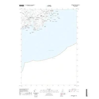 2021 Kennebunkport2021 Print · USGSCovers Arundel, including Kennebunk, Wells, and other nearby areas
 - 2021 Map of Kennebunk, 2021 Print
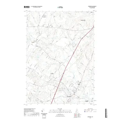 2021 Kennebunk2021 Print · USGSCovers Arundel, including Biddeford, Saco, and other nearby areas
 - 2021 Map of Biddeford, 2021 Print
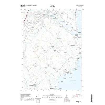 2021 Biddeford2021 Print · USGSCovers Arundel, including Biddeford, Saco, and other nearby areas
 - 2024 Map of Kennebunkport, 2024 Print
 2024 Kennebunkport2024 Print · USGSCoastal Maine settlement and maritime heritage are meticulously documented here in the modern era. Genealogists and historians can locate family-named landmarks and resting places like Home Cem, Wildes Corner, and the rocky prominent point at Walkers Point.
 - 2024 Map of Kennebunk, 2024 Print
 2024 Kennebunk2024 Print · USGSCoastal Maine's interior mill towns and family farmsteads are documented in this contemporary survey of York County. Genealogists and historians can trace family burial sites like Burbank Taylor Cem and historic mill locations at Days Mill or Bartlett Mills.
 - 2024 Map of Biddeford, 2024 Print
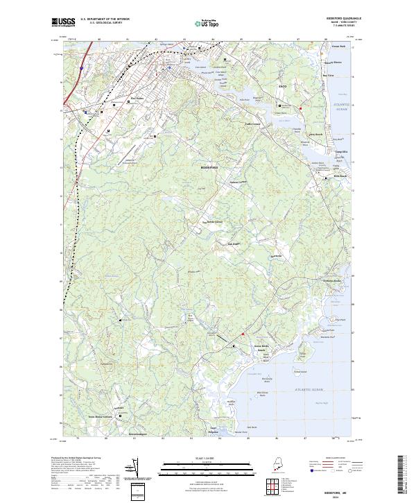 2024 Biddeford2024 Print · USGSThe York County coast comes into sharp focus in this contemporary survey of the Saco River estuary and the city of Biddeford. Genealogists and historians can trace numerous burial sites like Laurel Hill Cem and old crossroads such as Tea Kettle Corner and Town House Corners.
End of results
Showing maps 1-6 of 6
Top cities near Arundel
- Portland historical maps
- South Portland historical maps
- Biddeford historical maps
- Scarborough historical maps
- Sanford historical maps
- Westbrook historical maps
See more
Frequently asked questions
- What are the different types of historical maps available for Arundel?
- What is the oldest map of Arundel?
- Where can I purchase historical maps of Arundel for my home or office?
- Where can I download high-res historical maps of Arundel?
- Are there historical topographic maps available for Arundel?
- Is there historical aerial imagery available for Arundel?
- Where are historical maps of Arundel sourced from?