Old Maps of Waterbury Forest, Anne Arundel County for Hiking & Exploration
Hike through history with 25 historic maps of Waterbury Forest. Explore old trails, ghost towns, and forgotten backroads — perfect for outdoor adventurers and local explorers.
- Rediscover forgotten places: Map out old mining camps, roads, and footpaths that no longer exist on modern maps.
- Layer with modern tools: Combine with LiDAR or satellite views to plan hikes through historical terrain.
- Made for exploration: Popular among hikers, overlanders, and local history lovers.
Use these maps to find adventure and explore the hidden past of Waterbury Forest.
Waterbury Forest, Anne Arundel County maps
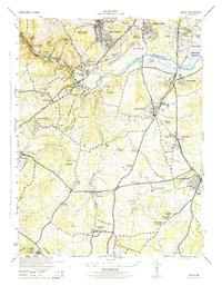
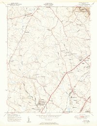
(25)- 1892 Map of Laurel
 1892 Laurel1892 Print · USGSCovers Waterbury Forest, including Columbia, Silver Spring, and other nearby areas
 - 1894 Map of Laurel
 1894 Laurel1894 Print · USGSCovers Waterbury Forest, including Columbia, Silver Spring, and other nearby areas4 unique versions available
 - 1894 Map of Relay
 1894 Relay1894 Print · USGSCovers Waterbury Forest, including Glen Burnie, Bowie, and other nearby areas4 unique versions available
 - 1897 Map of Laurel
 1897 Laurel1897 Print · USGSCovers Waterbury Forest, including Columbia, Silver Spring, and other nearby areas
 - 1907 Map of Laurel
 1907 Laurel1907 Print · USGSCovers Waterbury Forest, including Columbia, Silver Spring, and other nearby areas3 unique versions available
 - 1907 Map of Relay
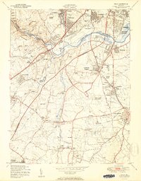
 1907 Relay1907 Print · USGSCovers Waterbury Forest, including Glen Burnie, Bowie, and other nearby areas8 unique versions available
 - 1908 Map of Patapsco
 1908 Patapsco1908 Print · USGSCovers Waterbury Forest, including Baltimore, Columbia, and other nearby areas4 unique versions available
 - 1926 Map of Laurel
 1926 Laurel1926 Print · USGSCovers Waterbury Forest, including Columbia, Silver Spring, and other nearby areas4 unique versions available
 - 1942 Map of Laurel
 1942 Laurel1942 Print · USGSCovers Waterbury Forest, including Columbia, Silver Spring, and other nearby areas
 - 1944 Map of Relay
 1944 Relay1944 Print · USGSCovers Waterbury Forest, including Arbutus, Ferndale, and other nearby areas2 unique versions available
 - 1947 Map of Relay, 1954 Print
 1947 Relay1954 Print · USGSCovers Waterbury Forest, including Glen Burnie, Bowie, and other nearby areas2 unique versions available
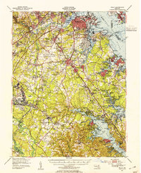
 - 1948 Map of Baltimore
 1948 Baltimore1948 Print · USGSCovers Waterbury Forest, including Baltimore, Columbia, and other nearby areas2 unique versions available
 - 1949 Map of Laurel, 1954 Print
 1949 Laurel1954 Print · USGSCovers Waterbury Forest, including Columbia, Silver Spring, and other nearby areas2 unique versions available
 - 1950 Map of Relay
 1950 Relay1950 Print · USGSCovers Waterbury Forest, including Arbutus, Ferndale, and other nearby areas2 unique versions available
 - 1950 Map of Savage
 1950 Savage1950 Print · USGSCovers Waterbury Forest, including Columbia, Springwood, and other nearby areas2 unique versions available
 - 1954 Map of Baltimore
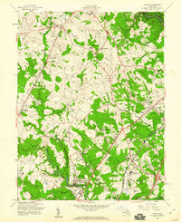
 1954 Baltimore1954 Print · USGSCovers Waterbury Forest, including Baltimore, Columbia, and other nearby areas
 - 1956 Map of Baltimore
 1956 Baltimore1956 Print · USGSCovers Waterbury Forest, including Baltimore, Columbia, and other nearby areas
 - 1957 Map of Savage, 1960 Print
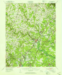
 1957 Savage1960 Print · USGSCovers Waterbury Forest, including Columbia, Springwood, and other nearby areas6 unique versions available
 - 1957 Map of Relay, 1960 Print
 1957 Relay1960 Print · USGSCovers Waterbury Forest, including Arbutus, Ferndale, and other nearby areas5 unique versions available
 - 1957 Map of Baltimore, 1964 Print
 1957 Baltimore1964 Print · USGSCovers Waterbury Forest, including Baltimore, Columbia, and other nearby areas5 unique versions available
 - 1961 Map of Baltimore
 1961 Baltimore1961 Print · USGSCovers Waterbury Forest, including Baltimore, Columbia, and other nearby areas
 - 1981 Map of Savage, 1986 Print
 1981 Savage1986 Print · USGSCovers Waterbury Forest, including Columbia, Springwood, and other nearby areas
 - 1981 Map of Relay, 1986 Print
 1981 Relay1986 Print · USGSCovers Waterbury Forest, including Arbutus, Ferndale, and other nearby areas
 - 1984 Map of Baltimore
 1984 Baltimore1984 Print · USGSCovers Waterbury Forest, including Baltimore, Columbia, and other nearby areas
 - 1989 Map of Baltimore
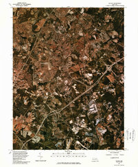
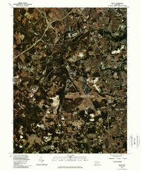
 1989 Baltimore1989 Print · USGSCovers Waterbury Forest, including Baltimore, Columbia, and other nearby areas
End of results
Showing maps 1-25 of 25
Frequently asked questions
- What are the different types of historical maps available for Waterbury Forest?
- What is the oldest map of Waterbury Forest?
- Where can I purchase historical maps of Waterbury Forest for my home or office?
- Where can I download high-res historical maps of Waterbury Forest?
- Are there historical topographic maps available for Waterbury Forest?
- Is there historical aerial imagery available for Waterbury Forest?
- Where are historical maps of Waterbury Forest sourced from?