Old Maps of Brook Valley Farms, Maryland for Genealogy
Trace your family roots with 13 historic maps of Brook Valley Farms. These high-res maps reveal old neighborhoods, homesites, landmarks, and streets — helping you uncover where your ancestors lived and how the area evolved over time.
- Explore historic neighborhoods: Identify where your relatives may have lived in the 1800s or 1900s.
- Compare maps over time: Trace the changes in streets, buildings, and landmarks for multi-generational research.
- Perfect for genealogy & ancestry research: Used by family historians and researchers to map out lineage and migration.
These maps are an incredible resource for exploring your personal connection to Brook Valley Farms's past.
Brook Valley Farms, MD maps
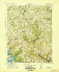
(13)- 1900 Map of Parkton
 1900 Parkton1900 Print · USGSCovers Brook Valley Farms, including Shrewsbury, New Freedom, and other nearby areas
 - 1902 Map of Parkton
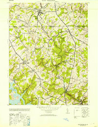
 1902 Parkton1902 Print · USGSCovers Brook Valley Farms, including Shrewsbury, New Freedom, and other nearby areas7 unique versions available
 - 1944 Map of New Freedom
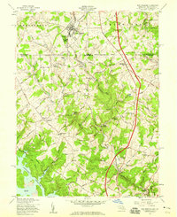
 1944 New Freedom1944 Print · USGSCovers Brook Valley Farms, including Shrewsbury, New Freedom, and other nearby areas
 - 1948 Map of Baltimore
 1948 Baltimore1948 Print · USGSCovers Brook Valley Farms, including Baltimore, Columbia, and other nearby areas2 unique versions available
 - 1953 Map of New Freedom
 1953 New Freedom1953 Print · USGSCovers Brook Valley Farms, including Shrewsbury, New Freedom, and other nearby areas
 - 1954 Map of Baltimore
 1954 Baltimore1954 Print · USGSCovers Brook Valley Farms, including Baltimore, Columbia, and other nearby areas
 - 1956 Map of Baltimore
 1956 Baltimore1956 Print · USGSCovers Brook Valley Farms, including Baltimore, Columbia, and other nearby areas
 - 1957 Map of Baltimore, 1964 Print
 1957 Baltimore1964 Print · USGSCovers Brook Valley Farms, including Baltimore, Columbia, and other nearby areas5 unique versions available
 - 1958 Map of New Freedom, 1959 Print
 1958 New Freedom1959 Print · USGSCovers Brook Valley Farms, including Shrewsbury, New Freedom, and other nearby areas5 unique versions available
 - 1961 Map of Baltimore
 1961 Baltimore1961 Print · USGSCovers Brook Valley Farms, including Baltimore, Columbia, and other nearby areas
 - 1983 Map of York, 1984 Print
 1983 York1984 Print · USGSCovers Brook Valley Farms, including York, Westminster, and other nearby areas2 unique versions available
 - 1989 Map of Baltimore
 1989 Baltimore1989 Print · USGSCovers Brook Valley Farms, including Baltimore, Columbia, and other nearby areas
 - 2023 Map of New Freedom, 2023 Print
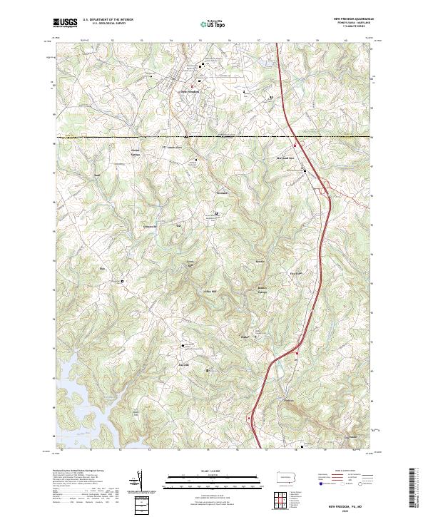 2023 New Freedom2023 Print · USGSCovers Brook Valley Farms, including Shrewsbury, New Freedom, and other nearby areas
End of results
Showing maps 1-13 of 13
Top cities near Brook Valley Farms
- Cockeysville historical maps
- West Manheim Township historical maps
- Shrewsbury historical maps
- Hampstead historical maps
- Red Lion historical maps
- Manchester historical maps
See more
Frequently asked questions
- What are the different types of historical maps available for Brook Valley Farms?
- What is the oldest map of Brook Valley Farms?
- Where can I purchase historical maps of Brook Valley Farms for my home or office?
- Where can I download high-res historical maps of Brook Valley Farms?
- Are there historical topographic maps available for Brook Valley Farms?
- Is there historical aerial imagery available for Brook Valley Farms?
- Where are historical maps of Brook Valley Farms sourced from?