Old Maps of Ramona Beach, Baltimore County for Hiking & Exploration
Hike through history with 21 historic maps of Ramona Beach. Explore old trails, ghost towns, and forgotten backroads — perfect for outdoor adventurers and local explorers.
- Rediscover forgotten places: Map out old mining camps, roads, and footpaths that no longer exist on modern maps.
- Layer with modern tools: Combine with LiDAR or satellite views to plan hikes through historical terrain.
- Made for exploration: Popular among hikers, overlanders, and local history lovers.
Use these maps to find adventure and explore the hidden past of Ramona Beach.
Ramona Beach, Baltimore County maps
(21)- 1893 Map of North Point
 1893 North Point1893 Print · USGSMaryland's maritime heart is captured here in the late nineteenth century, showing the industrial rise of Steelton and the rural reaches of Anne Arundel. Researchers can trace old landings and light stations like Wilson Wharf, Sandy Pt. Light, and the settlement at Jacob Store.3 unique versions available
 - 1898 Map of Tolchester
 1898 Tolchester1898 Print · USGSThe upper Chesapeake Bay and its tidal tributaries are shown in the late 1890s, when steamships and railroads still dominated regional commerce. Trace the landings and rail stops that fueled the bay economy, from Buck Neck Landing to Stillpond Sta. and the historic Harford Furnace.
 - 1903 Map of Tolchester
 1903 Tolchester1903 Print · USGSThe upper Chesapeake Bay at the turn of the century shows a bustling maritime landscape where steamship wharves and major rail lines met. Researchers can trace defunct stops like Baldwin Sta. and Clayton Sta. or locate historic landings such as Rockhall Landing and Quaker Wharf.
 - 1904 Map of North Point
 1904 North Point1904 Print · USGSChesapeake Bay maritime life at the turn of the century is captured here, from industrial waterfronts to rural landings. Genealogists can trace family landmarks and ferry points like Love Point Landing, Sparrow Point, and Skidmore.5 unique versions available
 - 1908 Map of Tolchester
 1908 Tolchester1908 Print · USGSChesapeake Bay life at the turn of the century centered on a complex network of tidewater landings and strategic railroad lines. Researchers can trace historic family settlements and maritime landmarks like Fort Howard, Harford Furnace, and the Sevenfoot Knoll LH.4 unique versions available
 - 1943 Map of North Point
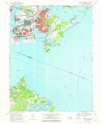
 1943 North Point1943 Print · USGSThe Chesapeake Bay's maritime approaches are captured here during the 1940s, highlighting the industrial strength of Sparrows Point and the coastal defenses at Fort Howard. Researchers can trace the rail connections at Love Point Landing or explore the mid-century waterfronts of Gibson Island and Bay Shore.
 - 1944 Map of Sparrows Point
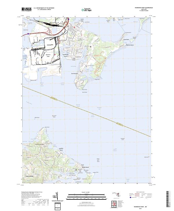
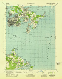 1944 Sparrows Point1944 Print · USGSThe industrial and maritime heart of the Chesapeake coast is captured here during the wartime height of the 1940s. Genealogists and historians can trace the development of Sparrows Point steel works and find local landmarks like the Edgemere Community Chapel and Bay Shore Park.3 unique versions available
 - 1947 Map of North Point, 1955 Print
 1947 North Point1955 Print · USGSCoastal Maryland at the close of the 1940s reveals a sharp contrast between the industrial might of Sparrows Point and the quiet summer communities of the western shore. Trace maritime history through dredging records and landmarks like Fort Howard, Gibson Island, and Sevenfoot Knoll Light.
 - 1948 Map of Baltimore
 1948 Baltimore1948 Print · USGSMaryland and Pennsylvania crossroads are captured in the late 1940s, showing a landscape defined by historic rail lines and major military installations. Genealogists can trace family connections in Gettysburg, Westminster, and near the U.S. Naval Academy in Annapolis.2 unique versions available
 - 1954 Map of Baltimore
 1954 Baltimore1954 Print · USGSThe Mid-Atlantic region in the early fifties shows a landscape of growing suburban centers and heavy rail corridors. Trace mid-century transit networks and military landmarks from the Aberdeen Proving Ground to the Gettysburg National Military Park.
 - 1956 Map of Baltimore
 1956 Baltimore1956 Print · USGSMid-century Maryland and Pennsylvania are captured here during a period of massive suburban and military growth across the Chesapeake region. Genealogists and historians can trace the rail corridors of the Baltimore & Ohio RR and locate landmarks like Fort McHenry or the Aberdeen Proving Ground.
 - 1957 Map of Baltimore, 1964 Print
 1957 Baltimore1964 Print · USGSMaryland and Southern Pennsylvania are shown during the mid-century expansion of the Baltimore-Washington corridor. Researchers can trace the extensive rail lines of the Baltimore & Ohio RR and locate sites like Fort Detrick and Gettysburg National Military Park.5 unique versions available
 - 1961 Map of Baltimore
 1961 Baltimore1961 Print · USGSMaryland and Pennsylvania are captured at a mid-century peak of industrial and military expansion. Genealogists and historians can trace rail corridors like the Western Maryland Ry or locate regional landmarks such as Camp Detrick and Kent Island.
 - 1969 Map of Sparrows Point, 1971 Print
 1969 Sparrows Point1971 Print · USGSThe industrial Patapsco shoreline and Chesapeake Bay beaches meet in the late sixties, showcasing the peak of the steel era. Genealogists can trace family footprints from Dundalk to coastal enclaves like Paradise Beach and Fairview.3 unique versions available
 - 1984 Map of Baltimore
 1984 Baltimore1984 Print · USGSThe Baltimore and Annapolis corridor in the mid-eighties shows a landscape of rapid suburban growth and deep-seated maritime history. Researchers can trace the massive footprints of the U S Naval Academy, Fort George G Meade, and Goddard Space Flight Ctr.
 - 1989 Map of Baltimore
 1989 Baltimore1989 Print · USGSThe Mid-Atlantic corridor in the late eighties is captured here, from the Baltimore harbor to the Blue Ridge foothills. Researchers can trace the sprawling footprints of Aberdeen Proving Ground, the historic grounds of Gettysburg National Military Park, and the winding Susquehanna River.
 - 2011 Map of Sparrows Point, 2011 Print
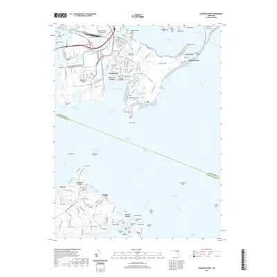
 2011 Sparrows Point2011 Print · USGSCovers Ramona Beach, including Bodkin Manor, Maryland Beach, and other nearby areas
 - 2014 Map of Sparrows Point, 2014 Print
 2014 Sparrows Point2014 Print · USGSCovers Ramona Beach, including Bodkin Manor, Maryland Beach, and other nearby areas
 - 2016 Map of Sparrows Point, 2016 Print
 2016 Sparrows Point2016 Print · USGSCovers Ramona Beach, including Bodkin Manor, Maryland Beach, and other nearby areas
 - 2019 Map of Sparrows Point, 2019 Print
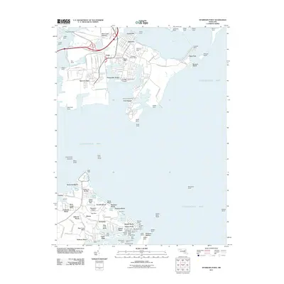
 2019 Sparrows Point2019 Print · USGSCovers Ramona Beach, including Bodkin Manor, Maryland Beach, and other nearby areas
 - 2023 Map of Sparrows Point, 2023 Print
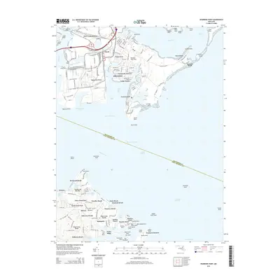
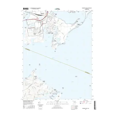
 2023 Sparrows Point2023 Print · USGSThe industrial shorelines and coastal communities of Baltimore County are captured here in the early 2020s. Genealogists and local researchers can locate family sites at Todds Inheritance Cem, the historic grounds of Fort Howard, and the waterfront streets of Venice on the Bay.
End of results
Showing maps 1-21 of 21
Frequently asked questions
- What are the different types of historical maps available for Ramona Beach?
- What is the oldest map of Ramona Beach?
- Where can I purchase historical maps of Ramona Beach for my home or office?
- Where can I download high-res historical maps of Ramona Beach?
- Are there historical topographic maps available for Ramona Beach?
- Is there historical aerial imagery available for Ramona Beach?
- Where are historical maps of Ramona Beach sourced from?