Old Maps of Saint Leonard Shores, Calvert County
Explore 22 old maps of Saint Leonard Shores, spanning from 1892 to today. These high-resolution historic maps reveal how streets, neighborhoods, landmarks, and natural features evolved over time — perfect for genealogy, metal detecting, research, and local history exploration.
What you can do with these maps:
- See how Saint Leonard Shores changed over time: Compare historical maps to modern-day views to trace roads, homesites, rail lines & more.
- View detailed metadata: Each map includes creators, publishers, year, scale, and archive source.
- Overlay maps with satellite & LiDAR: Visualize the past alongside modern tools to explore terrain & human change.
- Trusted historical sources: Maps sourced from the USGS, Library of Congress, and other archives.
- Access maps your way: View online, download high-res files, or order prints for personal or research use.
Start exploring old maps of Saint Leonard Shores to uncover forgotten places, hidden landmarks, and the deep history beneath your feet.
Saint Leonard Shores, Calvert County maps
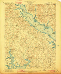
(22)- 1892 Map of Leonardtown
 1892 Leonardtown1892 Print · USGSCovers Saint Leonard Shores, including Lexington Park, California, and other nearby areas
 - 1892 Map of Drum Point
 1892 Drum Point1892 Print · USGSCovers Saint Leonard Shores, including Lexington Park, Chesapeake Ranch Estates, and other nearby areas2 unique versions available
 - 1895 Map of Leonardtown
 1895 Leonardtown1895 Print · USGSCovers Saint Leonard Shores, including Lexington Park, California, and other nearby areas
 - 1895 Map of Nomini
 1895 Nomini1895 Print · USGSCovers Saint Leonard Shores, including Lexington Park, California, and other nearby areas
 - 1898 Map of Nomini
 1898 Nomini1898 Print · USGSCovers Saint Leonard Shores, including Lexington Park, California, and other nearby areas5 unique versions available
 - 1898 Map of St. Marys
 1898 St. Marys1898 Print · USGSCovers Saint Leonard Shores, including Lexington Park, Chesapeake Ranch Estates, and other nearby areas2 unique versions available
 - 1901 Map of Drum Point
 1901 Drum Point1901 Print · USGSCovers Saint Leonard Shores, including Lexington Park, Chesapeake Ranch Estates, and other nearby areas
 - 1901 Map of Leonardtown
 1901 Leonardtown1901 Print · USGSCovers Saint Leonard Shores, including Lexington Park, California, and other nearby areas3 unique versions available
 - 1905 Map of Drum Point
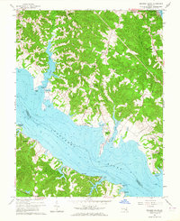
 1905 Drum Point1905 Print · USGSCovers Saint Leonard Shores, including Lexington Park, Chesapeake Ranch Estates, and other nearby areas4 unique versions available
 - 1906 Map of St. Marys
 1906 St. Marys1906 Print · USGSCovers Saint Leonard Shores, including Lexington Park, Chesapeake Ranch Estates, and other nearby areas4 unique versions available
 - 1936 Map of Leonardtown
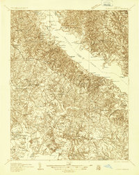 1936 Leonardtown1936 Print · USGSCovers Saint Leonard Shores, including Lexington Park, California, and other nearby areas
 - 1939 Map of Leonardtown
 1939 Leonardtown1939 Print · USGSCovers Saint Leonard Shores, including Lexington Park, California, and other nearby areas3 unique versions available
 - 1942 Map of Drum Point
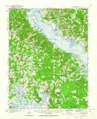
 1942 Drum Point1942 Print · USGSCovers Saint Leonard Shores, including Lexington Park, Chesapeake Ranch Estates, and other nearby areas
 - 1943 Map of Cove Point
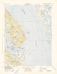
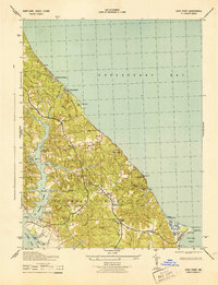 1943 Cove Point1943 Print · USGSCovers Saint Leonard Shores, including Sollers, Planters Wharf, and other nearby areas4 unique versions available
 - 1948 Map of Washington
 1948 Washington1948 Print · USGSCovers Saint Leonard Shores, including Washington, Arlington, and other nearby areas2 unique versions available
 - 1950 Map of Leonardtown, 1964 Print
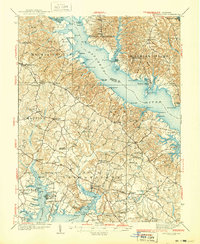
 1950 Leonardtown1964 Print · USGSCovers Saint Leonard Shores, including Lexington Park, California, and other nearby areas
 - 1957 Map of Washington, 1966 Print
 1957 Washington1966 Print · USGSCovers Saint Leonard Shores, including Washington, Arlington, and other nearby areas5 unique versions available
 - 1961 Map of Washington
 1961 Washington1961 Print · USGSCovers Saint Leonard Shores, including Washington, Arlington, and other nearby areas2 unique versions available
 - 1963 Map of Broomes Island, 1964 Print
 1963 Broomes Island1964 Print · USGSCovers Saint Leonard Shores, including Briscoe, Harbor Hills, and other nearby areas3 unique versions available
 - 1983 Map of Leonardtown, 1984 Print
 1983 Leonardtown1984 Print · USGSCovers Saint Leonard Shores, including Lexington Park, California, and other nearby areas2 unique versions available
 - 1987 Map of Cove Point
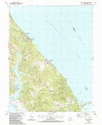 1987 Cove Point1987 Print · USGSCovers Saint Leonard Shores, including Sollers, Planters Wharf, and other nearby areas
 - 1989 Map of Washington
 1989 Washington1989 Print · USGSCovers Saint Leonard Shores, including Washington, Arlington, and other nearby areas
End of results
Showing maps 1-22 of 22
Frequently asked questions
- What are the different types of historical maps available for Saint Leonard Shores?
- What is the oldest map of Saint Leonard Shores?
- Where can I purchase historical maps of Saint Leonard Shores for my home or office?
- Where can I download high-res historical maps of Saint Leonard Shores?
- Are there historical topographic maps available for Saint Leonard Shores?
- Is there historical aerial imagery available for Saint Leonard Shores?
- Where are historical maps of Saint Leonard Shores sourced from?