Old Maps of Saint Leonard Shores, Calvert County for Hiking & Exploration
Hike through history with 22 historic maps of Saint Leonard Shores. Explore old trails, ghost towns, and forgotten backroads — perfect for outdoor adventurers and local explorers.
- Rediscover forgotten places: Map out old mining camps, roads, and footpaths that no longer exist on modern maps.
- Layer with modern tools: Combine with LiDAR or satellite views to plan hikes through historical terrain.
- Made for exploration: Popular among hikers, overlanders, and local history lovers.
Use these maps to find adventure and explore the hidden past of Saint Leonard Shores.
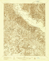
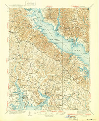
Saint Leonard Shores, Calvert County maps
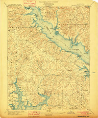
(22)- 1892 Map of Leonardtown
 1892 Leonardtown1892 Print · USGSCovers Saint Leonard Shores, including Lexington Park, California, and other nearby areas
 - 1892 Map of Drum Point
 1892 Drum Point1892 Print · USGSCovers Saint Leonard Shores, including Lexington Park, Chesapeake Ranch Estates, and other nearby areas2 unique versions available
 - 1895 Map of Leonardtown
 1895 Leonardtown1895 Print · USGSCovers Saint Leonard Shores, including Lexington Park, California, and other nearby areas
 - 1895 Map of Nomini
 1895 Nomini1895 Print · USGSCovers Saint Leonard Shores, including Lexington Park, California, and other nearby areas
 - 1898 Map of Nomini
 1898 Nomini1898 Print · USGSCovers Saint Leonard Shores, including Lexington Park, California, and other nearby areas5 unique versions available
 - 1898 Map of St. Marys
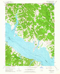
 1898 St. Marys1898 Print · USGSCovers Saint Leonard Shores, including Lexington Park, Chesapeake Ranch Estates, and other nearby areas2 unique versions available
 - 1901 Map of Drum Point
 1901 Drum Point1901 Print · USGSCovers Saint Leonard Shores, including Lexington Park, Chesapeake Ranch Estates, and other nearby areas
 - 1901 Map of Leonardtown
 1901 Leonardtown1901 Print · USGSCovers Saint Leonard Shores, including Lexington Park, California, and other nearby areas3 unique versions available
 - 1905 Map of Drum Point
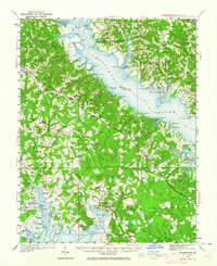
 1905 Drum Point1905 Print · USGSCovers Saint Leonard Shores, including Lexington Park, Chesapeake Ranch Estates, and other nearby areas4 unique versions available
 - 1906 Map of St. Marys
 1906 St. Marys1906 Print · USGSCovers Saint Leonard Shores, including Lexington Park, Chesapeake Ranch Estates, and other nearby areas4 unique versions available
 - 1936 Map of Leonardtown
 1936 Leonardtown1936 Print · USGSCovers Saint Leonard Shores, including Lexington Park, California, and other nearby areas
 - 1939 Map of Leonardtown
 1939 Leonardtown1939 Print · USGSCovers Saint Leonard Shores, including Lexington Park, California, and other nearby areas3 unique versions available
 - 1942 Map of Drum Point
 1942 Drum Point1942 Print · USGSCovers Saint Leonard Shores, including Lexington Park, Chesapeake Ranch Estates, and other nearby areas
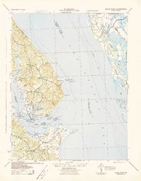
 - 1943 Map of Cove Point
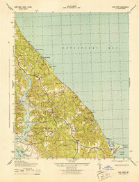 1943 Cove Point1943 Print · USGSCovers Saint Leonard Shores, including Sollers, Planters Wharf, and other nearby areas4 unique versions available
 - 1948 Map of Washington
 1948 Washington1948 Print · USGSCovers Saint Leonard Shores, including Washington, Arlington, and other nearby areas2 unique versions available
 - 1950 Map of Leonardtown, 1964 Print
 1950 Leonardtown1964 Print · USGSCovers Saint Leonard Shores, including Lexington Park, California, and other nearby areas
 - 1957 Map of Washington, 1966 Print
 1957 Washington1966 Print · USGSCovers Saint Leonard Shores, including Washington, Arlington, and other nearby areas5 unique versions available
 - 1961 Map of Washington
 1961 Washington1961 Print · USGSCovers Saint Leonard Shores, including Washington, Arlington, and other nearby areas2 unique versions available
 - 1963 Map of Broomes Island, 1964 Print
 1963 Broomes Island1964 Print · USGSCovers Saint Leonard Shores, including Briscoe, Harbor Hills, and other nearby areas3 unique versions available
 - 1983 Map of Leonardtown, 1984 Print
 1983 Leonardtown1984 Print · USGSCovers Saint Leonard Shores, including Lexington Park, California, and other nearby areas2 unique versions available
 - 1987 Map of Cove Point
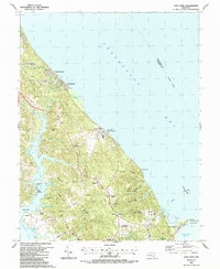 1987 Cove Point1987 Print · USGSCovers Saint Leonard Shores, including Sollers, Planters Wharf, and other nearby areas
 - 1989 Map of Washington
 1989 Washington1989 Print · USGSCovers Saint Leonard Shores, including Washington, Arlington, and other nearby areas
End of results
Showing maps 1-22 of 22
Frequently asked questions
- What are the different types of historical maps available for Saint Leonard Shores?
- What is the oldest map of Saint Leonard Shores?
- Where can I purchase historical maps of Saint Leonard Shores for my home or office?
- Where can I download high-res historical maps of Saint Leonard Shores?
- Are there historical topographic maps available for Saint Leonard Shores?
- Is there historical aerial imagery available for Saint Leonard Shores?
- Where are historical maps of Saint Leonard Shores sourced from?