Old Maps of Ridgely, Maryland
Explore 20 old maps of Ridgely, spanning from 1905 to today. These high-resolution historic maps reveal how streets, neighborhoods, landmarks, and natural features evolved over time — perfect for genealogy, metal detecting, research, and local history exploration.
What you can do with these maps:
- See how Ridgely changed over time: Compare historical maps to modern-day views to trace roads, homesites, rail lines & more.
- View detailed metadata: Each map includes creators, publishers, year, scale, and archive source.
- Overlay maps with satellite & LiDAR: Visualize the past alongside modern tools to explore terrain & human change.
- Trusted historical sources: Maps sourced from the USGS, Library of Congress, and other archives.
- Access maps your way: View online, download high-res files, or order prints for personal or research use.
Start exploring old maps of Ridgely to uncover forgotten places, hidden landmarks, and the deep history beneath your feet.
Ridgely, MD maps
(20)- 1905 Map of Denton
 1905 Denton1905 Print · USGSMaryland's Eastern Shore appears at the height of its riverboat and rail era, centered on the Choptank River. Genealogists and historians can trace the Steamboat Route to Wayman Wharf or locate old community hubs like American Corners and the Laurel Grove Church.3 unique versions available
 - 1944 Map of Denton
 1944 Denton1944 Print · USGSCaroline County's riverfront and agricultural heartland are shown here in the mid-1940s as the Choptank River economy transition from water to rail and road. Genealogists can trace family landmarks like Sewell Mills, Cokers Cem, and the Lockerman Sch in Denton.5 unique versions available
 - 1944 Map of Ridgely
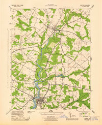
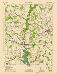 1944 Ridgely1944 Print · USGSThe Eastern Shore counties of Caroline, Queen Anne's, and Talbot meet along the Tuckahoe Creek during the final years of the war. Researchers can trace the rail corridor of the Baltimore and Eastern and find local landmarks like Adolph Landing and Allan Church.4 unique versions available
 - 1946 Map of Salisbury, 1948 Print
 1946 Salisbury1948 Print · USGSThe Delmarva Peninsula in the late nineteen-forties shows a landscape defined by its deep river arteries and emerging coastal defenses. Genealogists and historians can trace rail-connected towns like Federalsburg or locate maritime landmarks such as the Ocean City Seaplane Base and Fort Miles Military Reservation.4 unique versions available
 - 1947 Map of Salisbury, 1948 Print
 1947 Salisbury1948 Print · USGSThe Delmarva Peninsula in the late forties reveals a coastal landscape of maritime defense and growing seaside towns. Trace the post-war footprint of Salisbury, the strategic Fort Miles Military Reservation, and the Ocean City Seaplane Base.
 - 1948 Map of Salisbury, 1951 Print
 1948 Salisbury1951 Print · USGSThe Delmarva Peninsula in the late 1940s is shown here as a busy network of rail-towns and coastal outposts. Researchers can trace the legacy of the Pennsylvania Railroad through inland hubs like Georgetown or the maritime reaches of Crisfield and Cape May.
 - 1957 Map of Salisbury
 1957 Salisbury1957 Print · USGSThe Delmarva Peninsula in the mid-1950s reveals a landscape of coastal defenses and rail-driven commerce. Researchers can trace the Pennsylvania railroad lines or locate historic landmarks like the Fenwick Island Lighthouse and St Martin church.
 - 1961 Map of Salisbury
 1961 Salisbury1961 Print · USGSThe Delmarva Peninsula comes into focus in the early sixties, showing the vital road and rail networks connecting the Chesapeake to the Atlantic. Genealogists and historians can trace family-named landings and coastal landmarks from Crisfield to the Brandywine Shoal Lighthouse.
 - 1965 Map of Salisbury
 1965 Salisbury1965 Print · USGSThe Delmarva Peninsula in the mid-1960s is depicted here as a landscape of coastal defenses and maritime hubs. Genealogists and local historians can trace the foundations of bayside towns like Crisfield and the tactical positioning of the Fort Miles Military Reservation and Cape May Naval Air Station.
 - 1984 Map of Seaford, 1986 Print
 1984 Seaford1986 Print · USGSCoastal Delaware and the Maryland borderlands are captured here in the mid-eighties as modern tourism and traditional agriculture coexist. Researchers can trace the rail-and-river routes through Seaford, explore inland millponds like Chipman Pond, or study the shoreline at Cape Henlopen.2 unique versions available
 - 2011 Map of Ridgely, 2011 Print
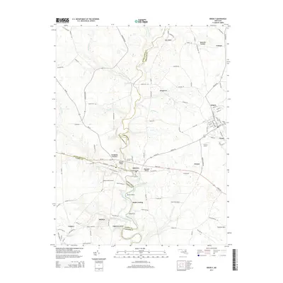
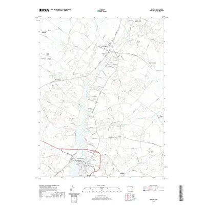
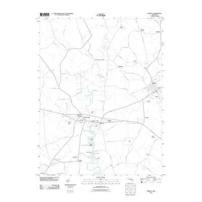 2011 Ridgely2011 Print · USGSCovers Ridgely, including Hillsboro, Hillsboro Estates, and other nearby areas
 - 2011 Map of Denton, 2011 Print
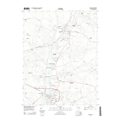
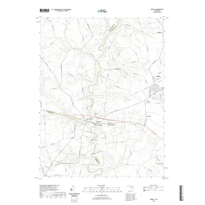
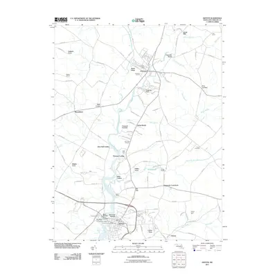 2011 Denton2011 Print · USGSCovers Ridgely, including Denton, Greensboro, and other nearby areas
 - 2014 Map of Ridgely, 2014 Print
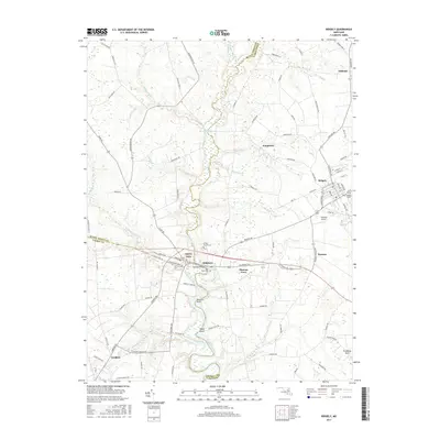
 2014 Ridgely2014 Print · USGSCovers Ridgely, including Hillsboro, Hillsboro Estates, and other nearby areas
 - 2014 Map of Denton, 2014 Print
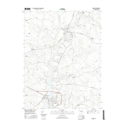
 2014 Denton2014 Print · USGSCovers Ridgely, including Denton, Greensboro, and other nearby areas
 - 2017 Map of Ridgely, 2017 Print
 2017 Ridgely2017 Print · USGSCovers Ridgely, including Hillsboro, Hillsboro Estates, and other nearby areas
 - 2017 Map of Denton, 2017 Print
 2017 Denton2017 Print · USGSCovers Ridgely, including Denton, Greensboro, and other nearby areas
 - 2019 Map of Denton, 2019 Print
 2019 Denton2019 Print · USGSCovers Ridgely, including Denton, Greensboro, and other nearby areas
 - 2019 Map of Ridgely, 2019 Print
 2019 Ridgely2019 Print · USGSCovers Ridgely, including Hillsboro, Hillsboro Estates, and other nearby areas
 - 2023 Map of Ridgely, 2023 Print
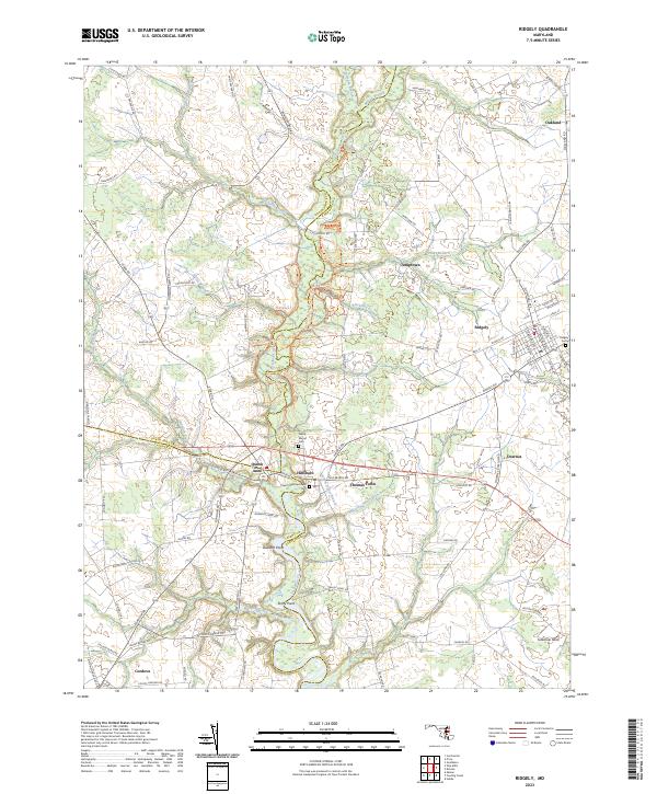 2023 Ridgely2023 Print · USGSThe Maryland Eastern Shore comes into focus in this contemporary study of the tri-county borderlands. Genealogists and local historians can trace family-named roads and landmarks from Hillsboro to Oakland, including Saint Pauls Episcopal Cem and Tuckahoe Neck.
 - 2023 Map of Denton, 2023 Print
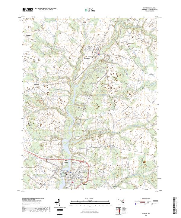 2023 Denton2023 Print · USGSThe Eastern Shore town of Denton and the surrounding Choptank River valley are documented here in the early twenty-first century. Researchers can locate family heritage sites at the Caroline County Courthouse or trace the legacy of the river crossing at the Denton Ferry.
End of results
Showing maps 1-20 of 20
Top cities near Ridgely
- Easton historical maps
- Denton historical maps
- Centreville historical maps
- Greensboro historical maps
- Church Hill historical maps
- Sudlersville historical maps
See more
Frequently asked questions
- What are the different types of historical maps available for Ridgely?
- What is the oldest map of Ridgely?
- Where can I purchase historical maps of Ridgely for my home or office?
- Where can I download high-res historical maps of Ridgely?
- Are there historical topographic maps available for Ridgely?
- Is there historical aerial imagery available for Ridgely?
- Where are historical maps of Ridgely sourced from?